J-Doc
-
Posts
3,426 -
Joined
-
Last visited
-
Days Won
1
Content Type
Profiles
Forums
Blogs
Events
Articles
Video Feed
Gallery
Everything posted by J-Doc
-
Man yall are wrong. Can we get flat brim hats too?? Lol!!
-

Who is willing to admit they are fishing this year's Polar Bear?
J-Doc replied to J-Doc's topic in Beaver Lake
Poor Jolicious. His sweet Mama dropped him on his head as a baby. Bless his heart... -
Who is willing to admit they are fishing this year's Polar Bear?
J-Doc replied to J-Doc's topic in Beaver Lake
I'm all for Tradition. Believe me. It's the only reason I've fished it before. But postponing it would be the better play. For everyone's safety. I'd be pleasantly surprised and pleased of they did. No one needs to risk their boats or lives for this. -
1132.03 crested. Now slowly dropping. If they keep the gates open, it could drop 3-4ft by Friday. Which will still be VERY high. The entire lake is dangerous for travel. Someone will damage a bass boat guaranteed.
-
Who is willing to admit they are fishing this year's Polar Bear?
J-Doc replied to J-Doc's topic in Beaver Lake
The mudline will likely be up near the dam itself. With the amount of widow makers floating between Prairie Creek and the Dam, if someone was to win, it would pay the insurance fees for hull repairs. :-) I saw a video of the Hickory Creek area and it looked to be anice 8-15mph current draw with how fast the tree was floating down river. Get out and look out of curiosity? Nothing to see. Just high water and debris floating everywhere. -
Who is willing to admit they are fishing this year's Polar Bear?
J-Doc posted a topic in Beaver Lake
(This could be fun) So with the highest recorded water level EVER today, and what will be extreme current for the next 2 days until the close the flood gates....... Who is crazy enough to admit they will fish this year's Polar Bear tournament? Not only will it be dangerous with floating debris everywhere......this is unprecedented fishing conditions. Winter, water temps should be in the mid to upper 40's, dirty as yesterday's EZ-Mart coffee, and on top of that........just plain cold with lows in the 20's Friday. -
Like 1135 or 1136? I think that's the center of the road?
-
You're a nut....
-
You could drive through yesterday. I figured it would flood out today.
-
Saw and had to share.

-
They are already open to 9.5 feet as of right now. Just saw the Facebook feed for it..... Releasing 91,000cuft PER SECOND!
-
1131.43 and climbing still as of 8am this morning...... Highest the lake has EVER been on record I believe.
-
That's TONs of water!
-
Most of the shad are way up river. They won't go over and feed TR. They will go deep and hide out where they have been which is from Coppermine to War Eagle. You are correct...........the Polar Bear is a total "re-boot" of everyone's game plan. I don't know of many who have fished the lake in flooded conditions in the middle of winter when the entire lake looks like a sea of "Yoo-Hoo" milk. It will be as brown as it can be by Friday with the amount of current pulled. And unless they get it drawn down at least 3-4ft by Friday (which they should), not many will fit beneath the 12 bridge so the river arm will be shut down. For safety sake, they should probably "amend" the rules for this year and keep everyone out of the river arms anyway. Way too risky for a bass boat to run up river with logs floating everywhere. And in the winter!! You get in that water and hypothermia will set in faster than you can say "Oh SHhh...................oot!".
-
Wow. Even a bass boat will struggle to get under the 12 bridge now. It's definitely come up several feet since yesterday afternoon.
-
Lake is currently 1129.64 according to the Corp of Engineers app I have for Beaver Lake. It's risen from 1126.? something since early today. That's almost 3 ft total rise in less than 2 4hrs and still climbing witH all gates open at 5ft. That's a TON of water flowing inot the lake considerING they are releasing over 52k cuft per min. Billions of gallons. It's like watching the national debt....
-
That happened quick. Just earlier today, it was only in the river. Now it's flooded.
-
2010 was the highest recorded at 1131.08. We are already 1129.11 as of NOW. Bet it breaks the record.
-
Good question. 1131 or 1132 I believe. I think 2006 or 2007 was the highest it's been. I bet it hits 1132 again but.....they finally opened the gates today so, that should help.
-
The Corp of Engineers posted on their Facebook page that all 7 gates are open and lake is expected to crest at 1131.5. I laugh. I think 1132-1133 because they drug their feet. Should have opened the gates sooner BEFORE THE rain. Easy for me to armchair call the shots I suppose but it just seems they should have seen this coming and acted accordingly.
-
That gives NEW meaning to the phrase "floater". Lol!!
-
Wow that's high. Army Corp of Eng. posted in their Facebook page that the 7 flood gates have been opened as of 6pm tonight and lake is expected to crest at 1131.5.
-
Just think what it would do if it dropped into the mid to low 20's.....right NOW. Scary amounts of snowfall. Structural collapses everywhere...so it could be worse.
-
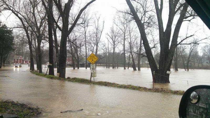
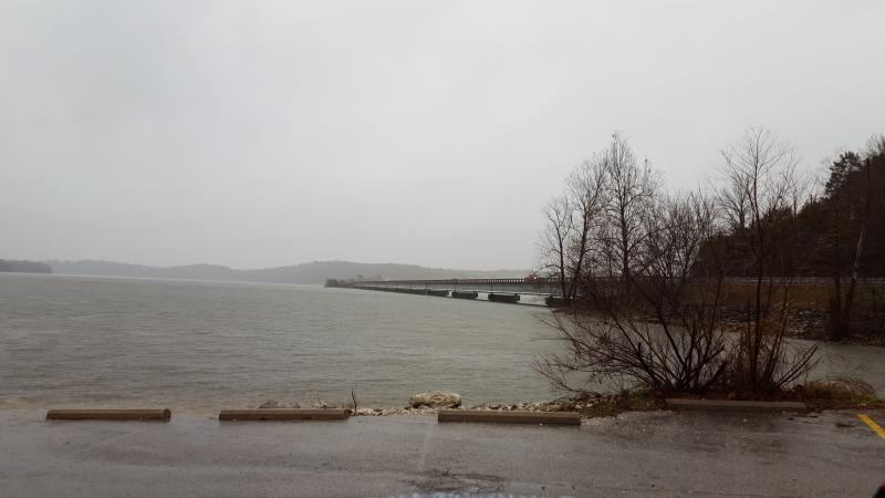
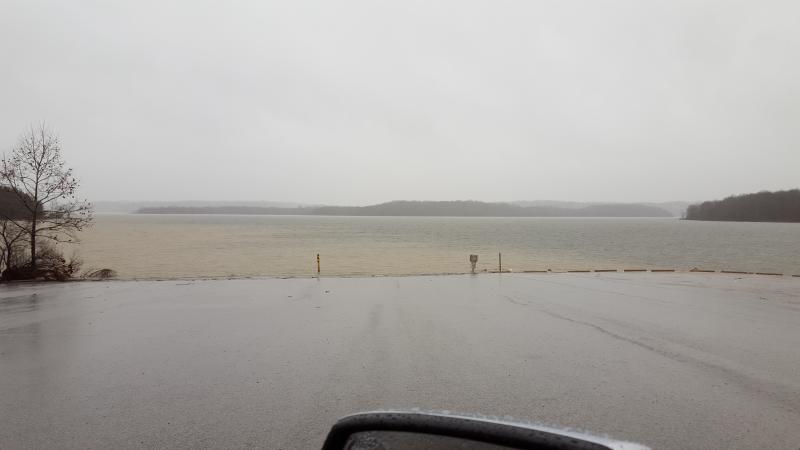
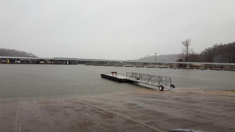
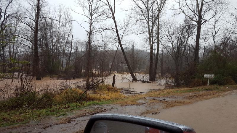
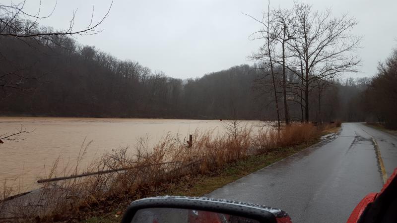
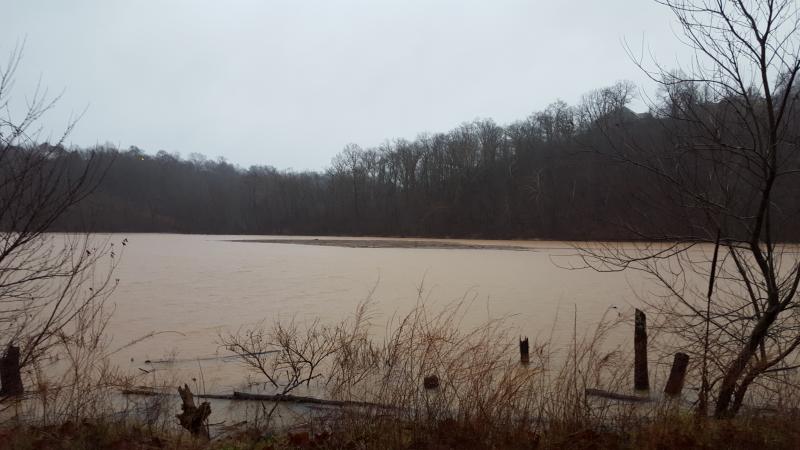
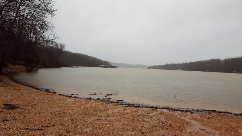
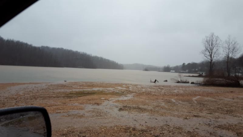
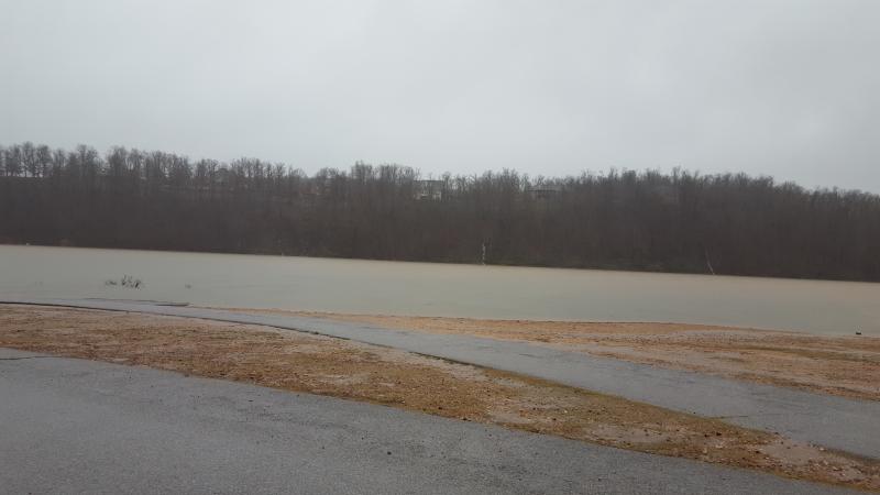
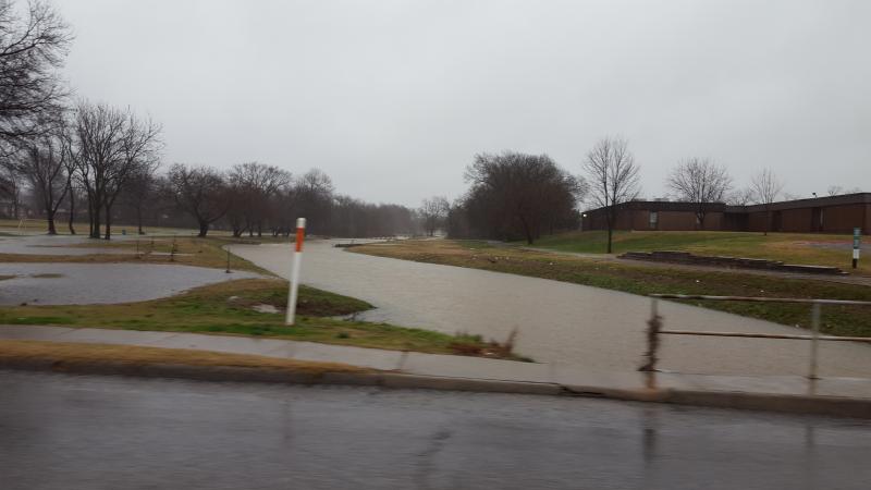
Seeing how I have been a little sick and have not left the house but once since Christmas Eve and that was fishing, I decided to get out and check the water levels at the lake. Seeing how the water level is at an all time historic level for winter time water levels. I am uploading a few of those photos. Hopefully the site will allow me to upload them. Got some interesting pics? Share them. This thread could be added as a sticky because it's not likely to happen again(?). Walnut is down to 2-lane traffic because the run-off is so bad it's not draining fast enough. I've seen high water and severe rainfall before but this is unprecidented. Scary stuff to think about what will happen once it gets past Norfork and how it's going to affect people in the delta. War Eagle River (stole this one from a Facebook feed) Hwy 12 Bridge Hwy 12 Ramp (notice the mudline mixing from runoff) Prairie Creek Marina (these ramps were completely out of the water on Christmas Day) Looking at Bradford Nursery from Old PC Road. That's Prairie Creek rushing into Beaver Lake) Very back of Prairie Creek Floating Debris Mat at Prairie Creek Sitting at the old dirt ramp in the back of Prairie Creek Monte Ne looking back towards the ampitheater. I clocked the water run-off going into Monte Ne at 8-9mph rushing down beside the highway. It was a rapid just before it hits the lake. Monte Ne Ramp (or lack there of) This is the drainage canal on the North side of Oakdale Middle School.