


JohnF52
-
Posts
453 -
Joined
-
Last visited
Content Type
Profiles
Forums
Blogs
Events
Articles
Video Feed
Gallery
Everything posted by JohnF52
-
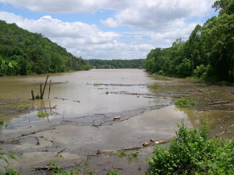
Here is a picture of a boat on plane running through the scattered debris coming down the upper lake. This was taken at Blue Springs bridge this afternoon.
-
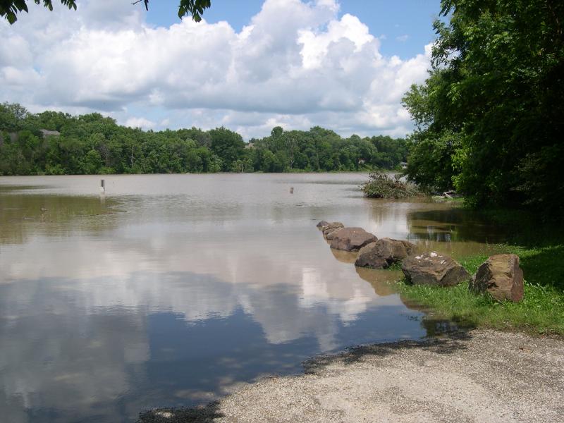
Here is a picture taken this afternoon near Beav-O-Rama public boat ramp. The ramp is out past the sign and the parking area is completely under water.
-
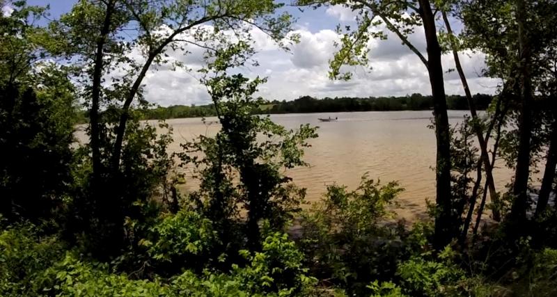
Here is a picture taken this afternoon from the road near Neil's Bluff in the river end. The channel is in the far background near the center of the picture, by the far treeline. Ordinarily, this is mostly a dry, gravelly creek bed. The lake is spread out HUGE at the river end compared to the usual. Carp were rolling in the debris in the foreground.
-
F&F, Can you see if the mud line has passed 12 bridge?
-
What can anyone say? Not slowing down is plain stupid.
-
This quick rise means lots of debris and large logs in the water. Hopefully, most boaters will realize that fact and slow down. I would be hesitant to exceed 15 mph on the water right now. A wind direction change can bring huge rafts of partially submerged debris off the banks, and some of it is difficult to spot in rough water until you are nearly on top of it. There might be lots of equipment damaged today.
-
They have been running all generators for seven straight hours now. The Southwest Power Administration controls that. Maybe they are taking advantage of all the nearly free power they can sell at this time. By generating around the clock, no more rain, and the inflow dropping rapidly, they might barely avoid 1130. Just maybe.
-
I have been around to these places during flood stage. They only close campsites and day use areas that are actually flooded or have access blocked by the high water. The higher sites remain open. 1129.02 at 9:00 AM.
-
Go to your White River link, then go to summary of all data available for this site, then go to peak streamflow. There is also another site that compares peak sreamflow to probability. The 2004 event calculates to a little less than a 1 percent probability, about 0.77% for any year. .77/1=1.298. 1.298 x 100 is about 130 years. The more common flood event recurrences are obvious from the graph. I used the table to get exact values.
-
Applied to the Beaver watershed, the 2011 events could be classified as 5 to 6-year events, but there were two of them about a month apart, in April and May 2011.
-
The historical record for the White at Wyman bridge is 140,000 CFS set in April 2004. I saw that flood. It washed out the road on the east side of that bridge. The current flood is about an every other year event. The 2004 event is rated as about a 130 year flood.
-
I think the flood gates will open sometime late Monday or Tuesday.
-
White River at Elkins is out of banks in many places at this time. Muddy and very trashy with woody debris.
-
I think it is true that 10 percent or less of the fishermen catch 90 percent or more of the fish. I am not close to being in that 10 percent, but am trying to work on it. This year has not been easy due to the flooding, since I usually fish the river end and smaller waters. I don't see the catching problem as fishing pressure, but as lack of skills.
-
If Sequoyah dam was removed, there would be many more miles of flowing water. It is almost completely silted in anyway.
-
Creeks above Elkins are raging torrents. Floodwaters are on the way to Beaver Lake.
-
I am scared to get on the big end of Beaver in my 25 hp Xpress 1650VJ unless I am in a heavily timbered cove. 16 inch transom and only 26 mph max.
-
Lots of shorts get kept in the spring river run because most don't seem to know about the size limits. Plus--I am shocked by the inability of some to identify fish species. Some can't tell a walleye from a white bass.
-
The Richland Creek USGS gauge at Goshen is inaccurate at this time. I was there today and there is about three feet of lake water at the gauge. The flow is calculated from gauge height. There was a bass boat up in there where I dragged a canoe over shoals a few weeks ago.
-
Guy I talked to that saw it said he called game and fish and they never showed and didn't seem that interested in enforcement (can't get blood from a turnip thing...iow the perps have no assets).
-
There have been 2nd hand reports of early spring night time illegal cast netting on the shoals above Twin Bridges. Also I saw a kayak coming down the upper white with a big stringer of small walleye (12-15 inch). These kinds of things don't help.
-
It is supposed to be good for future fishing if we have a high water year. If it stays up through July, maybe the new fry (if any, it was a crazy weather spawning season) can survive by hiding in the flooded grass and bushes. If we have a low water year subsequently, then fishing should be good at that time.
-
Since lower Branson flooded in 2011, I think there is political push to keep Table Rock from getting too high if at all possible. Lots of money was lost in and near Branson. Congressmen can influence the Corps by funding or not funding.
-
On Beaver, I go fishless more often than not. I like to fish a lot, but unless conditions are at least decent, I will find something else to do. This year has been frustrating due to cold snaps, wind, and multiple river floods.
-
Beaver is the first flood control lake in a chain of three. If the USACE lets water out they cannot put it back. I think it might be also related to greater pressure from the tourism industry near Branson. High water makes conditions worse for camping and water sports in general.


