SKMO
-
Posts
366 -
Joined
-
Last visited
Content Type
Profiles
Forums
Blogs
Events
Articles
Video Feed
Gallery
Everything posted by SKMO
-
Ok Guys – I want all TR fishermen to take notice of this. I’ll throw out some random thoughts I have after listening to Stephan McMurray, the MDC Fisheries Research Biologist as he gave a presentation to the MNRC (Missouri Natural Resources Conference) at Lake Ozark , (Tan-Tar-A) last week. Please forgive me if I have some facts somewhat skewed but I’ll do my best. The economic impacts of Z-Mussel infestation are horrendous. From a fisherman’s standpoint they are almost insignificant, when compared to the problems they create with water utilities and power generation facilities and other infrastructure they are pretty minor. We are talking about hundred of millions of dollars to respond to the problems that zebra mussels create. The main problem that Zebras present (and there are actually 2 species) to fishermen that they are complainng about is that they are razor sharp objects that cut fishing line. At least that is the initial feedback state agencies have gotten from fishermen, in their focused point of view, as far as their concern regarding the mussels. Not too concerned about overall biology, definitely most concerned about losing $4 baits. The BIG question that we all have as fishermen is not so much getting our baits cut off on sharp mussels, but what is this, might this, will this, do to our fishery. Here is the concern: Yes the mussels are filter feeders and might clarify the water (not like we have a water clarity problem) BUT newly hatched fry of bass, crappie and other game fish also feed on the same plankton that the mussels suck out of the fo0d chain, Plus is water clarity a problem on TR? No! What might be a problem will be the overall disruption of the food chain link of phytoplankton to fry to recruitment of gamefish. I am sure you all have an opinion on this but the Biologists I have talked with are the first to admit they do not have a clue whether the Z will have a positive, negative, or neutral impact on Table Rock, when it gets here, And I do not think there is any question as to maybe/if, just when. I have not talked with anyone who has any degree of doubt that the Z will end up in TR. Repurcussions are a complete unknown. The biologists I have talked with are totally dependant on those of us that take boats from one waterway to another to slow the spread of the things.
-
Ok Guys – Let me check in on this Zebra Mussel conversation. I’ll throw out some random thoughts I have after listening to Stephan McMurray, the MDC Fisheries Research Biologist as he gave a presentation to the MNRC (Missouri Natural Resources Conference) at Lake Ozark , (Tan-Tar-A) last week. Please forgive me if I have some facts somewhat skewed but I’ll do my best. The economic impacts of Z-Mussel infestation are horrendous. From a fisherman’s standpoint they are almost insignificant. Compared to the problems they create with water utilities and power generation facilities they are pretty minor. We are talking about hundred of millions of dollars to respond to the problems that zebra mussels create. The main problem that Zebras present to fishermen is that they are razor sharp objects that cut fishing line. At least that is the initial feedback state agencies have gotten from fishermen, in their focused point of view, as far as their concern regarding the mussels. Not too concerned about overall biology, definitely concerned about losing baits. The question that we all have as fishermen is not so much getting our baits cut off on sharp mussels, but what is this, might this, will this, do to our fisheries.. Here is the concern: Yes the mussels are filter feeders and might clarify the water BUT newly hatched fry of bass, crappie and other gamefish also feed on the same plankton. I am sure you all have an opinion on this but the Biologists I have talked with are the first to admit they do not have a clue whether the Z will have a positive, negative, or neutral impact on LOZ.
-
Tom - Go to the Kings River section of the forum (there is not all that much there) and read those posts. Then go to the Table Rock Archives and pull that up and do a search on the word "Walleye" After reading what you find in those spots fire away with any additional questions, if you have some unanswered someone will try to help. I think you will find info on access, timing, baits, etc already posted and not much has changed in the last year but if you do not find the info you need after reviewing the older stuff just fire away. No need to reinvent or retype the wheel, I think the info you want is mostly there.
-
Great report from Billy B as usual, assimilated from a variety of quality sources, least of which being myself as I sure pounded mud 3 trips in a row a couple weeks ago. But might have some momentum going again. Hints: Stickbait as Bill indicated. Some shade of purple on top of the stick seems to get attention, as do slimmer baits like the ol' classic Rogue, (in preference to my love affair with the Pointer 100 the last couple years.) This gal has (pointer) has given much attention to my dance card the last few years but it is Ms Rogue for me for now. Not sure why the plumper EASIER to throw pointers don't work for me, but they are not. My #2 pattern, which some days is #1, is pitching jigs around laydowns. Not too far off main lake channel. Main lake gravel pockets with some wood, or just inside coves. 1/4 or 3/8 oz jig with twin trailer in some shade of green or brown. Water must have some discolor as I do not have any confidence in this in clear water. In dingy water there are some nice fish that park under laydowns in 2-8' of water. This is a mid-day to afternoon bite for sure and works best when the sun shines. Pitch the jig on top of a log, let it fall of and work it out to the tip of the tree. This is a real good time to be out for bigger fish. Maybe a bite or so per hour but is actually uncommon to catch a short fish.
-
I have a 2006 Navionics Hotmap chip for use in GPS or Chartplotters. It was purchased in Oct 2006 and shows Missouri lake and all southern lakes at 20' contour intervals. 12 states of data from NE to NM to FL and everything in between. Reason I am selling it is because I upgraded to the 2007 data set which has Table Rock and some other MO/AR lakes mapped at 1' contours. Cost 150 new I will sell for 50 or consider something you got on a trade. You might ask why you would buy an older chip when a newer more accurate one is available: Reason being some 2-3 year old GPS/Sonar units will NOT run this chip. X-15's and X-17 and many other units not really all that old will not run the 2007 Premium chip. In any case I'll sell it for 1/3 price or take something on trade if anyone is interested.
-
I have both seen and read about them. I am actually a little confused as to how to interpret them. For one thing when I vertical fish I want to know exactly what is under the boat, not off to one side. Also they seem to show bottom structure real well and can produce nice pictures of trees, bridges, sunken boats etc. but it seems like the fish echos are kind of indistinct and harder to interpret. I talked with a fellow who tested on for a week and he said that to get the nice pretty underwater pictures (of a bridge for example) you had to be going at just the right angle and speed to produce a perfect looking image, otherwise it's a lot harder to interpret. After field testing it for a week he decided not to go for one, as he said for him it offered more confusion than answers and he did not feel like undertaking the learning curve. I guess I too am an old dog not ready to learn new tricks, and when I upgraded to a Lowrance 25C last fall I was not convinced that the side scanners would be any advantage to me and in fact might have been a disadvantage. In any case I am 100% pleased with the 25 and cannot imagine wanting or needing more information. I am sure they are great units once you learn to work with them.
-
Increasing the sensitivity gives a wider cone angle: http://www.lowrance.com/tutorials/sonar/so...tutorial_01.asp Read the section on cone angles it it explains it, but do not know if you would get 60 degrees. There is a ton of good info in all the sections of the tutororial, worth reading or re-reading any time.
-
I think it's a problem with the Yamaha finishes but I have tried all the products everyone listed above and still the only way for me to even touch the stuff is with a polishing compound.
-
Been out of town at meeting all week. Ramp was snow covered this AM, would take 4WD to launch and it did not lok like it had been used. This one takes a while to clear since it faces north and does not get any sun. I have launched before when it was like tis at Campbell Point. Don't use the concrete ramp, just launch right off the gravel bank over by the marina dock, it faces south and clears quick plus you are on a gravel base for some traction.
-
We threw the stickbait a bunch but only caught a couple. Did better on jigs and cranks fished around laydowns close to the bank. Water was pretty dingy around Big M and around 44 degrees wherever we went. I think there was quite a bit of muddy water that came down Rock Creek and Roaring River. I imagine if you got past Roaring River the water would be a lot clearer. I personally do not seem to do well with a stickbait in dingy water.
-
Private mail me your phone number or email and I will give it to Tom who is a friend and neighbor. You must have a bad email address or something. Or call him at the Shell Knob Chamber of Commerce any Thursday or Friday (858-3300) he will answer the phone. Or write to him at the chamber of commerce: Shell Knob Chamber of Commerce, Shell Knob MO 65747. He is not hard to get in touch with.
-
Put in about 0930 at the SK bridge and went upstream on the White to get out of the mud which is real bad coming out of the Kings, but clears quite a bit as you go upstream, but still not as clear as usual. Water around 44 degrees wherever we went. Made it as far as Owl creek. 2 of us caught 14 by 2 PM with 7 legal LM, largest was 19", most were just solid 16-17. Pattern for us was on 45 degree chunk rock banks up to 100 yds inside cove mouths or in little chunk rock pockets on the main lake. Caught 2 on stickbaits, 3 more on cranks, but best bait for me (had 9) was pitching a jig along laydown logs in 2-6' of water. The shallow wood seemed inportant we caught almost all the fish bouncing the stick, crank or jig right on the wood. Around 2PM found a major cove with pretty clear water with quite a few birds milling around and pretty quickly found a large bunch of shad. Between 2 and 4:30 caught maybe a dozen Ky's with 3 legals, plus 2 crappie and a 22" walleye. This done with smoke jigs and tubes around 45-50 deep in 70' of water.
-
http://www.dyna-prop.com/ Dyna-Prop at Cape Fair is good, I have used them a lot. There is another one on 86, can not remember the name. A couple more in Nixa and Ozark. I have heard good things about all of the prop shops, seems like they are all decent and return your prop in new condition for about the same price,
-
Went out at daybreak and threw a purple/chartruse buzzbait with great success..... Wait a minute, I'm just making this all up! Suckah! Just wondered how many people would look at the post, how many bass fishermen were hungry for info. Sorry if you feel taken advantage of, but I needed to feel the bite. SKMO
-
Here in Shell Knob at 11:30 still 34 degrees and liquid. Talked w/folks in Monett and they got hammered last night, guess the critical temp is still stalled somewhere in the middle of Barry County. Also talked with a guy south of Cassville and they started icing last night. Anyway no ice here right next to the lake. Have never figured this out as I thought cold air sank and it would be colder in the lake valley, but it is always colder up on the plateau/mountains. Warmer around the lake. Doubt if it has anything to do with "lake effect" i.e. lake water would affect the air temp that much. So explain this: Cold air sinks due to density, yet higher elevations are colder as well. I have 3 days to figure this out I guess as I do not have the Cajones to venture forth this weekend.
-
As Bill above related someone somewhere can figure out a bite of some sort. Maybe a bit of an update or some info you could put to use: Talked with some more SK area fisherman that I know were out yesterday (Thurs), and my buddy ran down the rest. Nobody did worth a hoot in this area. Only good report we got was from a real good source and they trashed the KY's on the big wind-swept gravel flats in 15-25' of water around Baxter throwing spoons. Sounded similar to chasing white bass on Stockton or Grand. Anyway they said they were in 2' rollers and the only thing they could even fish was a heavy spoon as the water was wicked. They did really well. Can't say I have ever done this on TR but kudos to the guys that figured it out at that point in time. I wish I was there.... Moral of the story is: Well not sure there is even anything like morals involved but I would have to say the water is not that cold and the bass are still relatively active and eating, and it just aggrevates me when I can not get onto at least a wimpy pattern. At least one boat got onto some good action Thursday. I have always liked the "contrarian" approach myself. Do wierd stuff that nobody else is doing and you might meet some new fish. Usually conventional wisdom gets me in a rut that I do not really want to fish anyway. Chase the fish, not the fisherman. You know as much as the next guy. If you follow day-old information on this lake you are a day late and a dollar short.
-
The ramp does get pretty flat at normal pool, better when the lake is low. At Campbell Point I usually launch off the gravel to the left of the walkway going out to the marina dock. Better pitch and plenty of room, just launch an pull forward a couple feet to get your trailer out of the water.
-
Just knew today would be fairly good day to hit the bank with wind, clouds, approaching front. I threw nothing but stickbaits, my partner threw a few sticks, but more jigs. Keep hearing about the shallow (2-10') bite but it was not in the cards for us today. Fished from about Campbell Point, upstream to about half way between SK and Big M. We fished channel swings, bluff ends, gravel points, rock points, gravel flats (thinking SM), 45 degree chunk banks inside coves, and isolated cedar trees. Final tally zero keepers, zero shorts, zero bites. For as hard as we fished we were Amazed we did not stumble across one stupid hungry fish. It was too windy really to go after the deep shad-related fish but we did find a real nice bunch in a cove mouth 60-70' of water, where they have been hanging out the last couple weeks and it was not too windy in this spot, so we tried them about 40 minutes. Caught some more zeros. Did not really see anything that looked like bass hanging around anyway so I was not surprised we did not get bit. But with shad so few and far between it was kind of Amazing there were not a few predator fish around. Just for grins we looked in at least a dozen other spots for the shad, even if we had found them we could not have fished them due to the wind but we were curious as to their whereabouts. Checked mid-lake channel, deep gravel flats, cove mouths, back in coves. No shad to be found anywhere. This added to our already keen level of Amazement, as they were all over these spots a week ago. Arriving back at the SK ramp about 2:45 we were Amazed to find that 6 of the 9 rigs parked there at 11:00 were already gone! Quitters! Amazing how easily some people give up. As I let my buddy off he commented that he was going to have to set himself up with a Double Dewar's and Lakewater prior to making his evening's journal entry. This was amazing because I did not know he could write, and as far as I knew he took it neat straight from the bottle. Like I said it was an Amazing excursion. You could not imagine, how many times throughout the day we remarked to each other, "This is Amazing". Oh yeah, water temp was ~47.
-
After my bass fishing experience today catching carp sounds pretty attractive.
-
Welcome to SK, "The Quiet End" of the lake.
-
Here is the lake list: http://www.navionics.com/PremiumLakeList_07.asp?RegionID=2 All the "Red" lakes are the HD lakes. Last year MO had no HD lakes. Navionics is obviously being agressive in this market since they have to float their own fleet of contractors to collect the data which can not be cheap. Taneycome is not listed. As posted before I was not aware they even mapped it, maybe it will be out on a mid-year chip or it might be 01/08 before it is released. HD Paper maps for TR should be out in "a few months" or so I was told.
-
If you want the Taneycomo data better make sure the chip actually has it. According to the Navionics website TR, Lake Ozark, Truman, Bull Shoals and Stockton are the only MO lakes mapped at 1' on the '07 chip. They might add it in mid-year, but they told me they normally introduce new chips in Jan of every year. Even if they add it in mid-year you'd have to be careful that you were actually buying a chip that had it, as what you were buying might have sat on a shelf for a couple months and actually not be the latest release. Also BPS store only got in 5 chips yesterday and sold them all. The warehouse is supposed to get 300 later this week so you may want to call store first to make sure they are in. Chips are $150 and you can get a $50 rebate if you send in an old Navionics chip, and I think same deal if you turn in a competittors chip.
-
It has happened and it is significant. Navionics has released the 2007 Premium South data chip with The Rock mapped at 1' contours. If contour lines mean nothing to you, or if you do not run GPS on your boat, or if you do not fish deeper than 20', or if you do not know how to interpret a topo map and have no interest in learning, then you will not be interested in anything beyond this point. For the rest of the clan here's what I know and I have been following this closely and bugging Navionics a bunch about the last couple months. The new Navionics data chip for Table Rock is very unique. They actually sent a flotilla of survey boats to TR a year ago to do their own premium mapping. Problem was all older underwater data was from old USGS topo maps made before the lake was flooded at 20’ contours. There has never been an underwater survey since then that would benefit fishermen. I saw and talked with the guys on the mapping boats so this is not 2nd hand info. It is out now at a 1’ contour interval and it is awesome. Mapped with military grade side scanning sonar. Going from 20' contours to 1' contours is a huge difference. Not all units will run this chip but you can go to their (Navionics.com) website to see what will work. They will also put this info out on a paper map later this year, they just got into the paper map business. 2 Maps $20 each to cover TR. Personally I am pretty keen on all this. Fired up big time actually and I know this will make a difference in my fishing,, especially in Summer positioning those 30' breaks. We TR deep fishermen have a ton of new info look at.
-
I caught a few, half dozen or so but it was not that great. I could easily find shad all over the middle of the lake and in cove mouths in 50-100' of water. Shad were at all depths but there seemed to be very few larger fish hanging around and most would look but not bite. Probably should have gone back and checked in some coves, but I figured with the water temp stable and as many shad as were in mid-lake there would be some fish hanging around and I have yet to find any great numbers of shad past the cove mouths. Kind of clueless actually. Talked with 3 other boats and nobody was doing any good. One guy came up and told me there was a boat fishing Friday the exact same spot as I was in (75-90' of water with plenty of shad only 20-30' deep) and they had caught several legal KYs throwing chartruse rooster tails. Whatever. They were shallow enough that I had been fan casting a grub and spoon but no takers.
-
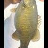
I launched at the SK bridge today and noticed that yesterday someone had cleaned maybe half 6-7 crappie up to 12" and one walleye that looked about 22", so to answer your question I guess somebody is getting a few on TR. Obviously don't know where, how or on what they were caught on. My guess would be minner fishermen on a bluff end. I saw a few of those out there to and they seemed pretty contentedly parked in the same spots for quite a while. Water temp still ~49 around SK. Has cleared up real well.