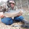
timsfly Posted November 7, 2008 Posted November 7, 2008 Fished a few hrs below Roaring River park today, caught 9 trout, 5 browns, 4 rainbows. Nothing over 15" but all appeared to be in good shape, all of them came out on a #8 mohair leech(olive) I started at the conservation area below the park, fished there a bit, and then drove down to the next bridge(muncy). Caught most of my fish around the conservation area parking lot, caught the nicest fish about 1/4 mile above the muncy bridge, it was a nice 15" brown. Great weather, saw a few more fish, missed several. Lots of deer out and about today, saw 1 nice buck and 7 does this afternoon. Tim Homesley 23387 st. hwy 112 Cassville, Mo 65625 Roaring River State park Tim's Fly Shop www.missouritrout.com/timsflyshop
strangercreek Posted November 11, 2008 Posted November 11, 2008 Tim, Do you know of a good map online that I can use to find the areas below the park? I have looked around before and did not have much luck finding access.
timsfly Posted November 11, 2008 Author Posted November 11, 2008 Tim, Do you know of a good map online that I can use to find the areas below the park? I have looked around before and did not have much luck finding access. You can get a good map on www.google.com/maps I use this a lot when going to new places. You can center in on Roaring River state park, and then you can move the map to the east and follow F-hwy. the road marked Prior rd, is the road that takes you to muncy, and if you go on down to hwy 86, and turn to the south, you'll see FR-2280, this will take you to Curry bridge, and the bridge is the end of Roaring River, every thing below the bridge is considered lake, there are trout below the bridge in the winter and some even into late spring. The best fishing is from the bridge up, good luck. Tim Homesley 23387 st. hwy 112 Cassville, Mo 65625 Roaring River State park Tim's Fly Shop www.missouritrout.com/timsflyshop
KCRIVERRAT Posted November 12, 2008 Posted November 12, 2008 Tim, Is the Muncy bridge the low-water bridge by the cemetary off of F Hwy.? If not, do you know the name of this bridge. I fish from there upstream quite a bit (my in-laws live in Shell Knob). Used to be a hole maybe a 1/4 mile or less upstream that produced nicely but a few years ago somebody lined rocks across the river and it silted in. If you've been by there I was wondering how it looked as I'll be down Thanksgiving. Thanks! HUMAN RELATIONS MANAGER @ OZARK FISHING EXPEDITIONS
timsfly Posted November 12, 2008 Author Posted November 12, 2008 The bridge at, or just below the muncy cemetary is the muncy bridge. Tim Homesley 23387 st. hwy 112 Cassville, Mo 65625 Roaring River State park Tim's Fly Shop www.missouritrout.com/timsflyshop
Members Poke 'Em Posted November 12, 2008 Members Posted November 12, 2008 I fished below the park last weekend and caught two small (4-5") rainbows. Do you suspect these are just some little fish that accidentally got put out with the stockers, or do you think there might be some natural reproduction in that stream?
timsfly Posted November 12, 2008 Author Posted November 12, 2008 The conservation guys have told me time and again that there is no natural reproduction in Roaring River, but how could there not be ? The rainbows keep going in other streams in the area, so I think yes there has to be some natural reproduction, not much maybe but there has to be some. I catch those little fellows quite often and they look as wild as a trout can look. Tim Homesley 23387 st. hwy 112 Cassville, Mo 65625 Roaring River State park Tim's Fly Shop www.missouritrout.com/timsflyshop
strangercreek Posted November 13, 2008 Posted November 13, 2008 You can get a good map on www.google.com/maps I use this a lot when going to new places. You can center in on Roaring River state park, and then you can move the map to the east and follow F-hwy. the road marked Prior rd, is the road that takes you to muncy, and if you go on down to hwy 86, and turn to the south, you'll see FR-2280, this will take you to Curry bridge, and the bridge is the end of Roaring River, every thing below the bridge is considered lake, there are trout below the bridge in the winter and some even into late spring. The best fishing is from the bridge up, good luck. Thanks Tim, I was using Google earth and the image isn't that good for the area (it gets me turned around). I will use the maps to see if that helps.
strangercreek Posted November 26, 2008 Posted November 26, 2008 Tim, I did some driving around Saturday after C&R ended at 4:00. I went down Prier Road (which I think is marked as FR1162) and went to the bottom of the hill near Muncy cemetery, is this area public access? There is a no trespassing sign near the end of the road. I then went down FR2260 (heads back west from 86 before you get to Eagle Rock), which goes past a campground, then to a low water concrete bridge, is this the Curry bridge? I did see fish in this area. My last question: I am not finding the parking lot to the conservation below the park. Is it the area right off Highway F, up on the hill? I saw some vehicles parked there. Sorry for all the questions but I guess it is best to ask an expert on the area. Thanks Jason
timsfly Posted November 26, 2008 Author Posted November 26, 2008 The Conservation pull off area is just right outside the park, probabaly where you saw all the cars(deer season) All the muncy area is flood plain, you can go to the bridge just past the cemetary and start there and fish up or down stream and nobody will say a word, just don't go walking accross the properties and you'll be ok. I go to the Curry bridge area and I park there sometimes and walk upstream from there, stay in the river or inside the flood plain areas and you'll do fine. Charles Curry lives just above the bridge. He was the hatchery manager for years at Roaring River, the hatchery stocks to the bridge once a month march-oct. Below the bridge is where the lake officially starts, above the bridge is where stream rules apply. Have fun, the fishing is good down there. Tim Homesley 23387 st. hwy 112 Cassville, Mo 65625 Roaring River State park Tim's Fly Shop www.missouritrout.com/timsflyshop

Recommended Posts
Create an account or sign in to comment
You need to be a member in order to leave a comment
Create an account
Sign up for a new account in our community. It's easy!
Register a new accountSign in
Already have an account? Sign in here.
Sign In Now