
Phil Lilley
-
Posts
19,030 -
Joined
-
Last visited
-
Days Won
132
Content Type
Profiles
Forums
Blogs
Events
Articles
Video Feed
Gallery
Everything posted by Phil Lilley
-
-
55 mw is a full unit of water BUT # of units running doesn't mean anything!!! They run 2-3 units most of the time so that they can more effectively inject liquid O2 in the turbines, mixing the water before exiting. This happens in the fall when the DO is low coning out of Table Rock. So either MW or lake level is the key to knowing whether or not it's wadeable. They've been running 16 mw of water the last couple of days. That's contrary to what the schedule says they would run. 16 mw is a strange level because they don't run that little very often. They SAID that small amounts of generation is very hard on the turbine prop's blades - but that's what they're running at times. Sixteen mw I would think would be excellent for wading... even better than no generation at all. But I'm not up there enough to be an authority on that subject.
-
They catching rainbows and browns?
-
Any other suggestions/additions are welcome!!?
-
Lake of the Ozarks is known mostly as “Lake Oz” or the “Magic Dragon,” due to its shape. It was impounded in 1931 with the damming of the Osage River by Bagnell Dam. The dam, built by Union Electric Co. out of St. Louis, is currently owned by Ameren Electric. This 92-mile stretch of the mighty Osage River impounds 56,000 acres of water. It rarely rises or falls more than five feet from its standard pool level of 660 feet. It is the largest lake in the world that has never been a flood-control basin. Lake of the Ozarks Lake Levels Lake of the Ozarks’ diverse population is the basis of its wide appeal. It can be called "Little Miami" for its thunderous 70-foot jet boats and multi-million dollar retreats in the Lake Ozark, Osage Beach, Sunrise Beach areas of the lake contrasted with the extremely modest cabins and small lake front homes on the Osage Arm of the lake, from Camdenton to Warsaw. Lake of the Ozarks’ real calling card, however, is the fishing. Without a doubt, Lake Oz harbors one of the most diverse fisheries in the entire Midwest. Fishing season really jumpstarts on March 15 with paddle fish or spoonbill snagging season; these prehistoric residents of the Osage are mined from the river above the 60-mile mark to Truman Dam. Sixty- to 80-pound fish are caught every year. Lake Oz is also known for fantastic crappie fishing as most of its 25,000 private docks have been surrounded by brush that the dock owners have planted to entice these tasty white fish. Are there largemouth bass in Lake Oz? You bet. Lake Oz is one of Missouri's biggest stops for the play-for-pay boys. FLW, Bassmaster Elite, Stren, Everstart and loads of regional and local fishing tournaments -- along with about everyone with a rear winder -- wants to pitch a bait on this big bass factory. Lake Oz also has extremely high populations of blue cat, white bass, hybrids, sunfish and rough fish, making it, unquestionably, one of Missouri's top fishing destinations. With abundant accommodations, on its 1,500 miles of shoreline and water ranging from murky on the Osage to clear on the Niangua and Gravois Creek arms, there is something for everyone on Mid-Missouri's Lake of the Ozarks. Fishing Regulations Bass, black (largemouth), smallmouth and spotted bass (kentuckies)- 15-inch length limit, 6 daily, 12 possession. White bass, striper, hybrid bass- 15 total daily (only 4- 18 inches or longer can be kept in a daily limit), 30 possession. Rock bass (goggleye) - no length limit, 15 daily, 30 possession. Crappie, white or black - 9-inch length limit, 15 daily, 30 possession. Bluegill - no limit Catfish - no length limit, 10 daily (only 5 can be flatheads in a daily limit), 20 possession Walleye - 18 inch minimum length, 4 daily, 8 possession. Spoonbill - 2 daily between March 15 and April 30. Length - 34 inches between the eye to the fork of the tail minimum. Non-Game fish - Snagging, snaring and grabbing are allowed from 3/15 - 4/30 only. Fishing Licenses - Costs: Missouri Resident Annual License is $12 Non-resident annual license is $49 Trout permits are only sold annually, and they are $10 for adults and $5 for kids under 16 years of age All Missouri licenses and permits expire on March 1 Non-resident One Day - $8 Non-resident Three Day - $24 Missouri Residents over age 65 only need a trout permit $10 Buy Missouri Fishing Licenses Online! Missouri Wildlife Code Report Violations - Poachers In cooperation with the Missouri Department of Conservation, Operation Game Theft works to stop the illegal taking of fish and wildlife that includes trophy animals and rare and endangered species. Interesting information about water level and flood gates at Bagnell Dam - One or two times in an average year the floodgates at Bagnell Dam are opened wide to accomodate high water on the Osage River. If you're one of the relatively few people who have seen the show in person, I'm sure you'll agree with me that it is an awesome sight to behold. For those of you who have never seen it, take a look at these fantastic photos shot by area resident Kevin Dreps. Kevin was on hand January 10, 2005, to capture this amazing display of power as 1,212,000 gallons per second roared through the floodgates. MDC Structure Habitat Map Buy Missouri Fishing Licenses Online! Compiled by Bill Babler View full article
-
 Lake of the Ozarks is known mostly as “Lake Oz” or the “Magic Dragon,” due to its shape. It was impounded in 1931 with the damming of the Osage River by Bagnell Dam. The dam, built by Union Electric Co. out of St. Louis, is currently owned by Ameren Electric. This 92-mile stretch of the mighty Osage River impounds 56,000 acres of water. It rarely rises or falls more than five feet from its standard pool level of 660 feet. It is the largest lake in the world that has never been a flood-control basin. Lake of the Ozarks Lake Levels Lake of the Ozarks’ diverse population is the basis of its wide appeal. It can be called "Little Miami" for its thunderous 70-foot jet boats and multi-million dollar retreats in the Lake Ozark, Osage Beach, Sunrise Beach areas of the lake contrasted with the extremely modest cabins and small lake front homes on the Osage Arm of the lake, from Camdenton to Warsaw. Lake of the Ozarks’ real calling card, however, is the fishing. Without a doubt, Lake Oz harbors one of the most diverse fisheries in the entire Midwest. Fishing season really jumpstarts on March 15 with paddle fish or spoonbill snagging season; these prehistoric residents of the Osage are mined from the river above the 60-mile mark to Truman Dam. Sixty- to 80-pound fish are caught every year. Lake Oz is also known for fantastic crappie fishing as most of its 25,000 private docks have been surrounded by brush that the dock owners have planted to entice these tasty white fish. Are there largemouth bass in Lake Oz? You bet. Lake Oz is one of Missouri's biggest stops for the play-for-pay boys. FLW, Bassmaster Elite, Stren, Everstart and loads of regional and local fishing tournaments -- along with about everyone with a rear winder -- wants to pitch a bait on this big bass factory. Lake Oz also has extremely high populations of blue cat, white bass, hybrids, sunfish and rough fish, making it, unquestionably, one of Missouri's top fishing destinations. With abundant accommodations, on its 1,500 miles of shoreline and water ranging from murky on the Osage to clear on the Niangua and Gravois Creek arms, there is something for everyone on Mid-Missouri's Lake of the Ozarks. Fishing Regulations Bass, black (largemouth), smallmouth and spotted bass (kentuckies)- 15-inch length limit, 6 daily, 12 possession. White bass, striper, hybrid bass- 15 total daily (only 4- 18 inches or longer can be kept in a daily limit), 30 possession. Rock bass (goggleye) - no length limit, 15 daily, 30 possession. Crappie, white or black - 9-inch length limit, 15 daily, 30 possession. Bluegill - no limit Catfish - no length limit, 10 daily (only 5 can be flatheads in a daily limit), 20 possession Walleye - 18 inch minimum length, 4 daily, 8 possession. Spoonbill - 2 daily between March 15 and April 30. Length - 34 inches between the eye to the fork of the tail minimum. Non-Game fish - Snagging, snaring and grabbing are allowed from 3/15 - 4/30 only. Fishing Licenses - Costs: Missouri Resident Annual License is $12 Non-resident annual license is $49 Trout permits are only sold annually, and they are $10 for adults and $5 for kids under 16 years of age All Missouri licenses and permits expire on March 1 Non-resident One Day - $8 Non-resident Three Day - $24 Missouri Residents over age 65 only need a trout permit $10 Buy Missouri Fishing Licenses Online! Missouri Wildlife Code Report Violations - Poachers In cooperation with the Missouri Department of Conservation, Operation Game Theft works to stop the illegal taking of fish and wildlife that includes trophy animals and rare and endangered species. Interesting information about water level and flood gates at Bagnell Dam - One or two times in an average year the floodgates at Bagnell Dam are opened wide to accomodate high water on the Osage River. If you're one of the relatively few people who have seen the show in person, I'm sure you'll agree with me that it is an awesome sight to behold. For those of you who have never seen it, take a look at these fantastic photos shot by area resident Kevin Dreps. Kevin was on hand January 10, 2005, to capture this amazing display of power as 1,212,000 gallons per second roared through the floodgates. MDC Structure Habitat Map Buy Missouri Fishing Licenses Online! Compiled by Bill Babler
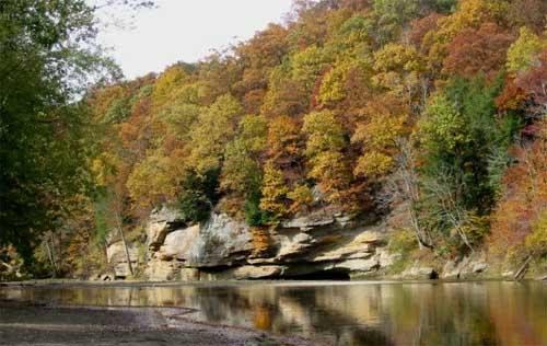
 -
 Crane Creek is one of the most unique streams in the Midwest. In the late 1800's, railcar brought a strain of rainbow trout called the McCloud from the west coast to be raised and stocked in spring fed creeks and rivers in Arkansas and Missouri, including Crane Creek. In 1967, the Missouri Department of Conservation stocked rainbows in Crane, and trout have not been stocked there since. The rainbows found in Crane Creek today could be a kin to the famous McCloud strain but it is not a pure strain. But the trout are wild, born and raised in Crane. Crane Creek is one of seven streams the Conservation Department has designated as wild trout management areas which also include Barren Fork, Blue Springs Creek, Mill Creek, Spring Creek and portions of the North Fork and Eleven Point rivers. The wild trout are treasured in a state that does not have naturally producing trout, serving as a genetic pool backup in case hatchery fish become diseased. Crane Creek rainbows have a reputation for being shy, one reason for their endurance. They tend to seek shelter with any strange movement, making them a challenge to sneek up on. Some say they aren't too picky about what fly they take, but getting close enough to cast to them is the trick. Crane Creek is located in and around the town of Crane, Missouri, southwest of Springfield and southeast of Joplin. There is plenty of public fishing in town as well as in areas owned and managed by the MDC. The Department has placed special regulations on fishing some areas of the creek, such as catch-and-release only or flies and lures only. See our Crane Creek map for more details. If you get the privledge to fish this little gem, please be careful with our wild rainbows. Try not to handle them. Use barbless hooks or bend the barbs down on the hooks you have. And return those caught to the water as quickly as possible. Click on Map for a PDF Formated Map download you can print and use. Fishing Regulations Crane Creek only has a Blue Ribbon Trout Area 8.0 miles Stone and Lawrence Counties Upstream from Quail Spur Road crossing on Stone County Rd 13-195 At least 18-inches Daily Limit - 1 Artificial lures and flies only Trout Lure Definitions Fly is an artificial lure constructed on a single point hook, using any material except soft plastic bait and natural and scented baits as defined below, that is tied, glued or otherwise permanently attached. Artificial Lure is a lure constructed of any material excluding soft plastic bait and natural and scented bait as defined below. Soft Plastic Bait - synthetic eggs, synthetic worms, synthetic grubs and soft plastic lures. Natural and Scented Baits - a natural fish food such as bait fish, crayfish, frogs permitted as bait, grubs, insects, larvae, worms, salmon eggs, cheese, corn and other food substances not containing any ingredient to stupefy, injure or kill fish. This does not include flies or artificial lures. It does include dough bait, putty or paste-type bait, any substance designed to attract fish by taste or smell and any fly, lure or bait containing or used with such substances. Fishing Licenses - Residents - those fishing of the ages of 16 and older and 65 are required to have on their person a valid Missouri fishing license. Those 65 and older do not need a fishing license. Proof of residency - Valid Missouri Drivers License. Non-residents - those fishing of the ages of 16 and older are required to have on their person a valid Missouri fishing license. For Missouri & Arkansas residents only - a special border permit can be purchased to allow fishing in both Missouri and Arkansas without purchasing an out-of-state license. A Missouri TROUT STAMP is required for ANYONE who fishes the trophy or Blue Ribbon area on the Current River, regardless if the angler is keeping or releasing their catch. (New March 1, 2005) Costs - Resident - $12 annual Non-resident - $42 Daily - $7 Trout Stamp - $7 Buy Missouri Fishing Licenses Online! Missouri Wildlife Code Report Violations - Poachers In cooperation with the Missouri Department of Conservation, Operation Game Theft works to stop the illegal taking of fish and wildlife that includes trophy animals and rare and endangered species.
 -
 The James River that is covered by this site runs from Springfield Dam down to the Table Rock Lake confluence. These maps show accesses as well as proximity to local roads and routes. Click each link to download a PDF formated file that can be printed and used. James River Full Map.pdf Full James River Map ~~~~~~~~~~~~~~~~~~~~~~~~~~~~~~~~~~~~~~~~~~~~~ James River Map- Upper River.pdf Upper James River Map ~~~~~~~~~~~~~~~~~~~~~~~~~~~~~~~~~~~~~~~~~~~~~ James River Map- Middle River Three.pdf James River Middle River Map #3 ~~~~~~~~~~~~~~~~~~~~~~~~~~~~~~~~~~~~~~~~~~~~~ James River Map- Middle River Two.pdf James River Middle River Map #2 ~~~~~~~~~~~~~~~~~~~~~~~~~~~~~~~~~~~~~~~~~~~~~ James River Map- Middle River One.pdf James River Middle River Map #1 ~~~~~~~~~~~~~~~~~~~~~~~~~~~~~~~~~~~~~~~~~~~~~ James River Map- Lower River Two.pdf James River Lower River Map #2 ~~~~~~~~~~~~~~~~~~~~~~~~~~~~~~~~~~~~~~~~~~~~ James River Map- Lower River One.pdf James River Lower River Map #1 ~~~~~~~~~~~~~~~~~~~~~~~~~~~~~~~~~~~~~~~~~~~~~
 -
 The James River, with its proximity to Springfield, draws fishermen who may only have an afternoon to wade or canoe the water, angling for smallmouth, rock fish and walleye. Its deep holes and shallow riffles offer plenty of hiding places for big fish -- bigger than most anglers think. It's a slow moving, fairly straight river, not like its neighbors, the Gasconade and Niangua rivers. Its watershed covers a vast area around Springfield, so it can move a great deal of water if necessary. The James is one of four rivers that feed Table Rock Lake along with the White, Kings and Long rivers. In the spring, the James gets a great run of game fish heading up river to spawn. White bass, walleye, spoonbill and other fish crowd the river with anglers in boats and on the banks targeting them. There are outfitters that dot the river at major access points. They can help with shuttles, canoe rental and camping all up and down the river. James River Map Link USGS River Levels James River near Springfield, MO James River near Boaz, MO James River at Galena, MO Fishing Regulations **Bass, black (largemouth), smallmouth and spotted bass (kentuckies)- 12-inch length limit, 6 daily, 12 possession. **Exceptions - James River between Hootentown Bridge to Highway 13 Bridge, one small mouth, 15 inches or longer. Statewide season on bass in rivers and streams is open from the 4th Saturday of May till the last day in February annually. White bass, striper, hybrid bass- 15 total daily (only 4- 18 inches or longer can be kept in a daily limit), 30 possession. Rock bass (goggleye) - no length limit, 15 daily, 30 possession. Crappie, white or black - 10-inch length limit, 15 daily, 30 possession. Bluegill - no limit Catfish - no length limit, 10 daily (only 5 can be flatheads in a daily limit), 20 possession Walleye - 18 inch minimum length, 4 daily, 8 possession. Spoonbill - 2 daily between March 15 and April 30. Length - 34 inches between the eye to the fork of the tail minimum. Non-Game fish - Snagging, snaring and grabbing are allowed from 3/15 - 4/30 only. Fishing Licenses - Residents - those fishing of the ages of 16 and older and 65 are required to have on their person a valid Missouri fishing license. Those 65 and older do not need a fishing license. Proof of residency - Valid Missouri Drivers License. Non-residents - those fishing of the ages of 16 and older are required to have on their person a valid Missouri fishing license. For Missouri & Arkansas residents only - a special border permit can be purchased to allow fishing in both Missouri and Arkansas without purchasing an out-of-state license. Costs (Missouri) - Resident - $12 annual (March 1 thru last day of February) Border Permit - $10 Non-Resident - $42 annual (March 1 thru last day of February) Daily Permit - $7 (midnight to midnight) Buy Missouri Fishing Licenses Online! Missouri Wildlife Code Report Violations - Poachers In cooperation with the Missouri Department of Conservation, Operation Game Theft works to stop the illegal taking of fish and wildlife that includes trophy animals and rare and endangered species. Access to the river starting at the upper end below Lake Springfield: Henshaw Access Tailwaters Access 141 Road Access Blue Spring Road Access Nelson Bridge Access Delaware Twon Access Highway 14 Access Frazier Bridge Access Shelvin Rock Access Hootentown Access McCall Brdige Access H.L. Herr Access Ralph Cox Access (Galena) Blunks Access (Boat Ramp) McCord Bend Access (Boat Ramp) Flat Creek Access (Boat Ramp) Bridgeport Access (Boat Ramp) The Missouri Canoe Floaters Association is a non-profit organization of paddle sports outfitters who are dedicated to the preservation of our natural resources. Established in 2003, James River Outfitters of Galena offers a wide range of services including outfitting for canoeing, fishing, tent camping, floating, swimming, nature photography, bird watching or just relaxing and enjoying the scenery. Y - Bridge Canoe Rental, located in Galena, is nestled right alongside the beautiful James River, offering unforgettable experiences on the water. Hootontown Canoe Rental and Campground. Open May though September 7 days a week. Call ahead for reservations. Canoeing • Rafting • Tubing • Fishing • Swimming • Camping Shuttle Service available as well as winter reservations. Family owned and operated by Steve, Diana, Leah and Steven Newman (William Carver Hooton was a pioneeer settler of Hootontown, Missouri; the spelling has since changed to Hootentown.)
 -
 Elk River maps are brought to you by Russ Stovall, owner and operator of Hog Heaven Canoe Rentals. Click on each map header to download a pdf format of each full map. Mile-By-Mile Descriptions Big Sugar Creek 0.0 In high water, a put-in may be made on Big Sugar at the Roller Bridge. Hwy. 90 and KK. A county road parallels much of the creek from here to Powell. 5.5 Powell. Road is close to the creek and several bridges make this a good put-in area. 6.0 Bentonville Hollow (creek) and Hwy. E Bridge. 6.8 Low-water bridge on creek road. Mikes Creek on right. Creek road (south bank) shortest route to Cyclone. A few poor places in the road. 7.8 Kings Valley (creek) on right. 12.3 End of Hwy. V at Little Cedar Hollow on right. 14.6 Cyclone low-water bridge. Camping, swimming and good access. Many floats start here. Best put-in for normal water. Creek road on north side from here to Pineville. 20.4 MDC Deep Ford Access (public). 20.9 Low-water bridge at "Crag O Lea." Good access. 22.4 "Sugar Beach" (cottages). 23.9 Creek divides. Left channel flows into Little Sugar Creek and bypasses Pineville. Right channel is the old channel and shorter. 24.3 Little Sugar Creek joins to form Elk River. The lower part of Little Sugar has a gradient of 9 and is floatable in good normal water. Little Sugar Creek 0.0 Put in at Hwy. 90 Bridge northeast of Jane. 1.6 Griffin Ford low-water bridge, Hwy. 71 is 0.6 mile southwest. 6.9 Havenhurst Mill Dam and Hwy. K Bridge. Portage left. Falls below dam too shallow to run. 7.9 Elk River. Elk River 24.5 U.S. Hwy. 71 Bridge. Kozy Kamp. Private campground. River road on south side. 25.9 Road close on left. 27.4 Road on left bank at Riverside Inn. 30.3 Indian Creek (on right) nearly doubles volume of river. Indian Creek is a good float stream and is described separately. Water fast and heavy just below here at high water. Use caution at bridge. 30.7 Kansas City Southern R.R. Bridge, closely followed by concrete low-water bridge. 31.2 Ginger Blue Resort on right. 31.7 "Shady Beach," good private campground and take-out, on right. 32.0 MDC Mt. Shira Access on right. 35.0 Mouth of Butler Creek, at Noel, is adjacent to Hwys. 59 and 90. Take-out or continue down Shadow Lake. 35.4 Hwy. 59 Bridge over Shadow Lake. 35.8 Dam. Portage. 36.3 Road close on right. Fair put-in. 37.8 Henderson's Campground. Private. Good put-in. 45.3 State Hwy. 43 Bridge. MDC Cowskin Access. 47.3 Oklahoma state line. Elk River becomes Lake of the Cherokees in Oklahoma. Indian Creek 0.0 Hwy D Bridge access in spring or high water only. 0.5 Spring Branch on left. 3.5 Wolfenbrager Bridge on Spruce Drive off Racoon Road. 7.4 Mill Dam at McNatt. Stream backed up for about half a mile above this. Portage over dam. Rift below dam is hard on canoes except in high water. 8.4 Elkorn Creek on right. 10.1 Old bridge 3.5 miles east of Goodman just off Hwy C. Private. 11.1 Bullskin Creek on right. 13.1 Mayfield Bridge. 18.8 Seller's Ford low-water bridge. Hwy 71 and Anderson are 0.5 miles west. 19.3 Indian Creek Campground at Hwy 71 Bridge. 19.8 Hwy 76 Bridge. 21.3 Town Hole Access on right, next to Post Office in Anderson. Must carry canoes/kayaks to river. Fair access. 21.6 Iron Canning Factory Bridge on county road south of Anderson. 24.5 Concrete slab at Bosky Dell Ford, not shown on maps. If there is water over the slab, approach with caution! It is slippery, and there is a 4 foot drop below it. Except in high water, portage right. 25.1 Lanagan City Park Access (Lanagan) on right. 25.5 Hwy EE Bridge. 27.0 Elk River. Next access at low-water bridge 0.4 mile downstream or at Mt. Shira Access 1.3 miles beyond that, on right with gravel ramp.
 -
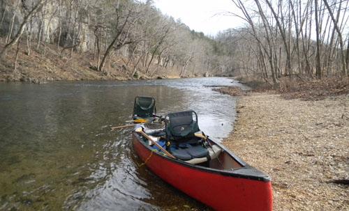
 The Elk River and its tributary, Big Sugar Creek, is probably the most popular waters to float in Western Missouri. On any given weekend in the summer, you'll find these rivers full of enthusiastic canoeist enjoying the cool outdoors on this Ozark river. But it's not just the canoeist and kayakers who love this river. . . anglers love the smallmouth, largemouth bass and goggleye fishing that if offers. The river is dotted with big riffles and long holes for fishermen to fish, as well as wood and rock structures that give fish a place to live and hide from predators. The lower part of the Elk offers white bass and hybrid opportunities in late spring and early summer as well as a very good population of other bass that move up out of Grand Lake to both spawn and feed after spawning. The Elk and its tributaries waters are generally clear except after a good rain but it loses its turbidity fairly quickly because of its fast moving current and rocky bottom. For the most part, the river is wide enough for fly casters to have room to do their thing, casting for bass, goggleye and good sized blue gill. This is an electronic reprint of a Missouri Department of Conservation document. More or updated information on this topic can be found at the Missouri Department of Conservation web site located at: mdc.mo.gov. Copyright 2003 by the Conservation Commission of the State of Missouri. River Levels Elk River near Tiff City, Mo River Maps Link Big Sugar Creek Big Sugar Creek can be very challenging and dangerous. Downed trees on a rapid run or around a blind curve pose the biggest threat. Talk to locals or outfitters to find out if runs are safe. Always call ahead to setup shuttle or parking. Cyclone to Macs Big Rock This is a very beautiful, peaceful and less traveled stretch. Water is usually very clear, light tackle and gear needed to catch plenty of small mouth, goggle eye or the occasional largemouth. If you are quiet you should see several bald eagles sitting peacefully in the limbs that stretch out over the river. Smallie in super clear water Looking downstream close to Macs Big Rock Macs Big Rock to Craig O Lee Note: Craig O Lee is a low water bridge that is passable by car (depending on water level). Portage bridge by canoe or kayak (RIVER LEFT). You will see a few floaters on the weekends during season. This also is a great stretch for fishing, plenty of small mouth, goggle eye and the occasional largemouth. Always keep a close eye for Bald Eagles, Great Blue Herons and Wood Peckers. Craig O Lee Low water crossing Morning on Big Sugar Creek Craig O Lee to Elk River This is a great fishing run with plenty of twists and turns. Nice deep pools and plenty of rock stucture on the river edges. You will see plenty of floaters on the weekends but mostly quiet during the week. You will catch smallmouth, goggle eye, largemouth and the occasional crappie. Rock Ledge small drop off just past Rock Jetties (winter) Rock Jetties close to Elk River on Big Sugar Creek Elk River to Low Water Bridge Note: the confluence of Little sugar Creek is on (RIVER LEFT). This is where the Elk River starts. New fishing regulations from here on down. Please know the rules if you plan to keep fish. Note 2 : “Low Water Bridge” or “Tressel Bridge”. These are two bridges at the end of this stretch that are 150 yards apart. Tressel is a tall bridge that trains use. Low water Bridge is a one lane car bridge that crosses the river. Please note that this is a very popular spot and is private property. Be prepared to pay to park or float on by to the next (PA) (Mt Shira)1 mile down. Elk River is usually clear of obstructions because outfitters will cut out downed trees. This stretch has changed dramatically since the last two major floods, resulting in a wider and shallower river, but don’t be discouraged because this is some of the best smallmouth fishing in the state. Fish the structure on the edges, try the beginning and ending of deeper pools. You can catch largemouth, smallmouth, goggle eye, catfish and even monster crappie. This stretch is heavily floated on the weekends during season but you can be mostly all alone during the week. Treacle Bridge looking upstream from low water bridge (winter) Interstate 71 bridge looking downstream Elk River looking downstream by Riverside Sunset on the Elk River Looking downstream from Riverside Low Water Bridge to Noel Dam Note: This stretch has a public access (PA) called Mt Shira (one mile down from Low water bridge on RIVER RIGHT). This stretch is the floated the most during season on weekends but don’t let that keep you from fishing this awesome stretch. The river widens and slows down dramatically. And you can hook Mr. Big on this run. Seems like you catch more largemouth on this stretch than the others but don’t be surprised to hook that trophy smallmouth--he is out there. Hwy 59 bridge just up river from Noel Dam Bluff looking upstream, down river from (PA) Mt. Shira Bluff looking down river from (PA) Mt. Shira Noel Dam to Cowskin access This stretch is seldom floated--only one outfittter on this stretch. This is some fine fishing, with the river widening and slowing down even more than above the dam. Deep, wide and long pools; you might want to have a trolling motor. You can catch largemouth, small mouth, catfish, goggle eye, crappie, hybrids and white bass. Noel Dam Cave (private) near Cowskin Access Real nice bluffs between the dam and Cowskin Paddling downstream from the dam River Questions & Answers: How does the Big Sugar compare to the Elk and how does the Indian compare to either? Volume of water on average, depth, faster? Upper Big Sugar (above Craig O Lee) and Indian Creek are very similar in size and flow. The Indian is less traveled and outfitters rarely cut down trees out of the stream. Fishing can be extremely good on Indian with plenty of small smallmouth, but don't be shocked to hook a trophy small mouth. Are the smaller creeks small enough to consider taking smaller rods, smaller lures? A small to med spinning rod with 6lb line or less will pretty much cover any of the waters here, I fish with the hook exposed so setting the hook with a powerful rod is not needed. Do the fish, say bass, hold is the slow pools or in the fast water, in the pockets? I believe these fish are always hanging out under cover (see pic G4_03 in group 4), they will cruze the bank in schools of 5 or less looking for a easy dinner. They also will hang out at the beginning of a deep pool to capitalize on food being sweep downstream, I have caught fish throwing underneath rafts full of people. I think they were seeking shade. How to the fish bite in the a. winter b. spring c. summer and d. fall? Fish are active 10 months or so a year , it seems that when the water gets cold they are hard to locate and even harder to catch.
 -
 It's not often you can actually point to the origin of a major river, but you can on the Current River. You can point at bubbling, flowing water coming from Montauk Spring in Montauk State Park in Southeast Missouri. The flow from the spring and Pigeon Creek moves through the park, and leaving the park, it enters the Ozark National Scenic Riverways. The Current River is approximately 184 miles long. It dumps into the Black River near Pocahontas, Arkansas. Of those 184 miles, 105 miles are in the federally protected Riverways. It runs through Mark Twain State Forest until it reaches Highway 160 near Doniphan, Missouri. There are natural springs that dot the Ozarks countryside along the river including Welch Spring, the largest. The river is nearly doubled in size just 14 miles down from Montauk Park. Other notable springs are Round, Pulltite and Cave Spring. Montauk state hatchery raises about 300,000 to 400,000 rainbows and stocks about 200,000 trout in the park annually. But the rainbows don't necessarily stay in the park, migrating down river to make up a majority of the game fish in the first 20 miles of the river. Trout are also stocked at Welch Spring. -- Intro by Al Agnew River Levels Current River Level at Montauk Current River Level above Akers, MO Current River Level at Van Buren, MO Current River Level at Doniphan, MO Fishing Regulations Trout: Blue Ribbon Trout Area: From the lower boundary at Montauk State Park to Cedargrove Bridge 9.0 miles Daily Trout Limit - ONE - At least 18 inches in length Artificial lures and flies only No Red Ribbon Area on the Current River White Ribbon Trout Area: From the Cedargrove Bridge downstream 7.7 miles Daily Trout Limit - FOUR - rainbows and/or brown trout but browns have to be 15-inches or longer to keep. No bait restrictions See Montauk State Park for fishing regulations in the park. Warmwater Fish - **Bass, black (largemouth), smallmouth and spotted bass (kentuckies)- 12-inches length limit, 6 daily, 12 possession. **Statewide season on bass in rivers and streams is open from the 4th Saturday of May till the last day in February annually. White bass, striper, hybrid bass- 15 total daily (only 4- 18 inches or longer can be kept in a daily limit), 30 possession. Rock bass (goggleye) - no length limit, 15 daily, 30 possession. Crappie, white or black - no length limit, 30 daily, 60 possession. Bluegill - no limit Catfish - no length limit, 10 daily (only 5 can be flatheads in a daily limit), 20 possession. Walleye - 18 inch minimum length, 4 daily, 8 possession. From Cedar Grove to Arkansas state line - daily limit on hogsuckers is 5. Fishing Licenses - Residents - those fishing of the ages of 16 and older and 65 are required to have on their person a valid Missouri fishing license. Those 65 and older do not need a fishing license. Proof of residency - Valid Missouri Drivers License. Non-residents - those fishing of the ages of 16 and older are required to have on their person a valid Missouri fishing license. A Missouri TROUT STAMP is required for ANYONE who fishes the trophy or Blue Ribbon area on the Current River, regardless if the angler is keeping or releasing their catch. (New March 1, 2005) Costs - Resident - $12 annual Non-resident - $42 Daily - $7 Trout Stamp - $7 Buy Missouri Fishing Licenses Online! Report Violations - Poachers In cooperation with the Missouri Department of Conservation, Operation Game Theft works to stop the illegal taking of fish and wildlife that includes trophy animals and rare and endangered species. Missouri Wildlife Code Horsepower Limits Two Rivers upstream to Round Springs (Lower Access - 40 hp Above Round Spring Lower Access (Except above Akers from May 1 - September 15 10 HP Maximum) - 25 hp Two Rivers upstream to Alley Spring Campground Access - 40 hp Above Alley Spring Campground Access (Except above Bay Creek from March 1 to Saturday before Memorial Day - 10 HP) - 25 hp Two Rivers downstream to Big Spring John boat landing - 40 hp Big Spring Johnboat Landing downstream to park boundary - no limit Top Five Flies Sam Potter shares his experience and knowledge of fly fishing on the Current River in this article on OzarkAnglers. From streamers to dries, the Current is an excellent place to fly fish for trout as well as warmwater species such as smallmouth bass and goggleye.
 -
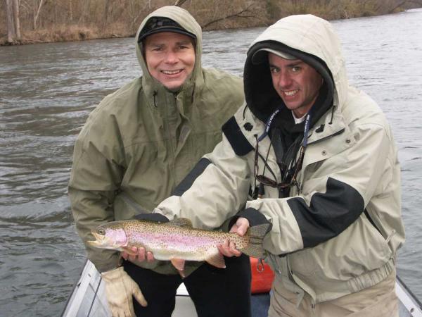 Norfork Dam was the first of five U.S. Army Corps of Engineers dams built in the White River basin after World War II. Named for the nearby town of Norfork, this dam offers a short but productive cold release tailwater (4.8 miles).) The confluence of the Norfork and White rivers is approximately 44 river miles from Bull Shoals Dam on the White. The powerhouse at Norfork Dam has two 40-megawatt generators and releases range from 40 cubic feet per second (ideal for wading) to 6500 cubic feet per second when it's at power crest. This is the least amount of flow out of any of the five dams during peak releases, and that makes it shallower and easier to fish when the water is high. That is also why this tailwater has a special place in the hearts of many fly fishermen. Notoriety Although many consider the fishing on the Norfork tailwater the best they've ever seen, the fact is that this trout stream used to be far more prolific. For many years very few people fished this obscure river, and the growth rates were amazing because of a rich and diverse food base. That obscurity ended in 1988 when a world-record brown trout was caught out of the Norfork. Since then pressure has steadily increased on the river. Now it is a popular spot, and can often be crowded during peak times. The fishery has an amazing resiliency and the ability to produce trout stretching longer than 18 inches. The average fish is very respectable, and the beauty of the fish on the Norfork is hard to find anywhere else (this has to do with their primary food source of scuds.) But it does look like more restrictive regulations, if implemented, could bring back the heyday fishing of the past. Food Base The Norfork is loaded with a wide array of food sources. Scuds (freshwater shrimp) make up the bulk of the trout's diet, but sow bugs and midges are also daily staples. Worms can be found all year, and the trout key in on this food source when the water is high. This right here is enough to have a great trout stream, but the Norfork has so much more -- tons of minnows, crayfish, and sculpins. Then throw in the usual winter shad kill, and it's easy to see why there is no trout stream with the potential of the Norfork anywhere else. The fish here can eat all they want whenever they want. There are also good insect hatches here during low water conditions. Sulphur mayflies, caddis, and crane flies come off all spring, summer and fall. Midges can be seen almost every day of the year, and there are even some blue-winged olives in the winter. This is a new stream from a geological perspective, so it is conceivable that new hatches will develop over time. Structure From Norfork Dam to McClellen's is a lot of gravel with some significant rock and bank structure. For the most part there is little trouble in the middle of the river. McClellen's to the Handicap Access has some gravel, but more flat rock and ledge rock, and this is pretty much the case up to the confluence. Credit - Gabe Cross Flows Low water: 20-40 cubic feet per second Power Crest (90mw): @6700 cubic feet per second New Minimum Flows - See Article Water temperatures The coldest water is usually in the summer where I've seen it as low as 49 degrees by the dam. Because the lake is smaller than the others we sometimes lose cold water in the late summer when near constant generation literally "sucks" the cold water from the bottom of the lake. When this happens, temperatures can reach 60 degrees in the fall. The average temp is around 52 degrees. Siphon A siphon through Norfork Dam is improving the North Fork and White rivers' trout habitat by sending a constant flow of cooler water downstream. See Article Species of fish Anglers on the Norfork can possibly catch brook trout up to 18 inches, (weighing about four pounds), brown trout up to 25 inches (it does happen), rainbows up to 22 inches, and cutthroats up to 18 inches. And there are definitely bigger ones out there than what I've mentioned. Fish Stocking Stockings are done on the Norfork weekly to daily depending on the seasonal demand. Trout are stocked by truck at Norfork Dam, McClellen's, and its confluence with the White River. Brook, brown, and cutthroat trout are often stocked once a year with rainbows making up the majority of fish stocked. Winter shad kill No other Ozarks tailwater event gets local and visiting anglers more excited than the annual shad kill. This is when the dynamics of the water in the lakes causes millions of threadfin and gizzard shad (these are a forage fish that are usually silver or white) to congregate by the dam's stock pens. The stock pens are the tubes that draw water into the generators. When power is generated, tons of the shad get sucked through the turbines, and they end up in the river. The harrowing ride usually leaves the shad crippled, and as they float along the surface they are easy prey for the river's trout. In order for a shad kill to occur, the winter must have some cold periods, and there must be enough water in the lakes to allow for power generation. Shad are warmwater fish, so the shad often start coming through the dams when the warmest water in the lake is at the same level of water that is drawn for power. Growth rates of the trout are amazing during this time, and it is also a great opportunity to catch a huge fish. When a food source becomes readily available, our trout will "key in," and they soon learn to feed very opportunistically. During the shad kill, the fishing is usually excellent throughout the White as many of the river's elusive browns begin feeding aggressively. Norfork can also be exciting during the shad kill, and it is fun because you don't know what species the next fish might be. On some days you catch mainly brook trout, cutthroats, and browns on the Norfork. Because a shad kill only occurs during high-water periods, the most effective way to fish at these times is from a boat. Much of the action occurs at or near the surface, and it can get pretty intense during the right conditions. If you are interested in a guide trip during the shad kill, please be sure to call early because guides are usually booked fast. Although shad kills have begun as early as October and have lasted through May, usually the best months for taking advantage of this phenomenon are January, February, March, and April. March is usually the peak because spring rains can supply the fuel for extended high-water periods. Even after the shad stop coming through the generators, many big fish still recognize this food source and shad imitations will work during certain conditions throughout the summer. Fishing Regulations Anglers 16 and older must have a fishing license and a trout permit to fish in the North Fork River below Norfork Dam. Daily limit of five trout total, which may include: Two brook trout (14 inches or longer) Two cutthroat trout (16 inches or longer) One brown trout (24 inches or longer) Up to five rainbow trout (no length limit) Rainbow trout may not be culled. Once an angler has kept a rainbow trout on a stringer, in a livewell or in a fish basket, it may not be released. (One rainbow trout longer than 16 inches may be temporarily kept in a livewell for measuring, weighing and photographing before being released.) Anglers may use no more than one fishing rod or pole and must attend it at all times. No other fishing devices may be used to catch fish. Chains or other objects capable of destroying aquatic vegetation may not be dragged. Trout may not be driven, harassed or pursued with noise, objects, boats or by wading to concentrate them. Fish that are filleted or have had head or tail removed may not be in possession while fishing from the shore, boat or transporting fish by boat. Norfork Catch-and-Release Area (from the downstream end of Long Hole to Bill Ackerman River Ridge Walk-in Access, as indicated by signs) All trout must be released immediately. Only artificial lures or flies may be used (no natural or scented baits allowed). All hooking points must be barbless. Chumming is not allowed. Dry Run Creek (Outflow from Norfork National Fish Hatchery) Only youths under 16 and mobility-impaired anglers may fish Dry Run Creek. All trout must be released immediately. Only artificial lures with a single, barbless hooking point may be used (no natural or scented baits allowed). Chumming is not allowed. Anglers may use no more than one fishing rod or pole, and must attend it at all times. No other devices may be used to catch fish. Fishing is allowed only from sunrise to sunset. Mobility-impaired anglers may fish only from the pier. Mobility-impaired card required for mobility-impaired adult anglers. Fishing License- Resident - $10.50 annual (from the time of purchase) Border Permit - $10 Resident 3-day - $6.50 Non-resident - $40 annual (from the time of purchase) Non-resident 3-day - $11.00 Non-resident 7-day - $17.00 Non-resident - $22.00 Buy your Arkansas Fishing License Online Here State Record River Fish The White River system holds several state records, and rightly so. I only bolsters the fact that the White River is one of the best fisheries in the state, as well in the country. Cutthroat Trout - Scott Rudolph's nine pounds, nine ounces, caught on the White River on October 6, 1985 Rainbow Trout - Jim Miller's 19 pounds, one ounce, caught on the White River on March 14, 1981 Striped Bass - Jeff Fletcher's 64 pounds, eight ounces, caught on the White River on April 28, 2000 Chain Pickerel - Ave Vogel's seven pounds, 10 ounces, caught on the Little Red River on January 6, 1979 Alligator Gar - John Stortz's 240-pounds, caught on the White River on July 28, 2004 Water release, past releases and river levels can be obtained by calling for a recorded message at 870-431-5311.
 -
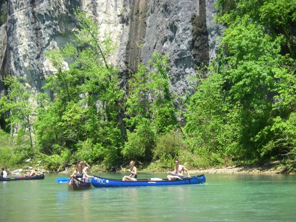 These are 3 maps of the Buffalo River showing points of interests as well as mile markers and access points. Special thanks to Zack Hoyt of Just Fishing Guides for help identifying the points of interests and other aspects of this map. Each map is clickable, linked to pdf files to be downloaded and printed.
 -
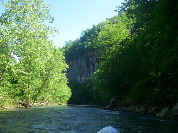 The Buffalo River is incredibly unique in that it is one of the few remaining rivers in our country with no dam, cutting through the Arkansas Ozarks Mountains and into the White River. Organizations like the Ozark Society were instrumental in saving the Buffalo River from dams; it was deemed the first National River Park in the United States. No other river in the Ozarks has such breathtaking bluffs, beautiful water and wilderness-like areas for terrific hiking and backpacking. The whole area is just plain wonderful country. Floating, fishing and camping on the Buffalo is a “stepping back in time” experience. Very few rivers offers such a combination of views, wildlife and fish as this spectacular river. Smallmouth bass, goggle-eye and green and longear sunfish are the targeted species, for the most part, with largemouth bass and catfish in the lower river. Floats choices vary from fast, whitewater rides in the upper river to slow pools dotted with a few riffles in the lower river. Outfitters and liveries at varied spots of the river can service any trip, no matter how short or long of a float you have in mind. Accesses, distances and services 0 - Boxley Bridge Access 6.1 – Ponca Bridge Access (toilet vault) Close to Ponca 8.7 – Steel Creek Access (camping, flush toilets, drinking water) 16.7 – Kyles Landing (camping, flush toilets, drinking water) 22.3 – Erbie (camping, toilet vault, drinking water, cell phone reception) 27.8 – Ozark (camping, flush toilets, drinking water) 29.9 – Pruitt Access (cell phone reception) 36.7 – Hasty Access (toilet vault) 40.9 – Carver (camping, flush toilets, drinking water) 47.7 – Mt Hersey (camping, toilet vault) 56.3 – Woolum (camping, toilet vault) 67.2 – Baker Ford (camping, toilet vault) 71.5 – Tyler Bend (camping, flush toilets, drinking water, showers) 73.0 – Grinders Ferry Access (camping, toilet vault) 76.9 – Gilbert Access (camping, toilet vault, drinking water) 88.4 – Maumee North (camping, toilet vault) 88.9 – Maumee South (camping, toilet vault) 93.7 – Spring Creek (camping, toilet vault) 98.3 – Hwy 14 Bridge Access (vault & flush toilets, drinking water) 99.8 – Buffalo Point (camping, flush toilets, drinking water, showers) 107.2 – Rush (camping, toilet vault, drinking water) 130.7 – White River Download a .xls file with landmarks between these points with mile markers. Other than the campsites mentioned, there are quite a few gravel bars that are nice to just pull up on and camp for the night. There are two campsites on the upper river that are designated for visitors with horses. These areas, Steel Creek and Erbie, are accessible by vehicle and provide basic facilities such as fire grates and vault toilets. Both camps are located adjacent to horse trails. Paddling: Perhaps the most famous of all Buffalo River floats are those that take place between Ponca and the Arkansas Highway 7 crossing (known until recent years as the community of Pruitt. Something for everyone can be found in this 25-mile section: Class I and II rapids (complete with hazards like "Gray Rock''); the highest waterfall in mid-America (at Hemmed-in-Hollow) the 11,300-acre Ponca Wilderness; towering cliffs including the 500-foot tall Big Slurry and an excellent assortment of swimming holes. In addition, there are several conveniently located access points/campgrounds - Steel Creek, Kyle's Landing. Erbie, and Ozark-between Ponca and Highway 7. The Buffalo's next stretch -- from Arkansas 7 to Highway 123 (or Carver) -- is about 10 miles in length. While it doesn't offer the spectacular scenery available just upstream, this is a fine float, especially for families. It features Class I rapids, gravel bars, and numerous bluffs. The Buffalo's final stretch -- from Buffalo Point to Buffalo City (on the White River) -- is 30 miles in length, with only a single takeout point (Rush) in between. The 7.5-mile float from Buffalo Point to Rush is short, scenic and safe for families. The remaining 23-mile trip passes through some of Arkansas's wildest country, including better than 39,000 acres of wilderness (the Lower Buffalo Wilderness and the adjacent Leatherwood Wilderness.) This is the area for those wanting to get away from it all. You’re always limited by water levels on the upper river, and by the middle of June, you probably won't be able to float above Pruitt. By July, on average, you won't be able to float above Gilbert. At least, no outfitters will rent canoes on the upper river if they deem it too low. Accesses on the upper river are pretty well-spaced. If you get really, really lucky and a perfectly-timed rain dumps some water in the upper end of the river without making it too high and muddy, Ponca to Erbie is the most beautiful piece of river in the Ozarks and can be good fishing. That stretch is about 16 miles and a good two-day trip. You can lengthen it by going on down to Pruitt, adding another eight miles, but that's probably more than you want to do in two days. You can rent canoes for that stretch at Ponca. Pruitt to Carver is about 11.5 miles, a short two-day or long one day trip with nice water. Pruitt on down to Mt. Hershey is about 18 miles, a good two-day trip. Between Mt. Hershey and Gilbert the accesses are a little less conveniently spaced for a two-day trip. Mt. Hershey to Woolum is 10.5 miles. Woolem to Baker Creek Ford is 11 miles. Woolem to Hwy. 65 is probably the best length in this stretch for two days at 16 or 17 miles. It's four more miles from Hwy. 65 to Gilbert. Gilbert to Maumee South is 12 miles. You could put in at Hwy. 65 and go to Maumee, 16 miles altogether. Maumee South to Buffalo Point is about 11 miles. Fishing Regulations Bass, black (largemouth), smallmouth and spotted bass (kentuckies)- Largemouth and spotted bass - minimum of 10 inches. Daily limit is 10 bass total. Smallmouth bass daily limit is two and each must be at least 14 inches long to keep. From confluence with Clabber Creek downstream to the confluence with the White River, smallmouth bass daily limit is 1 and must be at least 18 inches or longer to keep. Rock bass (goggleye) - no length limit, 10 daily, 20 possession. Crappie, white or black - 10-inch length limit, 15 daily, 30 possession. Bluegill - Bluegill, redear, longear, warmouth and other sunfishes combined. No daily limit on bream shorter than 4 inches. - Daily limit is 50. Catfish - Channel catfish, blue catfish and flathead catfish, combined. No daily limit on bullhead catfish. Daily limits is 10. Fishing License- Resident - $10.50 annual (from the time of purchase) Border Permit - $10 Resident 3-day - $6.50 Non-resident - $40 annual (from the time of purchase) Non-resident 3-day - $11.00 Non-resident 7-day - $17.00 Non-resident - $22.00 Buy your Arkansas Fishing License Online Here Water Levels- Helpful Links: Buffalo National River Services and River Level Guide Buffalo River near Boxley, AR Buffalo River at Ponca, AR Buffalo River at Pruitt, AR Buffalo River at St Joe, AR Buffalo River at Harriat, AR
 -
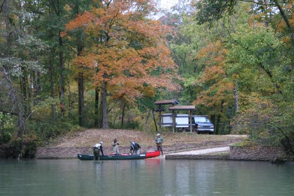 On the Elevenpoint, there are many variations of floats for both the angler and the floater. Where you put in and take out is very important as to what type of water you want to float--and fish. The upper river is great for trout and some smallmouth but the lower you float, the warmer the water and more bass/less trout you'll catch. Here are a couple of river maps that may help you find the perfect float you want. Click on each map header to download a pdf format of each full map. ~~~~~~~~~~~~~~~~~~~~~~~~~~~~~~~~~~~~~~ ~~~~~~~~~~~~~~~~~~~~~~~~~~~~~~~~~~~~~~
 -
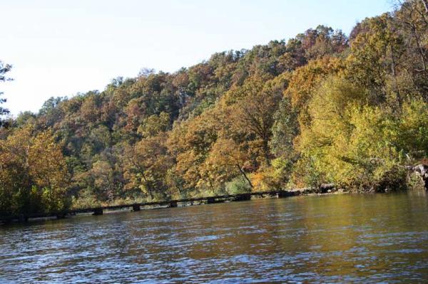 To pinpoint where you put in and take out is an important decision because of distance between accesses and the water you want to fish. This river map may help with your decision. Clickable and printable Map of the North Fork of the White River. Click this iamge and it will open in a pdf file format. Thanks to Brian Wise for his help on this map. River Mileage from start to finish- Bridge. Access. 0.5 Low-water bridge on connecting road between Hwys. 76 and E. Access. 6.6 Low-water bridge and spring at Topaz. An old mill remains standing. Access. 11.1 Slab ford. Access. 11.4 Indian Creek enters on left. 12.2 Osborn Ford low-water bridge in Round Valley, on County Road AH-260 off Hwy. AH and County Road 284 off Hwy. 181. 14.8 Hale Ford Bridge access on County Road 275 off Hwy. 181 and County Road W-278 off Hwy. 16.1 Fiddle Springs Hollow on left. 18.7 Bridge on connecting road between Hwys. AA and 14. Hebron Access on left, on County Road 279 off Hwy. 14. Gravel ramp. 24.1 Hwy. 14 Bridge at Twin Bridges. Other bridge is over Spring Creek. Access and camping. Roadside park on left bank just above Hwy. 14 Bridge is a popular access and campground. Store between bridges. 25.9 Spring Creek enters on left. The lower 8 miles of the creek have a gradient of 12.5 but it is more a wading/fishing stream than a floating stream and tends to be blocked by logs and other obstacles. Big Spring, 2.5 miles upstream, is only a third magnitude spring. 26.0 Hicks Spring on right just below the mouth of Spring Creek. 28.2 Mary's Hollow and creek on right. Spring up hillside on opposite side of river. 29.2 Hammond Camp Access just off Hwy. CC. Concrete bridge on West Plains Road. Forest Service North Fork Recreation Area and campground on left. 29.9 Blue Spring on left, at river level. The flow is seldom less than 7 million gallons per day. 33.3 North Fork spring issues from rock ledge on left. 33.5 Upper branch of Rainbow (Double) Spring on right. Lower branch enters river 1500 feet downstream from source. No admittance. Private use only. This is rated as the fifth largest spring in the state with mid-summer flows of up to 137 million gallons per day. There is a rocky riffle on the bend just below the mouth of the lower spring. 35.0 McKee Bridge. Private use only. 36.0 The Falls is merely a rock ledge about 2-3 feet high. Chute is best handled from the left and go toward the right, but check first. 39.2 Blair Bridge, concrete low-water bridge, on extension of Hwy. KK to Hwy. H. Access. It is necessary to pull boats over this bridge. Approach with caution, since a broadside approach in medium-high water could result in being swamped and pinned against the upstream side. Just below the bridge are some old concrete bridge piers which produce a tricky channel in low water. 39.4 Blair Bridge Access on left, on County Road H-354 off Hwy. KK. 39.9 Private campground on right. 40.9 Spring Creek on left, is fed by numerous springs, none of them large. It has a gradient of 14 on the 6 miles above its mouth but access to it is poor except at the Duncan Ford 2.3 miles upstream. It has often been floated from this point in springtime and provides a good ride, but a float from Cureall (12 miles) could entail much walking. 42.1 Hwy. H lowwater bridge. Patrick Bridge Access at northeast side of bridge. Gravel ramp. Althea Spring, rated as Missouri's 23rd largest, is just downstream on the left. 42.3 Althea Spring Branch enters the river at a fast riffle. 43.6 Private campground on right. 45.3 Hwy. PP Bridge. This is a high bridge, but the old road goes down to the water for easy access. 47.0 Dam Mill Dam. Water is backed up for about a quarter mile by this low dam. The dam has been run in high water, but it is a "canoe buster" and you must know the right spot. It is easily "portaged" by sliding the canoe down a shallow chute on the right end of the dam where there is also a rough path around the dam. There is a good rapids below the dam which is easily run. 47.1 Dam Bridge. Going under this bridge in high water is dangerous. Approach with caution and make sure there is clearance! The Dawt Mill is one of the most picturesque of those still operating in the area. The run from here to Tecumseh access has a number of riffles depending on lake level. 48.8 Repeating Riffle. This is the last drop when the lake is high. A ledge produces good standing waves which whitewater enthusiasts rerun by using a strong upstream eddy on the right to carry them to the ledge again with little paddling effort. 49.1 Junction with Bryant Creek. 49.5 U.S. Army Corps of Engineers Tecumseh Access and campground on right.
 -
 Most fishing guides dream of reeling in success to trade up for bigger and bigger boats with monster horsepower engines. But Kyle Kosovich of Springfield launched his outfitter service in the last year to resurrect the laid-back river float trips of bygone decades. With the backing and blessing of friends and family, he built his ideal watercraft – a 20-foot longboat powered only by his own brawn, brain and paddle. “A canoe is just hard to guide out of,” Kosovich said on a guide trip last week, admitting he had even tried tying two together. “And not everybody can wade fish on the North Fork; it’s a slippery, fast river. So I did a lot of research. I wasn’t a big fan of the drift boat since they were designed for fast western streams-- with high sides. I had oared a few, and they are tough to oar down the river, especially when a gust of wind blows – and it usually blows upstream.” He found some plans online of the old White River jon boats made famous by Jim Owen and Charlie Barnes when the floaters could cruise 250 miles from Branson to Cotter, AR. Once the White River was dammed for flood control, the non-motorized jons disappeared, but the lure of the longboat folklore lived on. Kosovich just mulled over handcrafting such a boat and guiding from it, until his friends spurred him on with a surprise “board meeting” at the Watershed Committee of the Ozarks office where he works. “Long story short I went in there all frustrated and flustered thinking I was having to do a big presentation,” Kosovich said, “and I saw all my friends sitting around the table and didn’t even see all these sheets of plywood leaned up against the wall.” He didn’t finally understand their plan until one friend said, “Here are your board members,” pointing to the plywood. As a native Ozarks river rat, growing up on Bryant Creek and the North Fork of the White River, he offers adventures on those waterways plus the Eleven Point, Gasconade and James rivers all year long. With a degree in Fish and Wildlife Biology from Missouri State University, and current and past projects with the Missouri Department of Conservation and the Watershed Committee, he is an avid instructor about river ecosystems as well as flyfishing. “I like to tell kids that trout come from trees,” he said, relating that children (and adults) can better visualize the interdependence of nature when they can understand that a tree leaf falling into the water becomes the food for an insect that then feeds fish. With a practiced hop out of the boat, he likes to seine a spot of the river bottom to show the crawfish, scuds and other underwater critters to clients – both to choose the appropriate fly and to remind them of all the creatures depending on the river. Kosovich worked with the conservation department as an undergrad leading stream sampling crews around the state, which heightened his appreciation of the diverse water that marks Missouri. He joined the watershed program as an Americorps volunteer in 2006 and now is projects assistant for the Watershed Management Plan Grant. His Longboat Outfitters, in cooperation with Ozark Regional Land Trust, has received a Missouri Teaming with Wildlife mini grant from the Conservation Federation of Missouri for re-invigorating the Bryant Creek and North Fork Conservation Opportunity Areas. Kosovich tailors each trip to the client, following their preferences whether to focus on the world-class fishing or to allow opportunities for caving, arrowhead hunting, frog gigging or just relaxing on the water or by a campfire – especially while he cooks. For a day trip that might be a quickly prepared shore lunch of chicken fajitas set to sizzling over a small butane stove – with even a table packed into the longboat. For an overnight campout, dinner might be cornmeal catfish with all the fixings, hickory-grilled steak or spaghetti with homemade beer or wine. As a lean 25-year-old who is admittedly always hungry, food is an important part of the total sensory experience – whatever the special dietary needs. To Kosovich, a float trip is a one-of-a-kind adventure that can never be rated by the number of fish caught. He advises setting aside more than one day to allow for changes in river and weather patterns and just to “let the wild river wash away that entire residue of civilization locked up inside from work and real life.” Recently he and his wife, Bethany, hosted a couple celebrating their first anniversary for an overnight float trip, providing the tents, food and all equipment. The trip was something close to both their hearts since they both started fly tying and fishing at a young age – and actually fell in love on the river. “In high school I found out there was another student right there in Dora who loved to fly fish – and here was this gorgeous girl,” Kosovich remembers. Growing up on her family’s River of Life Farm, a premier 350-acre resort along the miracle mile of the North Fork’s wild river management area, Bethany agreed to a wager for a kiss on their first date – spent flyfishing on the river. She had thought she was pretty safe, he said, since he had not caught a fish in their first few spots. The two dated through high school and married while attending MSU’s West Plains campus before re-locating to Springfield. She now serves as children’s small group coordinator at the Fellowship Bible Church in Rogersville. Paddling easily down river, Kosovich said he will keep assessing and tweaking his unique new business. “It all comes back to a bunch of friends helping me start my dream, “ he said. “That’s why I wanted to call this boat ‘Amicus’ because it’s Latin for friendship. We’ll keep doing the best we can to provide the best Ozarks tradition and see where it goes.” Fishing the North Fork of the White The North Fork of the White River is unlike any other stream in Missouri, or the whole Midwest for that matter. It is a freestone stream formed by natural runoff and seven springs – Topaz, Spring Creek, Blue, North Fork, Rainbow and Althea, giving it the resemblance of western, mountain waters although located in the heart of the Ozarks. Another unique aspect is the fact that it is home to rainbow and brown trout. Most Ozarks waters are stocked with trout but the North Fork hasn’t been stocked with rainbows since the 1960s. They are wild rainbows, born and raised in the spring-fed river. Brown trout, on the other hand, are stocked annually. Several thousand browns are put in every spring. Food forage includes stone nymphs, a variety of mayfly nymphs and midge larva, caddis flies, sculpin, crawfish and many types of small fish forage including darters, shiners and creek chubs. The North Fork has been called the slickest river to wade in the Ozarks because of its hard, slick bedrock bottom. There is plenty of gravel in areas, but most of the long, slow runs have a slick bottom with long runner trenches about the width of your boot. These can grab you and trip you up if you’re not careful. Most of the time the water is clear, and the trout spook, leery of anglers and the plop of their fly lines on the surface of the water. Stealth fishing is a must, even to the point of crawling up on some pockets when the sun is bright and the water calm. You should pay close attention to your attire. Don’t wear bright colored shirts, jackets or hats. Anglers have to treat these trout like what they are – wild trout. They aren’t ignorant stockers that will take the first thing that floats down the river that looks good to eat. They will only take lures and flies that are presented in their natural state. That’s why this river is so special.
 -
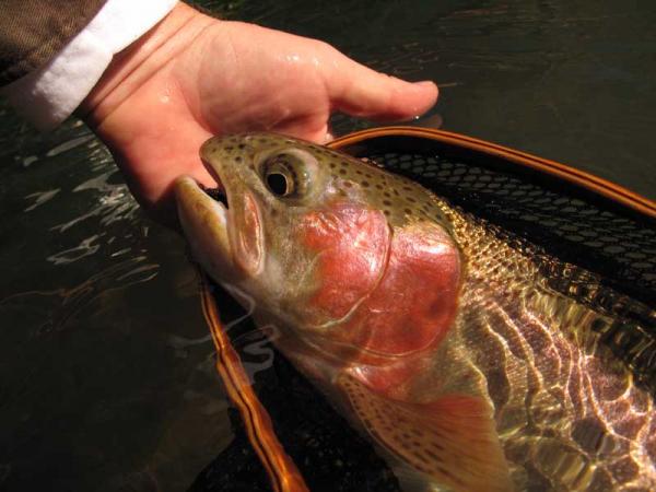 Missouri is blessed to have several free-floating rivers classified as top trout and smallmouth bass fisheries and the North Fork of the White is one of the finest. If most resembles a mountain stream in Colorado with little visible interference from the outside world along it’s banks. It’s nice to float and it’s even nicer to fish! The river starts near Mountain Grove and Cabool and ends at Tecumseh when it joins Bryant Creek to form the head of Norfork Lake. The upper 50 miles of river is smallmouth bass country but as the cold water of Rainbow Springs hits the river, it’s transformed into one of the best trout streams anywhere. The next 15 miles of river is deemed trout water as several other springs add more and more good, clean, cold water year-round. Most anglers float the river, starting and finishing from several public accesses named later in this article. But there are a couple of accesses one can enter the river and wade but tow things to remember: First is to respect private property. You can wade the river but cannot step out on the bank. Second, the river’s bottom is mostly slick bedrock so felt-sole shoes are recommended. Rainbow Springs dumps an average of 137,000,000 gallons of water each day. This spring and other springs make it possible for trout to thrive in the North Fork. Rainbows were last stocked in the North Fork in 1964. They have survived drought and floods and have reached incredible trophy size for the adversity they’ve seen. Brown trout on the other hand are stocked each year but they too have flourished to become a sought after trophy trout. River Map Link Both species of trout are a challenge to conquer. The water is clear and fish leery. They don’t call these rainbows “wild” for nothing. Don’t expect to drop in the river, present a good-looking fly and see a rainbow take it like a dumb stocker rainbow. You have to be at the top of your game or learn how to “match the hatch” as they say. Pretty flies are for selling . . . big ugly leeches and bead head midges are for catching trout on the North Fork. Check with the guides on this river and see what they tell you. Nymphing is the name of the game on the North Fork. Running a bead head through big white water rapids is an art and you have to learn it well to catch these trout. That’s where they are—in the biggest, fastest water. Pay close attention to the “seams”, where the fast water meets the slower, eddied water after the rapids. Another hiding place for rainbows. The deep holes are reserved for brown trout. They are nocturnal, coming out mainly at night to feed on forage fish, crawfish, sculpins and even a rainbow trout. But they will bite during the daytime. Best times are on dark, cloudy days, rainy and windier the better. They’re the ones who like the big, ugly flies. Spin fishing isn’t out of the question on the North Fork. Casting a small crawfish crank bait through the pools will hook a few rainbows and an occasional brown trout but marabou jigs, when worked in the right areas off the bottom can catch some incredible trout too. Eighth-ounce marabou in earth colors like black, brown, olive and sculpin are deadly on these wild rainbows and the browns like them too. River Levels River Level - the only USGS station on the North Fork of the White Missouri Department of Conservation Links Missouri Watershed Inventory and Assessment Report Fishing Regulations Blue, Red & White Ribbon Special Trout Areas 8.6 miles Ozark County Upper outlet of Rainbow Springs to Patrick At least 18 inches Daily Limit 1 Artificial lures and flies only 7.0 miles Ozark County The unimpounded portion of the river and its tributaries from Patrick Bridge to Norfork Lake At least 15 inches Daily Limit 2 No bait restrictions No White Ribbon Area on the North Fork of the White Brown trout state-wide limit is 15 inches. Bass, black (largemouth), smallmouth and spotted bass (kentuckies)- 15-inch length limit, 6 daily, 12 possession. Statewide season on bass in rivers and streams is open from the 4th Saturday of May till the last day in February annually. Rock bass (goggleye) - no length limit, 15 daily, 30 possession. Crappie, white or black - no length limit, 15 daily, 30 possession. Bluegill - no limit Catfish - no length limit, 10 daily (only 5 can be flatheads in a daily limit), 20 possession. Gigging, bowfishing and hand fishing are prohibited, and fish taken by these methods may not be possessed on these waters or their banks.Trout Lure Definitions Fly an artificial lure constructed on a single point hook, using any material except soft plastic bait and natural and scented baits as defined below, that is tied, glued or otherwise permanently attached. Artificial Lure a lure constructed of any material excluding soft plastic bait and natural and scented bait as defined below. Soft Plastic Bait synthetic eggs, synthetic worms, synthetic grubs and soft plastic lures. Natural and Scented Baits a natural fish food such as bait fish, crayfish, frogs permitted as bait, grubs, insects, larvae, worms, salmon eggs, cheese, corn and other food substances not containing any ingredient to stupefy, injure or kill fish. This does not include flies or artificial lures. It does include dough bait, putty or paste-type bait, any substance designed to attract fish by taste or smell and any fly, lure or bait containing or used with such substances. Fishing Licenses - Residents - those fishing of the ages of 16 and older and 65 are required to have on their person a valid Missouri fishing license. Those 65 and older do not need a fishing license. Proof of residency - Valid Missouri Drivers License. Non-residents - those fishing of the ages of 16 and older are required to have on their person a valid Missouri fishing license. For Missouri & Arkansas residents only - a special border permit can be purchased to allow fishing in both Missouri and Arkansas without purchasing an out-of-state license. A Missouri TROUT STAMP is required for ANYONE who fishes the trophy or Blue Ribbon area on the Current River, regardless if the angler is keeping or releasing their catch. (New March 1, 2005) Costs - Resident - $12 annual Non-resident - $42 Daily - $7 Trout Stamp - $7 Buy Missouri Fishing Licenses Online! Missouri Wildlife Code Report Violations - Poachers In cooperation with the Missouri Department of Conservation, Operation Game Theft works to stop the illegal taking of fish and wildlife that includes trophy animals and rare and endangered species.
 -
 The Eleven Point River is one of the most diverse and beautiful fisheries in Missouri. The Eleven Point is Missouri's only National Scenic and Wild Riverway and runs in large part through the Mark Twain National Forest. Fed by numerous springs, the river abounds with wildlife not only below the water's surface but also along its banks. The forested banks of the Eleven Point along with the many bluffs and some caves all make the Eleven Point probably the most pristine of the Missouri Ozark float streams. By being a little off the beaten path, the Eleven Point does not get nearly the traffic as the other famous float rivers in Missouri. As for fishing, the Eleven Point offers quality rainbow trout fishing for about 20 miles and boasts one of the only reproducing populations. Other species of note are smallmouth bass, goggle-eye, chain pickerel, and walleye. Trout fishing starts at the confluence of the Greer Spring branch and the river. Greer is the world's 10th largest spring and doubles the size of the river while turning it into a cold water fishery. This is the beginning of the blue ribbon trout section and it extends about six miles to Turner Mill Spring. Flies and artificial lures are only are allowed (soft plastic and baits are prohibited); the limit is one fish at 18 inches or longer. There is a strong population in this section of river. The trout have taken hold and are very healthy. The average trout caught are 12-14 inches, and there are plenty of trophy-sized fish that are just a lot tougher to catch. The Eleven Point is deeper than most Ozarks trout streams and is difficult to wade for long stretches between shoals. Therefore, watercraft is advisable. You must be willing to go a little deeper for fish than in most rivers in this region. Dry fly fishing is a rarity on the Eleven Point. A 9-foot, 5- to 6-weight fly rod works best on this river. The following is a list of recommended flies: -Don's Crawdad --This is one of the most productive patterns on the Eleven Point. There are tons of crawdads in the river and they are a major food source. Fish this small crawdad under a strike indicator and look for takes on the dead drift and the swing. As with most things you fish here, you need to get it to the bottom for the best results. -M.O.A.T. (mother of all tungsten)- This is a stonefly like pattern with three tungsten beads, peacock dubbing, and rubber legs. It really gets down and catches fish. Use it as a lead fly and attach different smaller droppers. bh peasant tail soft hackle peasant tail hare's ear in tan, olive and black in-cased caddis (mostly green pupae, but do have some cream-colored ones) bh crackle back egg in fall through December midge pupae copper johns (variety of colors) san Juan worms, especially after a rain stone flies in black or brown will work most of the year, although use gold from late August through the first part of November leech patterns --Mohair and bunny leeches work well in tan, olive and black wooly buggers (variety of sizes and colors) sculpins and other streamer patterns, something to imitate a little rainbow trout The 14 miles below Turner Mill to Riverton (Hwy 160 bridge) is stocked regularly and is designated as white ribbon. The limit is four trout per day of any size and any lures and baits are allowed. All of the above flies and lures still apply to this area. In addition many spin fishermen report good luck using little rubber grubs, minnows, worms and Power Bait. Eleven Point River Trip - Fall 2015 from Focal Imaging LLC on Vimeo. Floating the Elevenpoint River To the experienced canoeist, the Eleven Point is a relatively easy river (Class I and Class II on the International Scale) requiring intermediate experience. Snags, trees and root wads still remain the most dangerous of all obstacles and, on occasion, may require scouting from shore. Although canoes are the time-tested means of travel through fast water, flat bottom jon boats are used on the river, primarily for fishing trips. You may encounter some boats with motors. Motor boats are restricted to a 25-horsepower limit. Canoeists should learn to read the water ahead. Whitewater riffles mean that rocks lie very close to the water surface, and you are about to enter a "chute" where water flows faster. The safest course to follow is the smooth water, shaped like a "V" pointing downstream. Watch out for root wads! Water rushes under and through the exposed roots of fallen trees and creates hazardous conditions. Learn to avoid obstructions. Back paddle as to change positions or use "draw" or "pry" strokes to move laterally. From OA Forum by Bob Steffen: Short 2 Day, trout intensive trek - Greer to Whitten 11.5 mi: Camp night before at Greer Access (NE intersection of MO-19 @ River). Allow 1 hour to visit Greer Spring (drive to the Spring Trail, S of river, W of MO-19 - then hike 1 mile down plus one mile back up). Or, allow 1 more hour to drive up to see the old mill at Falling Spring. Fish under the MO-19 bridge, upstream, and wherever you can cast to the south bank. Turn in early and get a good night sleep. See Eleven Point Canoe Rental for canoe and logistics. Get latest fishing conditions from Brian. Get on the river as early as possible. Spend lots of time fishing the side waters of the 1st island and below. Be heavy, get down, get deep. Stop and fish a lot. Great spots consecutively appear. Stop immediately below Mary Decker shoals and throw heavy stuff at the pigs that live beneath those boulders. Stop at Turner Mill north access and hike up to see the old mill wheel and the spring. Camp at Stinking Pond (5 mi and not smelly in the springtime) or Horseshoe Bend (9 mi) Forest Service Float camps. (Fish channel immediately upstream and waters across river from either Float camp). Stay up late. Enjoy the solitude. Watch the eagles and bats hunt. Keep an eye out for bears. Leisurely morning. Fish to Whitten. This is only 5 miles from Stinking Pond and even closer to Horseshoe Bend. More great fishing, so take your time and enjoy. All the way, you will need a strategy to keep the river from pulling you downstream faster than you want/need to go. Take out at Whitten Long 2 Day, fishing/exploration trek - Greer to Riverton 19 mi: All of the above, plus: Start catching 50-50 rainbows and smallmouth below Horseshoe Bend. Don's crawdad fly and Rebel Craw lure are hard to beat. Camp at Horseshoe Bend (9 mi), Barnhollow (10 mi), Whites Creek (12 mi), or Greenbriar (14 mi). Note: Each of these float camps is a short distance up an inlet/feeder creek. Some are not marked well. They all have flat tent space, fire rings, nice latrines, and decent fishing nearby; making them good campsite options. Be sure to check out the Boze Mill Spring on right, about 2 miles upstream from Riverton. Throw something meaty and deep downstream of the spring outlet, north shore. Take out at Riverton, US-160. If early, fish west side of river bank. Long 3 Day, trout & smallmouth trek - Greer to The Narrows 30 miles: It doesn't get any better than this, unless you've got all week. 90% smallmouth downstream of US-160. Rooster tail spinners (slower retrieve than trout). River Levels Elevenpoint River Levels near Ravenden Springs, AR Elevenpoint River Levels near Bardley, MO Access and Campsites- Thomasville at SH 99 Bridge at 0.0 miles (this section down to SH 19 not recommended in low-water) Cane Bluff Access and picnic area at 9.3 miles SH 19 bridge at 16.6 miles (campsites and put-in with trail to Greer Spring about a mile up the hill) USFS boat ramp in Greer Springs Campground on river right at about 16.7 miles Turner's Mill North (river left) and Turner's Mill South (river right) at about 21.5 miles Stinking Pond Float Camp on river left at 22.3 miles Horseshoe Bend Float Camp on river left at 26.5 miles Barn Hollow Float Camp on river left at 27.0 miles White Creek Float Camp on river left at 28.5 miles Greenbriar Float Camp on river left at 31.0 miles Bozeman Float Camp on river left at 33.5 miles Riverton / SH 160 bridge on east side at 35.7 miles Morgan Creek Float Camp at 44.0 miles SH 142 Bridge on river left at about 44.3 miles MDC Myrtle Access on river right at 48.0 miles Missouri-Arkansas state line at 49.0 miles Fishing Regulations Trout: 5.5 miles Oregon County Greer Spring Branch junction to Turner Mill Access At least 18 inches Daily Limit 1 Artificial lures and flies only No Red Ribbon Area on the Eleven Point 14.2 miles Oregon County Downstream from Turner Mill Access Rainbow trout - none. Brown trout - at least 15 inches. Daily limit- 4 trout. No bait restrictions *Limits: 4 trout daily. 8 possession. (no size restriction) *Brown trout state-wide limit is 15 inches. Eleven Point River Special Bass Management Area Map (pdf, 208 KB) Eleven Point River Blue Ribbon Trout Map (pdf, 184 KB) Eleven Point River White Ribbon Trout Map (pdf, 165 KB) Smallmouth Bass: They are found throughout the system. Statewide season on bass in rivers and streams is open from the 4th Saturday of May till the last day in February annually. From Thomasville Access to the Arkansas line: Goggle-eye—8 inch minimum length limit. 15 daily. 30 possession. Smallmouth bass—15 inch minimum length limit. The daily limit of 6 black bass may include only 1 smallmouth bass. Walleye and Sauger: These fish are found closer to the Arkansas border. The better walleye fishing is in Arkansas. 4 daily, 8 possession. 18-inch minimum length. Chain Pickerel: 6 daily, 12 possession Fishing Licenses - Residents - those fishing of the ages of 16 and older and 65 are required to have on their person a valid Missouri fishing license. Those 65 and older do not need a fishing license. Proof of residency - Valid Missouri Drivers License. Non-residents - those fishing of the ages of 16 and older are required to have on their person a valid Missouri fishing license. A Missouri TROUT STAMP is required for ANYONE who fishes the trophy or Blue Ribbon area on the Current River, regardless if the angler is keeping or releasing their catch. (New March 1, 2005) Cost- (prior to 3/31/20) Resident - $12 annual (March 1 thru last day of February) Border Permit - $10 Non-Resident - $42 annual (March 1 thru last day of February) Daily Permit - $7 (midnight to midnight) Buy Missouri Fishing Licenses Online! Report Violations - Poachers In cooperation with the Missouri Department of Conservation, Operation Game Theft works to stop the illegal taking of fish and wildlife that includes trophy animals and rare and endangered species.
 -

Can't get to second page of topics
Phil Lilley replied to fishinwrench's topic in Messages for, and from, the Admin
It was an ad setting- the google ad was hanging it up and Support changed the setting for me. -
Actually it's been 40 mw which is less than one unit. Then more starting 2-3 pm till dark generally. As I said in my PM, I've talked to a couple of ppl that didn't want to fish the outlets and found plenty of fish along the shore. I bet you could wade in just above the boat ramp and walk up and do pretty good nymphing.
-
I'm wrong. Not running water to pay for O2. The liquid O2 is cheaper than buying alternative power.
-
Got word - the Corp is running water to pay for the liquid O2 they're having to inject into the turbines to keep the DO levels in Taneycomo at respectable levels. So no telling how long they'll keep up this generation pattern.


