

Phil Lilley
-
Posts
19,030 -
Joined
-
Last visited
-
Days Won
132
Content Type
Profiles
Forums
Blogs
Events
Articles
Video Feed
Gallery
Everything posted by Phil Lilley
-
Fishing last night. Using a white jig in white foam. Never saw it coming till the last second. I usually can dodge them but not this time. Thought for sure I damaged the lens but didn't. Makes a cool video...
-
Not sure what "c-rig" is.
-
Rain - the amount of rain is decreasing for today for the whole area.
-
After writing this article, I see on my weather app the rain forecast is increasing from 1.5 to 2.3 inches of rain for the northern portions of the White River basin, mainly Table Rock. Back last week when the last bit of rain was passing, the Corps said we could handle a 2-inch rain. Now that the levels have dropped and the ground has dried out somewhat, I think a 2-inch rain won't hurt much. It may push them to release water from Bull Shoals early though. That wouldn't be a bad thing.
-
I've been wearing out two apps on my iPhone the last two weeks -- the weather app and the USACE Little Rock app. After the rain stopped, it's been the corps app. I'm watching lake levels, as we watch 23,000 c.f.s. of water move past our resort here on Taneycomo. It's an amazing amount of water moving through the system, but what's more amazing is that Table Rock's level hardly budges after a day of 10 flood gates and three turbines of water is removed from the lake. Beaver's level remains the same because that water is being held. So will Table Rock's water as soon as the three lakes -- Beaver, Table Rock and Bull Shoals -- are balanced, according to the Corps. On the USACE app, there's a section called Lake Forecast. This gives either what a lake crested at and the date or the estimated crest level and the future date. According to the app, Bull Shoals is to crest at 692.3 feet on May 14th. When a lake or river crests, it usually means that's the level it stops rising and starts to fall. If this is true, either the flow into Bull Shoals will slow or stop or water will start to be released from Bull Shoals when the lake reaches 692.3 feet. My guess is that both will happen to some degree. Another level and flow I've been watching is the USGS water monitoring station at Newport, Arkansas. This information is given on the app labeled White River Basin. The reason this level and flow is important is because this section of the White River, before it dumps into the Mississippi River, was flooded a week ago. This is the reason the corps could not release water from Bull Shoals--it would add more water to what already was close to a record flow. We were told by Steve Bays, of the corps' Little Rock office, that officials couldn't release water from Bull Shoals until seven days after the White River crested at Newport. There is another section that has my interest, (and I'm not sure it has any bearing on our lakes,) but it's in the White River Forecast section. It shows estimated flows and levels of the Mississippi River at Arkansas City, AR, which is below where the White and Arkansas rivers enter. Today the forecast for crest is May 14th, four days from now. Again, I'm not sure what bearing this has on the future release of Bull Shoals, but it is another piece of the puzzle that the corps uses to manage water in the system. This morning, Bull Shoal's level is 691.01 feet. It is rising .63 feet every 24 hours, but this rate of increase is slowing as the lake rises. Still, it looks as if it will reach 692.3 feet on the 12th or 13th of May. What then? The answer and effects of that question will play out on Lake Taneycomo and the flow, or lack thereof. It makes sense to me that two things will happen. One, the flow from Beaver/Table Rock will have to be slowed or stopped until Bull Shoals starts releasing water. Bays said that the three lakes would be balanced as to volume of water in each, keeping about the same amount of freeboard space in each lake. The term freeboard is the amount of space available for water storage within the flood pool of a lake. Two, Bull Shoals, at some point, will have to start releasing water. How much, how fast? Hard to say, but I would guess that officials will release as much as they can, taking into account flows on the Mississippi and Arkansas rivers. The hope is that this water will be moved out of the White River system before more rain falls in the basin. A little rainfall in spotted areas won't hurt, but heavy, widespread rainfall will cause more flooding, especially in the tailwaters. The lakes simply can't hold much more runoff. Now, what that does for boating and fishing on Lake Taneycomo . . . Fishing off the bank or from docks has been tough with this high flow of water. Fish tend to seek out slower currents in which to float and pick off food as it flows by. This could be along the bank, behind structures in the water or on the bottom where the current is slower. Getting your bait or lure to these spots, even fishing from a boat, isn't the easiest thing to do without practice and a keen sense of where your bait is at any given time. I've said in past reports and articles, that if you're not losing jigs and rigs on the bottom, you're probably not catching fish. If you're not feeling the occasional tick of the bottom when drifting, your bait isn't being seen by trout on the bottom. Two things to do -- add weight and/or add line. No three things -- change where you throw the line. If I'm having trouble getting down in fast, deep current, I won't throw directly upstream as usual. I'll throw to the side or just a little downstream to the side and let the sinker take my bait to the bottom. Then at some point I'll have to reel back in and repeat when the line moves upstream and stops bumping the bottom. There is a fourth thing you can do, but it takes time to learn how to manuever. It's using your trolling motor to slow the boat down, allowing the weight to drop down to the bottom with the slack line this creates. But if you slow the boat down too much, your weight and bait will catch up to the boat and probably get hung on the bottom. This technique is a little tricky. Now if and when the water slows down, I think fishing is going to get really good! The fish will have had a vacation from fishing pressure for almost two weeks and the absence of high, fast water will make getting to the fish much easier. During this time, the Missouri Department of Conservation have been stocking rainbows as usual, so there will be lots of fish in the lake to catch. With Memorial Weekend just around the corner, and the influx of fish normal stocked for the busy weekend, trout fishing should be excellent.
-
I think the release from gates will be reduced in the next couple of days. Bull Shoals is approaching 693 feet and that's the level they will settle on to hold. That means less water dumping in to the lake from Taney. I think they'll still run 15,000 cfs and that means a little water over the top but may be not!
-
No anchors in current ANYWHERE!
-
Steve Bays, Corps Little Rock, said in a conference call last week that BS couldn't release water until 7 days after the White crested at Newport, Ar. If it crested Wednesday, they may start releasing in a couple of days. We'll see. The Corps forecast site says BS will crest on May 14 at 692 feet. That's 3 feet short of flood pool levels. Bays said they were going to balance the lakes as to volume until BS can start releasing water. We've seen (Taney) 20,000 cfs of water since last Wednesday.
-
-
DD does it again.
-
-
Seth is right. You have 2 completely different streams of water - one from 130 feet deep and one off the top. The water color, density and temperature are different. The spill water falls 200 feet - I'm sure it's full of O2 and Nitrogen just below the dam. There's going to be lots of food coming in to the lake from the spill water... I told DD that the fish on the spill side are meateaters and the cold side - they're vegetarians ... one is all beafed up and the other aren't.
-
-
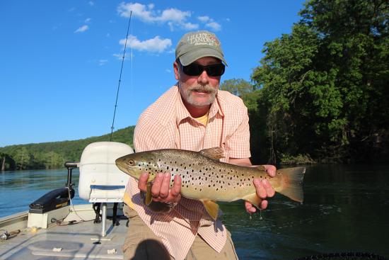
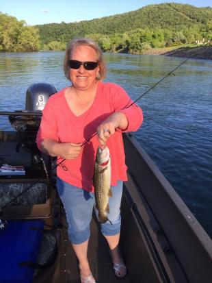
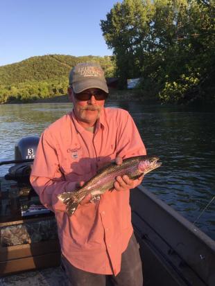
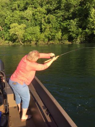
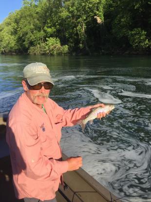
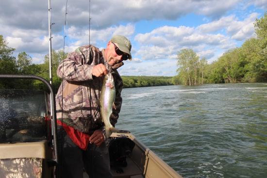
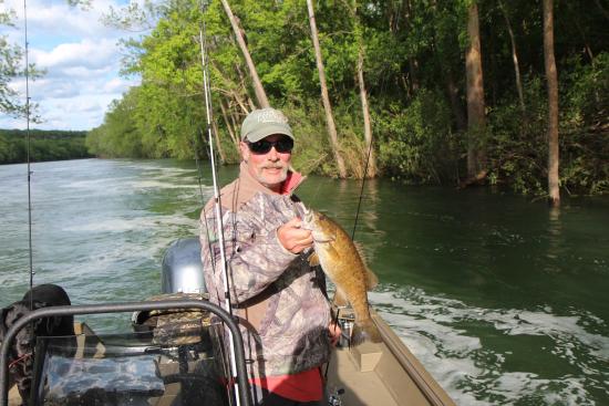
Flow: 20,000 cfs Duane and I boated to the dam yesterday evening. The short of it: Not a whole lot of damage. 2 docks gone. 1 dock upsidedown. Banks don't look too bad. Water color coming from the tubines - very clear. Over the gates, good color. Caught a few rainbows on the cold side, smallish and not fat. On the warm side, rainbows were huge (17-19 inches) and super broad and fat. Fought very hard. One brown trout and one nice small mouth - all on white 1/8th oz jigs. Had to just drift the jigs. Hard to get them down to the bottom and that's where it had to be. Next time I'd put a split shot on.
- 13 replies
-
- 10
-

-
Usually can off the road leading in. Have to be creative.
-

trophy area changes and brown trout changes?
Phil Lilley replied to Travis Swift's topic in Upper Lake Taneycomo
It'll be a while before the water is low enough to see the changes but I'm sure there will be some. I'm hoping to put a bass boat in and boat up to see what it all looks like. -
(Dam Notification) Table Rock Dam will reduce releases to 23,700 CFS at noon today. This will be the final notification for this event.
-
(Table Rock Lake Dam Release Update) Table Rock Dam will decrease releases to 36,500 cfs starting at 8:00 AM Thursday morning, May 4th.
-
White River Chain of Lakes Balancing Act
Phil Lilley replied to Phil Lilley's topic in General Angling Discussion
I know... there are a lot other varibles like head pressure (I heard this term at a meeting one time... I don't know what it is), and then there's recreation. The resorts and marinas don't like low lake levels. -
White River Chain of Lakes Balancing Act
Phil Lilley replied to Phil Lilley's topic in General Angling Discussion
Could you make the some point this way? I want to know how the Corp of Engineers will help prevent record drought going forward. If they would leave the lakes at record highs in anticipation of long dry spells and record lack of rainfall rates, the White River system could certainly retain the water needed for power demand generation, recreation and agricultural needs of the delta downstream. I'm not disagreeing with you... I'm playing the other side. Lowering the pool elevation would help but what would that elevation be? The lake was 907 ft not that long ago. -
In the conference call yesterday with the Corp and weather service, Steve Bays explained what's next for our lakes - Beaver, Table Rock and Bull Shoals. Once Bull Shoals approaches flood pool, the Corps will balance all 3 lakes as to volume of conservation pool remaining (I think that's the term). They will try to keep the same amount of free space in all 3 lakes without spilling at Bull Shoals. He said they have to wait 7 days after the White River crests at Newport before they can release at Bull Shoals. Even then, the Mississippi's high water will come into play at some point. So in for a wild ride this month.
-
If Table Rock is generating, Powersite will.
-
Sometimes you just shoot yourself in the foot...
-
Release dropped to 50,000 cfs this morning at 8 am. Just sprinkles here in Branson.
-
Moonshine is closed


