
Phil Lilley
-
Posts
19,030 -
Joined
-
Last visited
-
Days Won
132
Content Type
Profiles
Forums
Blogs
Events
Articles
Video Feed
Gallery
Everything posted by Phil Lilley
-
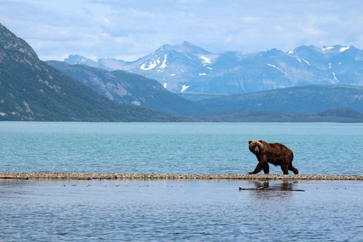
Have to add my phish to the thread. Not as long as some of the rainbows above but will hold it's weight in a fight. This guy headed upstream like a train- thought I may run out of line which doesn't enter my head very often. Hooked him on a white jig at the boat ramp. Not a bite till then though. Caught another chunk of a rainbow on the next pass and that was about it. They just weren't in the mood.
-
Oh... I did put my home phone on the forum... WHAT WAS I THINKING!!
-
Jigs- drop to the bottom and hop them. Carp- when you smoke them, the meat falls apart is sections and you can pick the bones out easy. No issues. Last time I soaked the carp in brine and it tasted like pork.
-
Anyone heard of this guy. http://www.arkansasnaturephotography.com I tried the email on the site and it bounced.
-
Wonder if there's a parking lot up on the hill.
-
I'll check. It was out last evening so it could be water but thanks for pointing it out.
-
I got mine on google images.... I stole it.
-
When Babler leaves and I go out.
-
Only when I know Babler is out fishing.
-
Catch and Release Certificates issued by Branson Trout Unlimited. You get a pin too. They are given out to all those who catch and release a trout 20 inches or longer. If you qualify for one, send your name, address and details about the trout to me and we'll mail one out to you.
-
-
Fishing is awfully good for you guys to be kicking each other around... again. And for the most part it's the same old crowd too, I might add. You're not going to change minds here - especially the way you all go about it... and especially each others. Sorry Trav, you should have jumped in while you had a chance.

-
Ozark Anglers
-
Here they are. 3-inches in diameter. Vinyl so they should peel off easy if you need to remove them. Cost will be $3 for 2 stickers with postage, $5 for 2 sets. More - 75 cents each. Payment - check mailed to the resort, or best yet, paypal. Payment to lilley@lilleyslanding.com I would take cc# but really have no where to call it in. Our resort's phone is ringing off the wall during the day with guests and I can't tie it up with this deal. Don't want to give out our home phone- my wife would not appreciate it and I can't do it on my cell. You can pick them up at the resort office for $1 each... no tax... we'll take care of that. Thanks for the idea. Hope it will work like you want it to.
-
I'll let speak to this... he had a pretty good trip this morning.
-
The title says it all.... report coming.
-
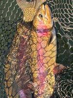
Last night, from about 6:45 till dark, we fished above the tin whistles for whites. Caught a few but not as much action as previous evenings. Water temp was in the mid to upper 50's and I think alot of the whites have moved upstream to spawn. Did catch this buffalo carp- took a white jig. Jimmy had a great time getting it in on 4 pound test. Fought real hard. Going to try smoking it today. It's fun fishing up there and listening to the town's people on the bank talk. It's like community time, talking about what everyone's doing... and not doing. It's quite a celebration on Beaver Creek's bank during white bass season. They haven't had a good season in quite a few years because of weather and high water.
-
I saw the ramp you're talking about- right across from Snapp. I thought it was private. MM - I've always turned off a road to the left off MM at the water tower to Black Ferry area (not sure if that's what it's called) but if you go straight you'll find this ramp? Never ventured down that road but will next time I head down there. Have to map it too.
-
Went to Beaver last night. Just like you said, not as many boats and not as many whites. Lots of people on the bank. Saw a few whites caught. We had 8. Heard daytime fishing was very slow. Fly roders caught lots of whites up in the moving water early in the day. I'd say the whites have moved up in the creek to spawn but not all of them, most.
-
Dutch- how was fishing? I'm going this evening and in the am I think and Beaver is my first choice. More boats?
-
We can entertain questions and comments on this thread but eventuall what I want to see is posts commenting on how lake levels are affecting us fishermen. Right now- I'd like to know what 660 does to the K Dock ramp- any one? How about lower in the lake? All ramps useable?
-
Rainfall dictates that, I would think, not the Corp. They are going to hold BS because of the Miss. flooding which they do every year.
-
This is the start of a thread that will be helpful to anglers in the future. Everyone can help. Bull Shoals lake level varies by over 50 feet. From 10 feet low to 40 feet high... but how does it affect our fishing spots, boat ramps, access to the lake, docks? This ongoing thread should help. Yesterday while fishing, I noted where the lake level were at 660 feet- River Run Ramp is fine. Beaver Ramp is fine. Don't know about K Dock but at 556 I think the road around was almost underwater. Someone can correct me. Note: at what level is K Dock Ramp non-useable? Swan Creek- the water is starting to flood the field to the west of the park pretty good. Not sure how far the lake runs up in the creek- someone can help me on that. Note: The level the lake is in a creek should be dictated by moving water... where does the creek end and the lake start. Beaver Creek- moving water at the Rock Hole. The bridge at 160 is not affected. BS is rising about 4 inches a day right now and this is not expected to change unless we get another rain.
-
Welcome
-
We released all our whites this evening. Nice sows! and a few bucks.


