
Phil Lilley
-
Posts
19,030 -
Joined
-
Last visited
-
Days Won
132
Content Type
Profiles
Forums
Blogs
Events
Articles
Video Feed
Gallery
Everything posted by Phil Lilley
-

Fish Kill Between Horseshoe Bend And Elbow?
Phil Lilley replied to Skeeter007's topic in Upper Bull Shoals
i posted a report on Lower BS earlier today. -
Below are two notices from Jeff Williams at AGFC that might be of interest. 1) Disolved Oxygen Update All, I just wanted to provide you all with an update on our monitoring of the dissolved oxygen (DO) levels on Bull Shoals and Norfork. As of today the breaker vents are blocked open on the turbines at all the White River project dams (Bulll Shoals, Norfork, Greers Ferry, and Beaver). Recommended maximum generation rates have been in place since August 18th and currently Bull Shoals is being operated at 85% of nameplate capacity and Norfork at 73%. On August 18th I recommended to implement stocking restrictions on the upper portion of the Norfork Tailwater. This means that no trout are being stocked at Quarry Park or Gene’s Trout Dock. Field measurements on that day indicated that the dissolved oxygen did not recover to 6 mg/l until nearly a mile above the Bill Ackerman/River Ridge Access. Trout that were scheduled to be stocked at the two upper locations will be placed at downstream locations until conditions improve. On September 2nd field measurements indicated that the dissolved oxygen on Bull Shoals Tailwater did not recover to 6 mg/l until about Bruce Creek. At that time I recommended stocking restrictions for upper Bull Shoals, which meant that trout would not be stocked at State Park, Gunga La, or Gaston’s. The dissolved oxygen levels have continued to decline since that time and last Friday (September 9th) I checked the DO levels on Bull Shoals and Norfork again. Although the location of recovery to 6 mg/l on Norfork has moved downstream somewhat, there was no need to adjust the stocking restrictions. On Bull Shoals, however, the dissolved oxygen now does not recover to 6 mg/l until below the White Hole Access. As a result earlier today I submitted a recommendation to extend the stocking restrictions to include Sportsman’s and the White Hole Access until conditions improve. Also, last Friday I received notification from the Corps of Engineers that they intend to maintain the current maximum generation levels for the next week even as DO levels are expected to drop into the 3.8 – 3.5 mg/l range. The Reservoir Control folks cited a reduced capacity to evacuate remaining flood waters as a result of the maximum generation restrictions. Although the lake elevations are well down from what they have been, I think they are trying stay ahead of any tropical storms that may come our way. Fortunately, we have not observed any evidence of a large-scale trout kill on Bull Shoals or Norfork and there is plenty of good fishable water remaining. We will monitor the situation closely and implement additional measures as needed. Please let me know if you have any questions. Thanks. Jeff 2) Trout Marking All, We are scheduled to mark approximately 8,000 11-inch rainbow trout on September 22nd and 23rd at our Jim Hinkle/Spring River Hatchery in Mammoth Spring. This is the last cohort of rainbow trout that will be marked as an ongoing growth and mortality study on the Spring River. Since our district biologists are busy with their fall sampling we are in need of some volunteer help to complete the marking. Volunteers can ride with us to and from the hatchery so you don’t have to use any of your own gas. Anyone that is willing and able to help please let me know as soon as possible and I will provide additional details. Thanks. Jeff
-
I would say by AJ's writing it's at 30 feet
-
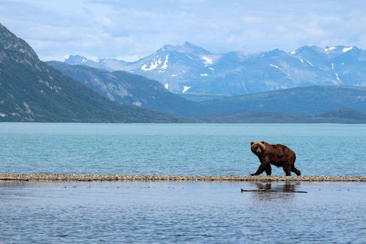
Heard about this last night- got this email from AJ Pratt, MDC biologist: Fish continue to die at Bull Shoals and it appears it is expanding to other areas of the lake. As a result, I’ve received a number of phone calls from anglers concerned about the situation and wondering what can be done. Below is a brief history of the kill and talking points in case you are contacted by the public/media. History: Reports of dead walleye began the week of Sept. 5 in the Lead Hill area and has now expanded below the Oakland area (Points 3-9). Initially, walleye and striped bass were the only fish affected, but as of Tuesday (9-13-11) yellow perch, suckers, drum, and longear have also been reported as dying. Talking Points: - Poor water quality is the primary cause for the fish kill. - Water quality measurements (temperature and dissolved oxygen) reveal water temperatures, from the surface down to 30 feet, range from 80 to 75 degrees F, respectively. Meanwhile, oxygen concentrations are adequate, from the surface to 30 feet, and range from 9 ppm to 6ppm, respectively. However, oxygen levels, from 30 to 35, feet drop to almost nonexistent (2 to 0.1 ppm). Fish become stressed when levels are under 3 ppm. Water temperatures below 30 feet cool to 72 degrees F. - Since walleye/striped bass/yellow perch/drum are a cool water fish, they cannot inhabit the cooler water found below the 30 foot depth. As they are forced to stay in the warmer water they are becoming stressed with some even dying. - Due to the extreme high water, the thermocline usually sets up higher in the water column as compared to years with normal water levels. Also, due to the decomposition of organic material, washed in from the spring floods and surrounding vegetation, oxygen levels below the thermocline are extremely low. This combination forces fish to stay in the upper water column. In typical years, oxygen levels, below the thermocline, remain high enough for fish to survive for short periods of time. - The same situation happened in 2004, another high water year, when walleye, drum, and blue catfish died. - Currently, there has not been any record the water quality is negatively affecting other popular gamefish (black bass, catfish, and crappie). - It is unclear how significant the kill is at this point. - MDC staff continue to monitor the die-off. - Fish kills are currently happening in other White River reservoirs (Norfork and Beaver) and are mainly affecting striped bass. If you have additional questions, do not hesitate to contact me. Thanks. A.J. Pratt Fisheries Management Biologist Missouri Dept. of Conservation 551 Joe Jones Blvd. West Plains, MO 65775 (417) 255-9561, ext. 277 Anthony.Pratt@mdc.mo.gov
-
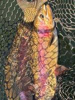
Here's a better explanation from Shane Bush, MDC biologist who conducts the study - Twenty percent of the brown trout we sampled were over 20 inches. The attached table shows actual fish captured. We caught 10 fish that were over 20 inches, the 20 percent is just the percentage of fish captured greater than 11 inches (stock size) that were also over 20 inches. The fish in the sample that were below stock size were brown trout that we stocked early to prevent them from getting disease with the poor water quality coming through TRL dam to the hatchery this year. We stocked them at about 8.5 inches in June so they’ve grown at least an inch already. These are encouraging numbers and if we can continue to increase stocking numbers for next year we should be in good shape in a few as the larger fish exit the population. Brown trout densities are definitely lower than previous years though and this is shown through the inverse relationship of numbers to size. More fish = smaller fish, less fish = larger fish. It all has to do with competition and food availability. It should be balanced somewhere in the middle. We’ll get back to that eventually if we can get some “normal” water years. In the meantime, enjoy that year class of large browns! http://ozarkanglers.com/taneycomo/Individual-Brown-Trout-2011.htm
-
Welcome- glad you found us. I have an uncle that lives in Fairhope but he plays golf, doesn't fish much. I've been down there a few times and love the Gulf Shores area. If you want to share any articles, please send them to me and I'll post them on the main site, as well you can post them here on the forum. I know some of the forum members fish down that way so your salt water perspective will be helpful and interesting. Thanks again.
-
Yea- Shane already corrected me in an email... you beat me to the punch. Still good size but the numbers are still off from 2008. Here's a link to the raw data he sent me. http://ozarkanglers.com/taneycomo/Individual-Brown-Trout-2011.htm
-
PDF file One number stands out... 20 browns measured over 20 inches!! Compared to past years, that's pretty incredible. Taneycomo-2011-study.pdf
-
Dam Area Report Table Rock Lake Current Fishing Report
Phil Lilley replied to Bill Babler's topic in Table Rock Lake
Do ya think you'll get google's attention with that big, long title????? -
Sounds like a challenge to me... I'm up for it. Soon as I get home, I'll make plans. What's the average size you think? What's the easiest way to get to them- I know by boat but where do you put in?
-
Bob- did you float the Elevenpoint this summer?
-
Gavin- you answered this question several years ago when I asked... and here was your answer- Gavin - 1)Mohairs & Buggers 2)Rubber Leg Stones 3)Rubber Leg Prince 4)Rubber Leg Hairs Ear 5)Egg Patterns Hasn't changed much! Thanks!!
-
This was asked a LONG time ago and we have lots of new anglers on the forum since then so I thought I'd ask the question again. Add some technique if you'd like. Warning... you may be quoted! Thanks
-
Could have been trout food.
-
If he was chuming, it is legal. If he using live bait for bait, then he was breaking the law.
-
Felt Soled Waders Banned In Mo Trout Waters!
Phil Lilley replied to jdmidwest's topic in General Angling Discussion
Anyone else have any points? Ones we haven't heard? From members who haven't waded in? -
Yep
-
Felt Soled Waders Banned In Mo Trout Waters!
Phil Lilley replied to jdmidwest's topic in General Angling Discussion
Guess I was stating the obvious- that it will cost us money. I'm not dead set against the ban- it's going to happen and we'll make the best of it and come through it fine. And if it does keep it from spreading then that is a good thing. We already have Zebra Muscles in Taneycomo but like Al said, they don't always devastate a fishery. It hasn't ours and looks like it won't. I venture to say Zebras were brought to our lake by a boat or trailer, that's why I brought up the comparison. -
Felt Soled Waders Banned In Mo Trout Waters!
Phil Lilley replied to jdmidwest's topic in General Angling Discussion
I'll wade in... Like all businessmen, we have to deal with new regulations around almost every corner. The Health Department keeps us busy changing the way we serve coffee and keep our freezers and refrigerators. Glad that's all we do cause to do more means spending big money to keep thing legal. Our swimming pool- a lady drowns in another state and isn't found for three day in a public pool. The pool was cloudy in the deep end- that's what hid her body. Now, in Missouri, we have to close our pool is there's the least bit of cloudiness in the pool. We closed is several days this year by order of the H.D.. I could go on and on. Knee jerk reactions by regulators to try to keep bad things from happening- but you know- bad things keep happening and will continue. Will some of the regulations save lives (fish and humans) ? Some will and some won't. But most hurt business and this will hurt businesses in the short run. The only business it will help is the shoe makers and shoe sellers, and again, short term. I can see out of staters not coming to Missouri because of the ban and yes this will hurt our businesses and might even cause a decrease in license sales. How is algea spread from one water system to another anyhow? What's the most common vehicle? How are Zebra muscles spread? Same? Then what are you going to do with trailers and boats that carry water from one system to another? Could a case be made that trailers and boats could be more of a danger to spread didymo than boots? But there's no need to get all heated about it - we're going to disagree because it takes all kinds of people to run this world... MDC is going to do it regardless what we say- already did it sounds like. I do respects an opinion from the opposite side. It can't hurt, I guess. But it will hurt some of us in the pocket book- that's for sure, whether we have to buy new shoes or lose business because of it. -
I'm surprised it didn't hit the news... glad it didn't. Still may if it's still around, especially at the Landing. I did talk to someone at the Corp and he confirmed what I was told.
-
Lake Taneycomo Fishing Report For The Labor Weekend, 2011
Phil Lilley replied to Phil Lilley's topic in Upper Lake Taneycomo
We did not get out to mark the trees in the lake today. Will try again tomorrow. -
Lake Taneycomo Fishing Report For The Labor Weekend, 2011
Phil Lilley replied to Phil Lilley's topic in Upper Lake Taneycomo
posted on another thread about the oil. -
I saw it on the water yesterday am. Called MDC and they said they knew about it. The Corp told them that oil leaked from one turbine. It was fixed quickly yesterday morning and then the water turned on early to flush it out. It should dilute and dissipate in time. But there shouldn't be any upstream unless they have more problems with that turbine.
-
<img src="http://ozarkanglers.com/ice/narrows_530.jpg" width="530" height="195"></p> <p>Since my last fishing report was almost six weeks ago, I’m going to have to cover a lot of water, so to speak, because a great deal has changed since my last report… quite literally.<br><br> At the time I was leaving for Alaska, the boards at Powersite Dam were being reinstalled, bringing our lake back to what we call “normal pool.” But if you’re a frequent caller to the dam hotline, calling to see if water is generating or what the lake level is, you’re used to hearing “701.3 feet” as being the normal lake level when the water is off. Today, that’s not so. The new level is 702.0 feet. Why? Because gravel was moved by the high water from the banks and bottom above outlet #2 and piled up at the rebar area. It now acts as a little dam, holding back more water at a higher level than prior to the flood. There’s also very little current at all from the dam face to rebar, unlike before when there was good current, especially from about half way between outlets #1 and #2 through outlet #2. It’s deeper and pretty much still water in this area.<br><br> The rebar has changed completely, except for the fact that it’s still turns and goes to the south bank through what we call “the gauntlet.” Rebar isn’t one big shoot of water anymore. It’s four separate shoots, starting at different points but all ending up dumping into a big pool. I haven’t had time to look at it closely or fish it at all. It’s a matter of going and feeling out the area and see where the trout are holding. One thing positive is that I think there’s more room for anglers to find a good spot and not be as crowded.<br><br> I’ve also fished down at the boat ramp this past week. The water seems higher down there, too. The shoot at the end of the long pool down from the boat ramp has no channel whatsoever. It’s a shallow riffle all the way across at the top, which makes me think it’s dammed up, too, holding water behind it at a higher level. Also, there is not as much current either. This shoot at the end of the pool is much longer—extending all the way down to the former KOA property. It’s all filled in with gravel. At the end and on the south side, there’s a good channel that’s holding some nice trout, towards the point of the island. You can wade all the way down to the start of the KOA high rock bank, then it drops off into the deep channel as before.<br><br> Down from Lookout, the first pool is wide and deep from bank to bank. There’s very little left of the long shallow point just down from Andy William’s house that so many waders used to wade out on. It drops off pretty quickly and there are some deep holes washed out on that west side. There are also piles of gravel on the west side that extend well into the lake channel up and down this whole stretch. The edges are steep, and I’m sure loose, so if you’re wading close to them watch your step. You could be up to your chest in water real quick.<br><br> The narrows is another area that’s changed a lot. I posted some pictures of the narrows back when the boards were off and the water was running, and you can see the new shape of the gravel bar that extend from the west to east side of the lake. It’s higher out of the water for sure and there are all kinds of sticks, branches and small trees sticking out of the gravel all over the bar. All of it is buried, I guess washed down from above, and covered up by moving gravel with only parts sticking up. The flat used to be pretty clean of anything but gravel. With the water off, a lot of it is completely out of the water now, leaving just the channel on the east side. It’s narrow and shallow. When a boat is fishing the narrow, it’s tough to get around them without disturbing their fishing. I would not blow up through this anymore with my boat. There’s a couple of large boulders above the overhanging tree that come into play close to the bank and in the channel. You have to go slow and look for them. I’ve been going through with my motor trimmed up. This is a HUGE difference from the way it was before the flood.<br><br> Below the narrows the lake deepens out -- actually deeper than it was in some places, I think. It is much deeper along the chunk rock bank on the west side and holds a lot of fish, especially if generation is one to three units. The east side used to be fairly uniformed, straight and predictable—gravel bar sliding off into a deep channel. Now there are a couple of big trees lying on top of the bar and the bar has curves and cuts, dropoffs and shoots. The channel or west side is close to the same all the way to Fall Creek.<br><br> At Fall Creek, the channel most of us used to get up past the gravel bar is filled in so much that I’m not going to suggest using it anymore to boating clients here at the resort. The channel is deeper on the dock or west side of the lake now. The bar itself is not as deep all the way across, but when the water is off, it’s still shallow enough to eat props.<br><br> From Fall Creek to Trout Hollow, it’s changed, too. The channel is the same—along the bluff. There are two trees in the lake on the channel side that will get your lower unit. We took a chain saw to them back when they drew down the lake in July, but we couldn’t cut them low enough. We have tied buoys to them twice but they’re broken free. We are going to attempt to mark them again Friday (tomorrow) so that boaters can see where they are and avoid them. (There’s actually another tree about 1000 yards above our place (Lilleys’) that we will also mark with a buoy) You’ll see that the gravel is piled up high on the inside of the bend. If you have a depth finder on your boat, you should notice that the channel is deeper than it was before. There are actually several holes that are as much as 16 feet deep at low water. The gravel bar at Short Creek, the one that ate more props and lower units than any other on the lake, extends less than half what it used to; where the main part of the bar used to be, the water there is 10 feet deep. Amazing! It took that gravel and moved it about 300 yards and spread it all the way across the lake. There are two trees lodged on either side of the lake above Trout Hollow. At that point, the lake shallows up to less than four feet deep from bank to bank. There’s no channel. You can boat through this area with little trouble but back when the boards were off and the lake was lower, you could barely get a jon boat through this area with the motor tilted up.<br> No other noticeable changes below Trout Hollow.<br><br> Generation patterns have been fairly consistent this past week but should change as this cold front moves through the area later this weekend. The water has been off until mid day and then one to three units have been running until evening and off by 10 p.m. The DO (dissolved oxygen) content is starting to drop and is low when they are not running water. It jumps up when they run water because the U.S. Army Corps of Engineers is injecting liquid o2 in the water as they generate. This will continue to be a factor until the lake turns over later in December. Our water temperature is higher than normal because of the hard rains and flooding in the spring. It’s running about 57 degrees while normally it’s closer to 50. Low o2 levels coupled with high water temperatures means trout will feed less, and be less active than normal. They also won’t fight quite as hard and will be harder to release successfully. This means you need to fight them quickly and return them back to the water immediately. When flyfishing, don’t use ultra light tippet like 7x. A larger trout will literally give his all and you’ll fight him to his death— which is counterproductive when you want to catch and release.<br><br> Seems like to me our trout are looking for scuds when flyfishing. I’ve had the best luck fishing scuds early this week, before the water starts in the morning. Conditions have been rough with no generation, no wind and very bright sun. Those can make for a slow fishing trip most of the time, but we’ve been fishing with long leaders (5x or 6x fluorocarbon) and #14 gray or brown (mink) weighted scuds under an indicator and doing well. I’m fishing 1.5 times the depth of the water I’m fishing, setting a palsa indicator on the line and letting the scud drift to the bottom. Then I move it, swimming the scud across the gravel bottom. The trout are picking it up pretty quickly. I’ve been fishing below and above the narrows and between the narrows and Lookout. When the wind picks up and there’s a chop on the surface, I’ve gone to a jig and float and done well. Olive or tan micro, sculpin or ginger marabou jigs are great. Chuck Gries also sells a white micro jig that does real well, too. It has a chenille body and tiny marabou tail. They are chasing a small #16 wooly or crackleback, too, in windy conditions.<br><br> I ventured up below the dam this morning and visited with Tim Homesley from Roaring River. He was having fun catching rainbows close to outlet #2 on a white San Juan worm. I picked up a few rainbows on the north bank below outlet #2 on a #16 brown trout crack scud. I didn’t get to fish much before the horn blew. Night flyfishing has been pretty good, I hear. Some anglers are launching their boats at the boat ramp and fishing that area using darker jigs, PMS and sculpin patterns.<br><br> When they’re running water, I’ve done well throwing a 1/8t-ounce jig against the bluff banks from the dam clear down to Trout Hollow. Good colors have been sculpin, olive, black, brown, ginger and white. If they’re only running one to two units, throw a jig and float and fish it five-to seven- feet deep. Use white or pink micro or marabou jigs.<br><br> Air-injected night crawlers are catching most of the bigger trout below Fall Creek. I’d inject them either with the water off or running right now. Use the least amount of weight as needed to get the bait to the bottom. Unfortunately there’s more on the bottom of the lake now to get snagged on when drifting. The Missouri Department of Conservation has stocked rainbows this week in preparation for the Labor Day crowds, probably releasing them from Branson up to Cooper Creek because of water temperatures. It would be too warm for them to stock below Branson from now through the fall.</p>
-
Water temp is the key. You're going to have to go above the bridges I'd think to find good fishing for trout. Creeks aren't going to help at all- they're even warmer than the lake. I'd go up as far as Cooper Creek or further is needed. Probably not going to see much current either. Anchor and still fishing with night crawlers. Boating- watch your wake and you'll be fine.
