


Al Agnew
-
Posts
7,085 -
Joined
-
Last visited
-
Days Won
27
Content Type
Profiles
Forums
Blogs
Events
Articles
Video Feed
Gallery
Everything posted by Al Agnew
-
Well, this discussion went off the rails. Everything I've ever heard or read about heaven and eternal life sounds boring as heck after a few hundred years, maybe a lot fewer years than that. I'm sure I've told this here before, but when you get to be my age you tend to repeat yourself...when you get to be my age, you tend to repeat yourself........... An avid fly fisherman dies, and soon finds himself at the pearly gates. An angel comes and tells him to follow. He takes the angler to an absolutely gorgeous trout stream. The weather is perfect, there are big trout rising everywhere. The angel hands the angler a fine fly rod and a box of beautiful hand tied flies, and tells him, "This is your stretch of river. You can fish it for as long as you wish. Nobody else will intrude." The angler ties on a fly that appears to match the abundant mayflies. He picks out a rising trout and makes a perfect cast. The drift is beautiful. The trout takes solidly. The battle is spectacular, but finally the angler nets a beautiful 20-inch rainbow, admires it, and releases it. He picks out another rising trout. Another perfect cast and drift, another take, another battle, another 20 inch rainbow. The next cast is pretty sloppy, but it doesn't matter, the nearest trout takes, same kind of battle, another 20 incher. After a couple hours, the angler has gone through every fly in his box. He's purposely made terrible casts and dragged the fly along the surface, or let it sink when it gets waterlogged. Doesn't matter. Every cast gets a take. Every battle results in landing the fish. Every fish is 20 inches. Finally the angler walks back up the hill to where the angel is watching, and says, "Well, this has been terrific, but is there another stream we can try? Maybe one with more challenging fish, or bigger fish?" "Nope," says the angel. This is your assigned stream. It's the stream you will fish for all eternity." "Wow," says the angler. "I mean, it's great fishing but I thought Heaven would be more interesting than this." The angel looks at him sadly, and replies, "Who told you this was Heaven?"
-
3 species of longear sunfish, and possibly 6.
Al Agnew replied to Quillback's topic in Conservation Issues
Actually, I think it's an attempt to slow the spread of the invasive rusty crayfish. If you don't transport ANY crawdads to different waters, you can't transport the bad ones. -
3 species of longear sunfish, and possibly 6.
Al Agnew replied to Quillback's topic in Conservation Issues
It seems the freshwater fisheries world is in the throes of a "splitter" mentality these days. I think we're up to 19 species of black bass at this point, or is it 13? And now THREE species of smallmouth alone! Fact is, fish are not the most mobile of critters, and are limited to what they can swim to; they can't go overland to breed with the population in the next river system. So it stands to reason that there will be differences in widespread species like longears based upon which major river system they are in. There are certainly some differences that can be seen if you have two side by side to compare. And genetic studies bear it out to at least some extent. I suspect that if the genetic studies are done of ANY widespread species that lives in several different major river systems, they will find significant genetic differences in different populations. But is this enough to make them different species, or just different subspecies or strains? -
Yeah, I've met and talked with a few of them. Roland Martin was the biggest surprise...really nice guy to talk to when for some reason I didn't expect him to be.
-
Another unbelievably stupid species MDC pushed back in the day is multiflora rose. The land we just sold was thick with it. Had no bush honeysuckle or bradford pears, but that multiflora rose was evil. The land we just bought and live on now has quite a bit of bush honeysuckle close to the road, but hardly any multiflora rose. Gonna have to do battle with the bush honeysuckle.
-
Well, back in those days I watched those shows because they were about fishing, but didn't really much care for any of the personalities on them. Ensley was marginally okay, Virgil was pretty much a doofus, I thought. Jerry was the best of them, but wasn't often on the TV channels we could get. But I was pretty sure my dad and I knew more about catching big bass than any of them. When the bass guys started getting shows, I thought they were mostly okay. Probably enjoyed Jimmy Houston the most...he just seemed to do nothing but have fun, while some of the others were way too serious.
-
US supreme court sides with New Mexico Anglers over access.
Al Agnew replied to BilletHead's topic in Conservation Issues
Absolutely. As a river landowner myself, I can see both sides. But I bought my riverfront property (in two states) knowing that for the privilege of owning it, I would have to put up with public use. In the old days, landowners didn't mind people using the rivers flowing past their property, or thought it was public water. But in more recent years, and especially as more people (with proportionally just as many pinheads) began to use the rivers and new people bought up land along them, there have been many instances of stream stretches being closed off, informal accesses shut down, and all because either the landowner was influential in county politics or the law enforcement people would rather shut it down than do their jobs patrolling it. We are losing access, folks. For every parcel of land MDC has acquired and put in a nice boat ramp, there are two or three bridge crossing being closed to access. -
US supreme court sides with New Mexico Anglers over access.
Al Agnew replied to BilletHead's topic in Conservation Issues
Here is the exact wording in the MO Supreme Court case that settled public stream access in Missouri: "this river is navigable in fact by canoes, rowboats, and other small floating craft of similar size and nature, but that it is not navigable in fact by larger boats and vessels." Maybe not an exact definition, but not difficult to understand. -
US supreme court sides with New Mexico Anglers over access.
Al Agnew replied to BilletHead's topic in Conservation Issues
I highly doubt that ANY reading of the case will support "hiking for miles down a dry gully". There are NO states where such is the case. In Montana, you must be able to legally access the stream at some kind of public access, or through a landowner, in order to fish it, but once you've legally accessed it, you can fish it for as far upstream or downstream as you wish as long as you stay within the high water mark. Most states with permissive public access rules are some variation of that; in no state can you cross private property to reach the stream. Missouri and Arkansas are a bit more restrictive than Montana, in that the stream must be floatable in small craft before the public has an easement to float and fish it. You are correct that refusing to hear a case is different from siding with anglers, though. Had the Supreme Court taken the case and made a decision that affirmed the state supreme court decision, it would have probably been binding upon all other states. As it is, each state will have to litigate separately in order to gain the rights the NM Supreme Court decided for that state. -
Sure glad to see Mitch back in the lure business. His original HD Craw design was a game changer, and I have no doubt that these lures will also be great. The Shark Tail looks terrific in the water from the video I saw.
-
Yeah, it's probably been 20 years since it was an usable access. The last time I used it was with the MDC biologist in charge of Big River; we did electroshocking upstream from the access. It was not open to the public then, but he got permission to use it. Many years ago, I got to know the old guy who owned it. What I didn't know was that his family was gradually moving him out of taking care of the place. I got permission from him to use the access for $5 one day, and went back a few days later to give him some t-shirts with my artwork on them in hopes that he would let me use the access without charging me for it. The next time I went to use it, another guy who I think was his son or son-in-law stopped me and told me the access was closed, and that the old guy shouldn't have given me permission to use it the last time. Apparently he had been taking money from people (and my t-shirts!) when he no longer had the authority to let people in (his house was before you got the old farmhouse at the end of the road, so I guess everybody stopped there.)
-
There are two private low water bridges between the park and Blackwell. One is the bridge at what used to be known as Cole's Landing. It was once a fee access but is completely private now. In normal flows you can float under it with no problem, except that sometimes a bunch of driftwood piles up against the bridge and blocks the culverts going through it. The other is a couple miles downstream. The river splits just above this bridge, and for the last 10 years or so there has always been enough water to float the left channel, which bypasses the bridge but has a pretty sharp drop that can generate some 1-2 foot standing waves in springtime water flows. There usually isn't anything you have to portage, but up until last summer there was a bad log jam a couple miles above E Highway that required portaging. I think Jason of Wolf Head Outfitters finally got a passage sawed through it, but the big tree that anchors the whole jam is still there, so it could easily get jammed up again.
-
Nobody knows the answer other than the coaches and team, and they have been completely quiet on it. He dressed but was not at the pre-game shootaround tonight. If he's back to not contributing again, this team's ceiling just got lower. Tonight was a gutty win. With Gomillion and DeGray out with injuries and Shaw not getting a lot of minutes because Gates doesn't trust his defense and rebounding, add in Mosley not playing, and they are down to a seven man rotation plus Shaw. They can't sustain the kind of up tempo offense and full court pressure defense they need to play for the rest of the year with that limited a rotation; they badly need Mosley, Gomillion, and DeGray.
- 1 reply
-
- 3
-

-
The mountain streams coming out of the Absaroka/Beartooth Mountains, tributaries of the major rivers I named, are mostly heavily timbered. In fact, they are small and difficult to negotiate in many places, with heavy brush and timber hanging over the creek. Most are full of small, stupid native cutthroat, though one of them I've fished has, weirdly, mostly brown trout up to about 15 inches. You can drive up some of them through private land which contains some beautiful meadow stretches, but no easy access. Small rivers like the Boulder and Shields and Gallatin flow though farmland on their lower sections, with banks mostly lined with cottonwoods and occasional bluffs. Up in the park, there are all kinds of streams. Some are in heavy forest, some flow through wide open meadows, some in deep, narrow canyons. Streams like Hellroaring Creek, one of my favorites, are simply gorgeous, flowing through mixed meadows and forest. On the other hand, the Lamar River up in the Lamar Valley is nearly all meadows, very few trees anywhere...it's good fishing but you have to be on your toes all the time, because if the grizzlies aren't intruding upon your fishing the bison are threatening to trample you...and then you hear a couple wolves howling up on the mountainside and you begin to realize that you might not be the apex predator there!
-
Depending upon how close you live to I-29, you're probably 5 hours closer to Montana than I am when I'm in Missouri, since I'm down in southeastern MO. It takes us about 21 hours drive time to reach Livingston MT. We live part of the year in Livingston partly because that part of Montana is gorgeous, partly because there are all kinds of opportunities for fly fishing, and partly because of Montana's enlightened stream access law; if you can legally get on it, you can go anywhere you can reach on it. No other western state offers so much water open to the public; it drives me nuts to go to Colorado and see all the long stretches of private water that I can't fish. The stretch of I-90 between Hardin east of Billings and Three Forks west of Bozeman gives you easy access to the Bighorn, Stillwater, Clarks Fork, Boulder, Yellowstone, Gallatin, Jefferson, and Madison rivers, along with dozens of small streams coming out of the mountains. The difficulty isn't in finding a place to fish, it's in narrowing down your choices to a manageable number. Heck, in Livingston you're only an hour away from Yellowstone Park, with all the terrific streams you can fish within the park. And that's only one part of Montana; there are others just as good. My problem is that it's so nice in my area that I don't feel the need to do much exploring over the rest of the western half of the state. One very important thing to remember...water levels in Montana are not like water levels in Missouri. I'm constantly seeing people asking about visiting Montana to fish in June. That is the WORST time to go there. The spring runoff starts in early May most years, and in most years runs through June. While you CAN find fishable water during the runoff, your choices are severely limited, because all but the tailwater rivers are likely to be high and muddy. And for the wading angler, many streams can still be high and difficult to wade even through July. If you want to have good wading, plan to go in August and the first half of September (and if you don't mind taking chances on bad weather at times, through September and into October, or in April before the runoff starts). The only thing June has going for it is the salmon fly hatch, which is iffy...on most streams it happens when the water is high, and float fishing is the only way to go. You can often get a good salmon fly hatch on fishable and wadeable water on the Madison, but everybody and his dog knows it, so it's combat fishing. On most of the larger streams, you won't really need to worry about bears, but on those streams within Yellowstone Park and the small mountain tributaries, bear spray and PRACTICE USING IT is a very, very good idea.
-
In the past, when the mill dams on Big River were still intact, the Byrnes Mill mill dam was the farthest downstream, and formed a barrier to upstream travel, so it was the best spot for walleye on the river in late winter/early spring. I believe it deteriorated before the Rockford Beach mill dam, and then Rockford Beach became the best spot. I haven't heard of it being a good spot in recent years; I suspect that fish can get past it in early spring water flows. The only intact dam left is at Byrnesville, and there is a fish passage through it. I grew up on upper Big River, and never saw a walleye in the upper half of the river until about 15 years ago, when all the mill dams were in disrepair.
-
Yeah, I didn't even mention the tiff mining, which screwed the river up about where it started to recover from the lead mining. Back in 1975, a buddy and I headed to the river one morning to float from Blackwell to Washington Park. It had rained a lot the night before, but when we crossed the river in Desloge it was in good shape. Well, we crossed it at the old Blackwell bridge while heading on to Washington Park to drop off a vehicle, and it was pure red mud! A tiff mine tailings dam had burst the night before up on Mill Creek, which comes into the river just above Blackwell, and had dumped a huge amount of tailings into the river, so much that it pretty much killed everything from there to where the Mineral Fork came in and diluted it enough. I did a two day float from St. Francois Park to Washington Park the next year, and caught over 100 bass above Blackwell and exactly 2 bass below. It took about 10 years for that stretch to fully recover.
-
I hadn't heard about the Newberry Riffle being removed...I'm trying to remember the last time I floated that section. It was sometime during late summer, and it was still there. If it actually worked the way it was supposed to and was doing some good, it would have been a simple matter to make it easily passable by paddle craft; just pick a line through it and remove about four strategic boulders. I've had mixed feelings about it. The upper end of the pool it formed used to be a fast run that always held a really big smallmouth; I've probably caught a dozen 20 inchers there over the years. But the "dam" deepened and slowed it, and I hadn't caught a big one there since it was constructed. But the pool held a good bunch of nice fish once the thing was built.
-
You can do park to park in a day, but don't plan on fishing much. I float from St. Francois Park to a private access near Blackwell, about 14 miles, in a day, and fish hard, but it's 7 AM (as early as I can usually get into the park) to 8 PM. And I paddle through some of the longest pools, and often have to paddle the last mile or so. There is one dead pool that's a mile long, and a couple more that are close to a half mile long. There isn't a whole lot of development in that stretch, so there are several good gravel bars for camping where you won't be in sight of a dwelling if you decide to do it as an overnighter.
-
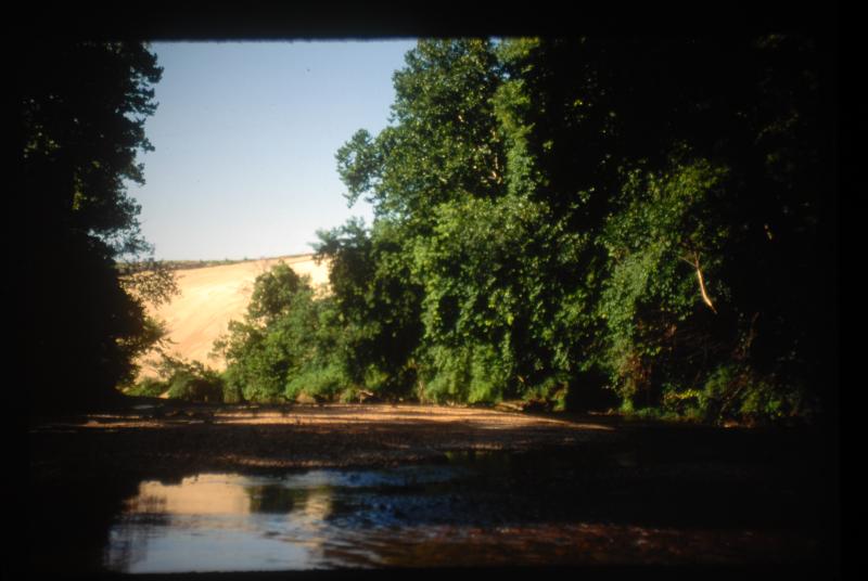
There is a creek that comes into the river about a quarter mile above the Leadwood Access--it's right where the river divides and bends sharply to the left against the last bluff (on river right) above the low water bridge. That is where the runoff from the farthest upstream mine tailings (the Leadwood Mine) comes in. So from Leadwood Access to Bone Hole there is a significant amount of tailings on the bottom, but not enough to fill in the pools much. Bone Hole is the beginning of the five mile bend--only a half mile across the neck of it there--where the Desloge Mine's tailings once filled the entire inside of the bend, and continually eroded into the river. The farther you went around that bend, the worse the tailings in the river were. By the time you completed the bend, the bottom consisted of 90% tailings. At the downstream end of the bend now, you'll come to a 75 ft. high slope covered in rip rap, with a couple bluff outcrops sticking out of the rip rap. That was once a slope of mine tailings that covered even most of those bluff outcrops, and came right down to the river. The tailings were partially excavated there as part of the Superfund cleanup and then stabilized with the rip rap. The photo I've attached is an old photo of those tailings the way they used to be. The tailings were bad enough, but the county was stupid enough to buy most of the inside of the bend from the lead company and make it their county landfill, without worrying about how stable the flimsy little dikes holding back most of the tailings. Eventually the dikes gave way and not only dumped 50,000 cubic yards of tailings into the river all at once, but also the trash and garbage that the county had buried in the tailings. This happened in 1977, and it was a mess. Farther downstream, Flat River Creek comes in (about a half mile below the 67 bridges north of Desloge). The tailings from the two biggest mines, the National and Federal mines surrounding Flat River (Now Park Hills), flowed down Flat River Creek to the river, and from there to St. Francois Park is the worst section of tailings. There was a time when the bottom was little better than a concrete channel, the tailings packed on the bottom, the gravel bars mostly tailings. And the tailings are almost sterile, so nothing grew on the bars and only that nasty algae grew on the bottom. The river is actually in much better shape now. The bottom still has a lot of tailings, but some of the pools are deeper and the habitat is somewhat better than it was for a long time. The nasty algae is still a problem in mid to late summer, and there is plenty of development along the river that wasn't there before, but it's not bad floating...except for the Newberry Riffle about a half mile below Flat River Creek. The EPA and Corps of Engineers decided to try something to remove some of the tailings...they built what amounts to a dam, but instead of a single dam wall, it's a stairstep rapid of big boulders piled up in four distinct steps. The idea was to form a slack water pool above the "riffle" where tailings would settle (the tailings are the consistency of fine sand and small gravel) and be periodically dredged out. The "riffle" was supposed to be shaped so that it could be floated over in normal water flows, thus not impeding floaters. But a huge flood right after it was built kinda jumbled up the boulders and made it very difficult to float. If the water is low you have to clamber down the rocks dragging your boat, and if it's up a little it's basically impossible to float and even more difficult to drag over or around. If it's up more than that, it makes a serious whitewater rapid.
-
Bass pro fly rod combo
Al Agnew replied to retired chem teacher's topic in General Angling Discussion
For $200, you can get a better rod and reel than the BPS combos. Or actually a better rod. The reel isn't all that important in Missouri fly fishing, basically all you need is a reel that will hold the line and has some sort of a drag, doesn't have to be great. You can find reels for $40 that will do the job. Then spend about $120 on the rod (Redington and Temple Fork Outfitters have some decent rods in that range.) And the rest of your $200 on the line. Sure, you can catch fish on a $100 combo. But you'll cast better and easier and it will feel better if you go closer to $200. I've owned both BPS and Cabelas fly rods, and in my experience the Cabelas ones were better for the same price, so if you go the combo route I'd try a Cabelas combo rather than a BPS one. -
Actually they are members of the sunfish family, same as bass and bluegill.
-
Not really a great fan of any saltwater fish...good but not great. Halibut is about as good as any when you catch it yourself and take good care of it.
-
Just to add a bit...there is a flow into the river about a mile below Bone Hole that started out as a drill pipe atop a high mud bank on river left. It gushed out of the pipe in the strongest flow of any of them and dropped off the bank and into the river in a little waterfall. As the years have gone by, I started to notice that I could no longer see the pipe on top of that bank, but the water was still flowing. Finally, last year I decided to see what was going on. The water is now coming out of a big pool back away from the bank that looks just like a natural spring. I really wonder if that was one of the original springs, and as the pipe rusted away the flow shifted back into the natural spring conduit.
-
I explained the bore pipes in your inquiry on Facebook, but will go into it here...Large scale lead mining started in the Lead Belt area around Bonne Terre and Leadwood during the Civil War, and by the turn of the century there were huge excavations of the five main mines. Leadwood and Desloge mines were closest to the river, and there are vast excavated caverns beneath the river in that area. The boreholes were originally exploratory, and several were drilled along the banks of the river, since that was the lowest ground and had the shortest drilling to the potential lead deposits. These boreholes were lined in iron pipes and capped with an iron cap, originally to keep the river OUT of them, as you didn't want water running down them into the mines. Once a mine was excavated, groundwater continually flowed into it and had to be pumped out of it to the surface. Apparently groundwater was close to the surface before the mines; in fact, my grandfather told me of several significant springs that fed the river that gradually stopped flowing as the mines were further excavated. So the springs dried up, but probably most of the water that had previously emerged as springs was now trying to fill the mines and was being pumped out into the river. There was a shaft just above Terre du Lac (it looks a lot like a cave and is gated now) from which a lot of water was pumped up and flowed over a pretty little rocky waterfall into the river at the base of a bluff. When I first started floating the river in the late 1960s this water was still entering the river, along with another large flow just below Terre du Lac at a place that was once a public access called Leadwood Beach. Between the two of them, they probably dumped about 25 cubic feet per second into the river, and in low summer water levels they about doubled the flow of the river. The last of the mines ceased operations in the early 1970s, and they simply stopped pumping that water out. It took about 10 years for the mines to fill with water. And once they did, by that time the iron pipes and especially the caps on those boreholes had rusted away, and it was a perfect conduit for that groundwater, that used to come out in springs, to instead come up the pipes and into the river. The springs had been dry for 50 years or more and had probably been clogged up by that time, so the pipes were an easier path for that water. When the mines stopped pumping water, summer river flows were cut in half, and for that 10 years or so the river in that stretch flowed about half what it had flowed before. But gradually the water started emerging from the boreholes, and brought summer flows up. The river still doesn't flow as much water as it did while the mines were pumping water, though. By the way, that groundwater would probably be pretty clean if it wasn't for the fact that when the mines shut down, they simply left every bit of their equipment, including excavating equipment, down there, where it sits to this day, slowing rusting away and leaking mechanical fluids.


