
Phil Lilley
-
Posts
19,030 -
Joined
-
Last visited
-
Days Won
132
Content Type
Profiles
Forums
Blogs
Events
Articles
Video Feed
Gallery
Everything posted by Phil Lilley
-
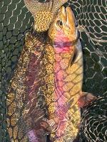
No- a diploid. Adipose fin isn't clipped.
-

MDC sets migratory game bird and waterfowl hunting seasons
Phil Lilley posted a article in Fishing Articles
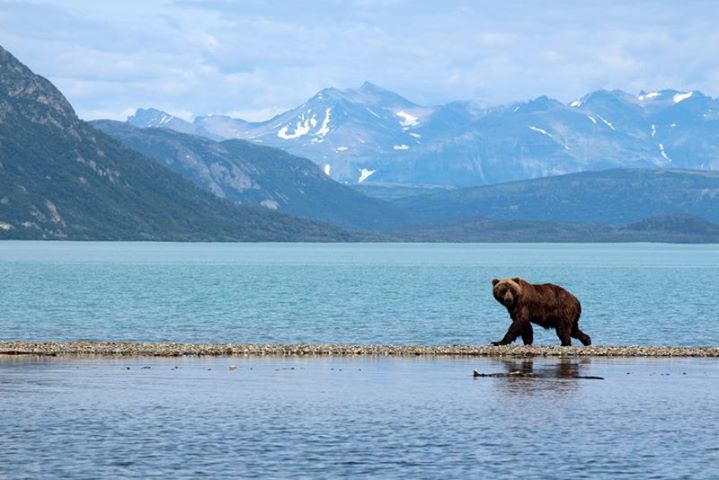
 JEFFERSON CITY, Mo. – At its April 5 meeting, the Missouri Conservation Commission approved recommendations from the Missouri Department of Conservation (MDC) for the upcoming 2018 migratory-game-bird-hunting seasons and 2018-2019 waterfowl-hunting seasons. 2018 MIGRATORY GAME BIRD HUNTING Mourning Doves, Eurasian Collared Doves, and White-Winged Doves Season: Sept. 1 through Nov. 29 Limits: 15 daily and 45 in possession combined total for all three species Hours: One-half hour before sunrise to sunset Sora and Virginia Rails Season: Sept. 1 through Nov. 9 Limits: 25 daily and 75 in possession combined for both species Hours: One-half hour before sunrise to sunset Wilson's (Common) Snipe Season: Sept. 1 through Dec. 16 Limits: 8 daily and 24 in possession Hours: One-half hour before sunrise to sunset American Woodcock Season: Oct. 15 through Nov. 28 Limits: 3 daily and 9 in possession Hours: One-half hour before sunrise to sunset 2018-2019 WATERFOWL HUNTING Teal Season: Sept. 8-23 Limits: 6 daily and 18 in possession Hours: Sunrise to sunset Ducks Season: North Zone: Nov. 3 through Jan. 1, 2019 Middle Zone: Nov. 3 through 9 and Nov. 15 through Jan. 6, 2019 South Zone: Nov. 22 through 25 and Dec. 3 through Jan. 27, 2019 Bag Limit: 6 ducks daily with species restrictions of: 4 mallards (no more than 2 females) 3 scaup 3 wood ducks 2 redheads 2 hooded mergansers 2 pintails (new limit) 2 canvasbacks 2 black ducks 1 mottled duck Possession Limit: Three times the daily bag or 18 total, varies by species Hours: One-half hour before sunrise to sunset Coots Season: Same as duck season dates in the respective zones Limits: 15 daily and 45 in possession Hours: One-half hour before sunrise to sunset Snow Geese (White and Blue Phases) and Ross's Geese Season: Nov. 11 through Feb. 6, 2019 Limits: 20 blue, snow, or Ross's geese daily with no possession limit Hours: One-half hour before sunrise to sunset White-Fronted Geese Season: Nov. 11 through Feb. 6, 2019 Limits: 2 daily and 6 in possession Hours: One-half hour before sunrise to sunset Canada Geese and Brant Season: Oct. 6-14 and Nov. 11 – Feb. 6, 2019 Limits: 3 Canada geese and brant in aggregate daily, 9 in possession Hours: One-half hour before sunrise to sunset Light Goose Conservation Order Season: Feb. 7 through April 30, 2019 Limits: No daily or possession limits Hours: One-half hour before sunrise to one-half hour after sunset Requirements: Persons must possess a Conservation Order permit to participate in the Conservation Order. An exception to the above permit requirement includes any person 15 years of age or younger provided either she or he is in the immediate presence of a properly permitted adult hunter 18 years of age or older with hunter-education certification or who is exempt. Methods: For the taking of blue, snow and Ross's geese, hunters may use shotguns capable of holding more than three shells and recorded or electronically amplified bird calls or sounds or imitations of bird calls or sounds. YOUTH HUNTING DAYS North Zone: Oct. 20 and 2 Middle Zone: Oct. 20 and 21 South Zone: Nov. 17 and 18 Limits: Same as during regular waterfowl season Hours: Same as during regular waterfowl season Requirements: Any person 15 years of age or younger may participate in youth waterfowl hunting days without permit provided they are in the immediate presence of an adult 18 years of age or older. If the youth hunter is not certified in hunter education, the adult must have the required permits and have in his or her possession proof of hunter-education unless exempt. The adult may not hunt ducks but may participate in other seasons that are open on youth hunting days. FALCONRY SEASONS Falconry Season for Doves Season: Sept. 1 through Dec. 16 Limits: 3 daily and 9 in possession, singly, or in the aggregate (any ducks, coots, or mergansers taken by falconers must be included in these limits) Hours: One-half hour before sunrise to sunset Falconry Season for Ducks, Coots, and Mergansers Season: Open during duck seasons (September teal season, youth hunting days, and duck seasons) and Feb. 10 through March 10, 2019 Limits: 3 daily and 9 in possession, singly, or in the aggregate during the regular duck-hunting seasons (including teal and youth seasons) and extended falconry seasons (any doves taken by falconers must be included in these limits) Hours: One-half hour before sunrise to sunset HUNTING ZONES Waterfowl hunting zones in Missouri are divided into North, Middle, and South zones. For a map and more information, visit short.mdc.mo.gov/Zq8. A map of hunting zones will also be included in MDC’s related hunting booklet on migratory game birds, available beginning in July where hunting permits are sold. NONTOXIC SHOT REQUIREMENTS Shells possessed or used while hunting waterfowl and coots statewide, and for other species as designated by posting on public areas, must be loaded with material approved as nontoxic by the U.S. Fish and Wildlife Service. MORE INFORMATION For more information on migratory-bird hunting and waterfowl hunting, visit MDC online at huntfish.mdc.mo.gov/hunting-trapping/species and select the specific species, or get copies of MDC’s related hunting booklet on migratory game birds, available beginning in July where hunting permits are sold. MDC recently set upcoming 2018 migratory-game-bird-hunting seasons and 2018-2019 waterfowl-hunting seasons. MDC offers numerous places to hunt waterfowl, such as Nodaway Valley Conservation Area north of St. Joseph (image), and many areas to hunt other migratory game birds. Get more information at huntfish.mdc.mo.gov/hunting-trapping/where-hunt-shoot.
 -
We were practicing for the tournament tomorrow... Duane's soar-lipping all of them today.
-
Hope you do well.
-
Yes it could be much worse... very grateful it's not like last year. With TR dropping almost .4 feet per 24 hours now, TR should be down to 915 within 7 days or less. At about 916, they should back off a bit. I'm telling you... when Taney drops and these fish are easier to get to, fishing is going to be very, very good.
-
I got this email from David Pitt sharing with me an app his company created. I tried it and it works. Current generation is pretty cool. Phil, I fish the white river tail waters quite a bit, also enjoy "one cast", so my company has created a free SMS (text message) app to obtain current and scheduled generation for White River Tail waters. It's been helpful to get this info on the water, or when away from a computer. Current Generation Text to 913.270.0360 following for Tablerock. >g table or > gen table Scheduled Generation Text to 913.270.0360 following for tablerock. > s table or > sched table Current day will be used by default, but you can also specify a day of week as follows... > s table fri or > s table wed For other tail waters, just replace "table" with the following... bull - Bullshoals beaver - Beaver littlered - Greers Ferry norfork - Norfork
- 1 reply
-
- 1
-

-
 There are fishing reports that are hard to write, and this is one of those hard ones. Why? Because up until this morning (Wednesday), catching trout on Lake Taneycomo has been fairly difficult when it really shouldn't be. I have learned not to discourage people from coming because of fishing reports because if I do, and fishing all of a sudden picks up, some might miss out on a fishing trip of a lifetime. This actually happened before -- and I was scolded by a man who didn't take my advice to cancel fishing here. He ended up catching fish, a lot of fish. So you never know . . . that's why we call it fishing and not catching. From the U.S. Army Corps of Engineers, Little Rock Division this morning: Generating Units 3 and 4 are both going to be offline for a time today. As a result we will augment release by opening spillway gates 6, 4, and 2 at one foot each. The total spillway release will be increased from 5,088 cfs to 8,141 cfs (cubic feet per second); however, the total outflow from the dam will remain around 15,000 cfs. Once unit four is back online, we will close gates 6, 4 and 2. So the Corps plans to open three more gates this morning. That would make eight gates at 8,000 cubic feet per second, plus two turbines at 7,000 c.f.s.. The water temperature coming over the dam is 49 degrees and 44 degrees through the turbines. We haven't seen any shad coming over the top so far, and the trout are hardly biting on white at all. Very, very strange indeed. There is no doubt some small forage fish are coming over the top, including threadfin, but not many or we'd see something. We are catching a few bass but not like in past years. More gates open should help our trout fishing, if not now, at least when the flow slows down and the fish are more accessible. Table Rock is dropping .3 feet per day right now. That will increase as the flow into TR decreases, which should increase to six inches a day. TR is at 918.3 feet right now and should be below 918 feet Thursday, 917 feet by Saturday -- and maybe, just maybe 915 feet by the middle of next week. But there are a lot of factors that could change that -- flow from Beaver Lake, more unexpected rain or decrease of TR flow before then. Fishing has been tough, no way around it. It is frustrating, too, because the techniques that usually work when we have this kind of high water event have not been fruitful, at least not yet. We generally do look forward to high water with flood gates because that does warm the water and puts more food in the lake for our trout, but so far the trout just haven't turned on to these prime conditions. We are catching trout, but just not the numbers we think we usually expect. Starting at the dam in the trophy area, 1/8th-ounce jigs are catching some fish, both cold- and warm-water species along the banks in the slower water and close to the bottom. Good colors are white, white/gray, sculpin and sculpin/ginger. Also drifting shad flies, #12 gray scuds, red San Juan worms and egg flies on the bottom are picking up some nice rainbows. Duane Doty came up with a technique last year during our high water event that's catching big trout right now. It's drifting a crank bait along the bottom -- but not just any ordinary crank bait. He's pinpointed a certain crank bait that works better than others. The only problem is that they're hard to come by, at least so far. It's the Bomber, Fat Free Fingerling in shad or pearl color. Yes, that's its name. While drifting, throw the Bomber out behind the boat like a drift rig and reel down a bit, but not far. The natural action of the bait will take it to the bottom, and it will stay there, digging its bill into the gravel bottom. Brown trout love it, or hate it enough to clobber it as it goes by. And, yes, you do lose baits, a lot of baits. Some anglers won't think it's an even trade, to have the chance for a trophy brown versus the cost of losing baits at $6-7 a pop. Yes, jigs are much cheaper -- drift jigs even more so -- but this technique has been proven to catch good-sized brown trout! Your rig must be heavier than the average trout rod and reel. You need to use at least six-pound line or even heavier. And your rod needs to be fairly stiff to handle the pull of the lure as is plows a row under the water. Writer Ryan Miloshewski has written an article about his experience fishing with Duane last week and catching some really nice rainbows and brown. You can read it here on OzarkAnglers.Com. The Missouri Department on Conservation have been stocking rainbows routinely in the Branson Landing area, and some of those trout are showing up in the creeks down in that area, but not like they did a month ago when our water was high. That doesn't mean they won't find the slower and warmer water of Turkey, Coon and Roark creeks, so it's always good to check those places out. The best way to catch them in these creeks is something under a float, such as a jig, a Berkley Powerworm (pink) on a small jig hook or even a Gulp Egg on a jig hook -- that works, too. They'll also chase a spinner or a spoon since there are a lot of minnows in these creeks. There are anglers doing fairly well just drifting either Gulp or Powerbait on the bottom from Cooper through Monkey Island. Boaters need stay in the middle or inside of the bend and away from the outside of bluff bank where the water is faster. Working the inside bank should be pretty good, too, with Cleos, jigs and small to medium stick baits. The water is really slow enough to anchor (very carefully) and tight line a minnow or night crawler behind the boat. Anchor off the front of the boat, not the side or back. In yesterday's One Cast, I show and explain how I'm anchoring and fishing with minnows. Stay tuned to all our media outlets for current fishing reports and especially changed to flow patterns - Youtube, Facebook and Ozarkanglers Forum. Also! Don't forget about out benefit fishing tournament this Saturday, April 7, here at the marina. Don't let the cold weather keep you off the water!
 -
There are fishing reports that are hard to write, and this is one of those hard ones. Why? Because up until this morning (Wednesday), catching trout on Lake Taneycomo has been fairly difficult when it really shouldn't be. I have learned not to discourage people from coming because of fishing reports because if I do, and fishing all of a sudden picks up, some might miss out on a fishing trip of a lifetime. This actually happened before -- and I was scolded by a man who didn't take my advice to cancel fishing here. He ended up catching fish, a lot of fish. So you never know . . . that's why we call it fishing and not catching. From the U.S. Army Corps of Engineers, Little Rock Division this morning: Generating Units 3 and 4 are both going to be offline for a time today. As a result we will augment release by opening spillway gates 6, 4, and 2 at one foot each. The total spillway release will be increased from 5,088 cfs to 8,141 cfs (cubic feet per second); however, the total outflow from the dam will remain around 15,000 cfs. Once unit four is back online, we will close gates 6, 4 and 2. So the Corps plans to open three more gates this morning. That would make eight gates at 8,000 cubic feet per second, plus two turbines at 7,000 c.f.s.. The water temperature coming over the dam is 49 degrees and 44 degrees through the turbines. We haven't seen any shad coming over the top so far, and the trout are hardly biting on white at all. Very, very strange indeed. There is no doubt some small forage fish are coming over the top, including threadfin, but not many or we'd see something. We are catching a few bass but not like in past years. More gates open should help our trout fishing, if not now, at least when the flow slows down and the fish are more accessible. Table Rock is dropping .3 feet per day right now. That will increase as the flow into TR decreases, which should increase to six inches a day. TR is at 918.3 feet right now and should be below 918 feet Thursday, 917 feet by Saturday -- and maybe, just maybe 915 feet by the middle of next week. But there are a lot of factors that could change that -- flow from Beaver Lake, more unexpected rain or decrease of TR flow before then. Fishing has been tough, no way around it. It is frustrating, too, because the techniques that usually work when we have this kind of high water event have not been fruitful, at least not yet. We generally do look forward to high water with flood gates because that does warm the water and puts more food in the lake for our trout, but so far the trout just haven't turned on to these prime conditions. We are catching trout, but just not the numbers we think we usually expect. Starting at the dam in the trophy area, 1/8th-ounce jigs are catching some fish, both cold- and warm-water species along the banks in the slower water and close to the bottom. Good colors are white, white/gray, sculpin and sculpin/ginger. Also drifting shad flies, #12 gray scuds, red San Juan worms and egg flies on the bottom are picking up some nice rainbows. Duane Doty came up with a technique last year during our high water event that's catching big trout right now. It's drifting a crank bait along the bottom -- but not just any ordinary crank bait. He's pinpointed a certain crank bait that works better than others. The only problem is that they're hard to come by, at least so far. It's the Bomber, Fat Free Fingerling in shad or pearl color. Yes, that's its name. While drifting, throw the Bomber out behind the boat like a drift rig and reel down a bit, but not far. The natural action of the bait will take it to the bottom, and it will stay there, digging its bill into the gravel bottom. Brown trout love it, or hate it enough to clobber it as it goes by. And, yes, you do lose baits, a lot of baits. Some anglers won't think it's an even trade, to have the chance for a trophy brown versus the cost of losing baits at $6-7 a pop. Yes, jigs are much cheaper -- drift jigs even more so -- but this technique has been proven to catch good-sized brown trout! Your rig must be heavier than the average trout rod and reel. You need to use at least six-pound line or even heavier. And your rod needs to be fairly stiff to handle the pull of the lure as is plows a row under the water. Writer Ryan Miloshewski has written an article about his experience fishing with Duane last week and catching some really nice rainbows and brown. You can read it here on OzarkAnglers.Com. The Missouri Department on Conservation have been stocking rainbows routinely in the Branson Landing area, and some of those trout are showing up in the creeks down in that area, but not like they did a month ago when our water was high. That doesn't mean they won't find the slower and warmer water of Turkey, Coon and Roark creeks, so it's always good to check those places out. The best way to catch them in these creeks is something under a float, such as a jig, a Berkley Powerworm (pink) on a small jig hook or even a Gulp Egg on a jig hook -- that works, too. They'll also chase a spinner or a spoon since there are a lot of minnows in these creeks. There are anglers doing fairly well just drifting either Gulp or Powerbait on the bottom from Cooper through Monkey Island. Boaters need stay in the middle or inside of the bend and away from the outside of bluff bank where the water is faster. Working the inside bank should be pretty good, too, with Cleos, jigs and small to medium stick baits. The water is really slow enough to anchor (very carefully) and tight line a minnow or night crawler behind the boat. Anchor off the front of the boat, not the side or back. In yesterday's One Cast, I show and explain how I'm anchoring and fishing with minnows. Stay tuned to all our media outlets for current fishing reports and especially changed to flow patterns - Youtube, Facebook and Ozarkanglers Forum. Also! Don't forget about out benefit fishing tournament this Saturday, April 7, here at the marina. Don't let the cold weather keep you off the water! View full article
-
You're exactly right... I don't like the cold but I like the drier air.
-
You can off load on the docks as well as fish from them.
-
Yes they have 5 open. 3 units going.
-
photo or avatar viewing problems?
Phil Lilley replied to BilletHead's topic in Messages for, and from, the Admin
We are looking at mirroring OAF's data on another service as a backup... -
photo or avatar viewing problems?
Phil Lilley replied to BilletHead's topic in Messages for, and from, the Admin
I can up the limit... didn't know there was one. -
photo or avatar viewing problems?
Phil Lilley replied to BilletHead's topic in Messages for, and from, the Admin
Well, it appears we have most images back. I'll check more extensively in the morning but after reinstating s3 service in my amazon account, the bucket still has stuff in it. Praise God! Thank you. -
The adipose fin is clipped on triploids.
-
photo or avatar viewing problems?
Phil Lilley replied to BilletHead's topic in Messages for, and from, the Admin
My service has been reinstated. I'm seeing some images but not all. It may take some time... I'm sure I lost some data. Just hope it's not as much as I am fearing. It is what it is though. I'm sure sorry about this guys and gals. 12 years of images may be gone. -
They shut down a turbine and opened 5 gates. Still running the same water.
-
photo or avatar viewing problems?
Phil Lilley replied to BilletHead's topic in Messages for, and from, the Admin
Just hoping there's a grace period... waiting for them to reply. Could be a while. -
photo or avatar viewing problems?
Phil Lilley replied to BilletHead's topic in Messages for, and from, the Admin
I have made a pretty big error... About a year ago, me and my server guy decided to send all the images from the forum to Amazon Web Services instead of clogging up his server. Yesterday I closed that AWS account by mistake. Yea... this could be bad. I have a trouble ticket in to AWS and they are supposed to call me later this morning. There is a chance my data has not been released or deleted.... we will see. I did this one other time- hit the wrong key and started reformatting a hard drive instead of a SD card. It's a bad, helpless feeling for sure. -
photo or avatar viewing problems?
Phil Lilley replied to BilletHead's topic in Messages for, and from, the Admin
I can't see most member's avatars... DD's isn't showing up now. Not sure what's going on. Server issues or forum issues. I'll turn in a trouble ticket and see what happens. Anyone else see anything? More info the better. -
I got a friend in Kingfisher, OK that's very jealous right now.
-
It’s stuck in West Oklahoma.
-
Trout fishing stunk on Taney today...
Phil Lilley replied to Phil Lilley's topic in Upper Lake Taneycomo
I don’t like to go over on that side when someone is fishing on the bank but next time I see the canoe I’ll come over and say hi. Did you see me almost knock Jackson (black lab) out of the boat? I misjudged my speed and ran under the cable. Freaked him out and almost push him in the lake. -
Trying to find some catchable fish today. Duane found them behind the big island above Lookout in the river right and in the big eddie in front of Andy Williams' house. Caught them on dark jigs - he can report. Babler's client caught them stripping a brown bugger against the slack bank before Lookout - he can report too. I'm going out and anchoring (safely) in slow current along choice banks, usually where there's an eddie, and tight lining a minnow behind the boat. Using minimal weight - split shot - #10 hook and hooking the minnow up through the lower and up through the upper lip. Got to let the fish have it to hook it. I anchored in front of the lower C of O waterfall first and then anchored below the small point just below that. There's good eddie water there. If it stops raining, I'm going back to that eddie and try a couple of things. I'm going to try some more spots too.


