rps
-
Posts
8,384 -
Joined
-
Last visited
-
Days Won
70
Content Type
Profiles
Forums
Blogs
Events
Articles
Video Feed
Gallery
Everything posted by rps
-
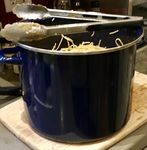
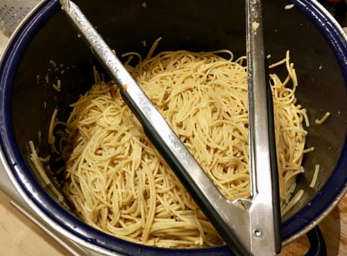
4 pounds of spaghetti noodles turned into sesame noodles for the 8th grade picnic. Now in baggies in the frig.
-
Hot Spots maps are based on U.S. Geological surveys done before the lakes were impounded. Then they supplement the information with what they can acquire from guides. As QB wrote, they are a useful starting point, but they do not show everything. For example, underwater stump beds, left over fencing, and rock walls I know exist on Table Rock do not show on the map.
-
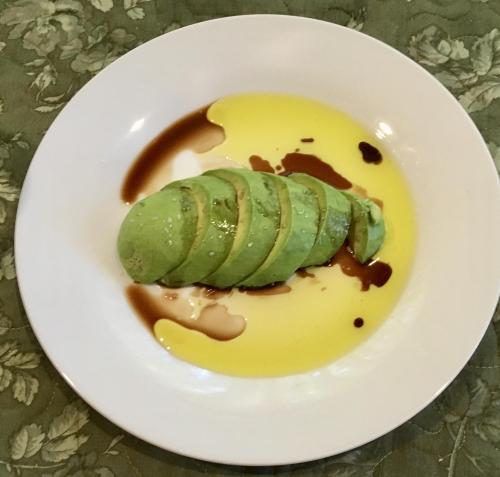
Interesting Blue Apron recipe tonight: Cento yellow tomato with gnocchi and side flavors of capers, roasted red pepper, oregano, crushed red pepper, garlic, and cream. Pretty tasty and something I can repeat from locally available ingredients.
-
The next lake down is a bit different as I understand it. The flow between Beaver dam and no flow lake is not long or strong enough. The only natural reproduction happens on the kings river some years. Stocking adds the vast majority of the walleye population. The Missouri experts tell me that they consider Table Rock a put and take lake for walleye.
-
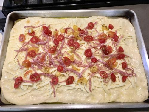
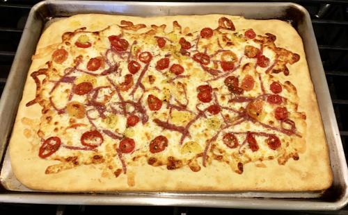
We had an urge last night for pizza even though it was not Friday night.
-
Great post and looks like an awesome trip!
-
Pineapple juice has an enzyme that causes meat to break down and is often used as a tenderizer on tough cuts.
-
It has been years, but the ramp at Bull Shoals Lake Boat Dock and the Bull Shoals Dam Public ramp are the nearest and very usable. Numerous cuts, points, creeks and coves within 5 miles of water. I am talking myself into going this year.
-
One alternative is to stay in one of the resorts on the river below the dam, Gastons or Sportsmans. The lake is minutes away and the river is beautiful.
-
We are still at 62 - 64 degrees up here. We may go through the slime period as we warm up.
-
-
Good for you Rodmaker! I retired from my first career at 52. I just could not stand lawyers anymore. I am now 15 years into my second career and have signed the contract to teach next year. The beautiful wife also teaches and has declared next year will be her last. As for learning the tricks of this lake, you will have it figured out (most of the time) within a year.
-
Saw some spawning right on the bank near Stubblefield Branch today. Warter temp was only 64.
-
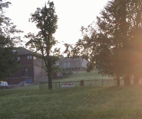
To avoid the wind I went out early this morning. Negative on the top water bite Swam a grub and had two half-hearted bumps. Caught somewhere between 15 and 20 on the Ned. In addition I landed 7 green sunfish.Used my net twice for a squeaker keeper and a 17 inch fish. I did see something I had never seen before. On the East side of the Island here at Holiday Island a small, cast iron fenced graveyard exists. Evidently someone has decided to sell it. Don't believe me? Check the picture below.
-
I said Terrova. I meant Ulterra.
-
Once you fish a spiral wrap, you don't want anything else.
-
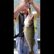
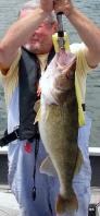
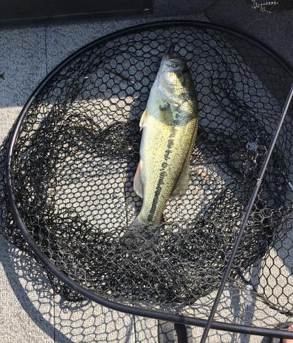
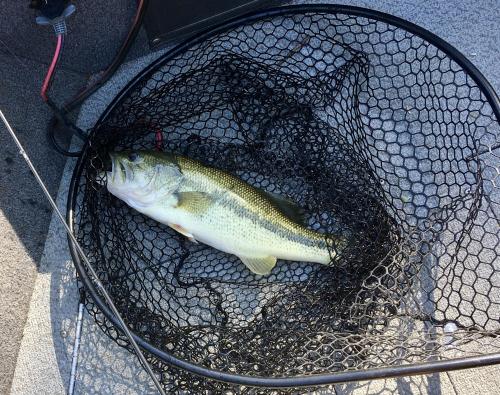
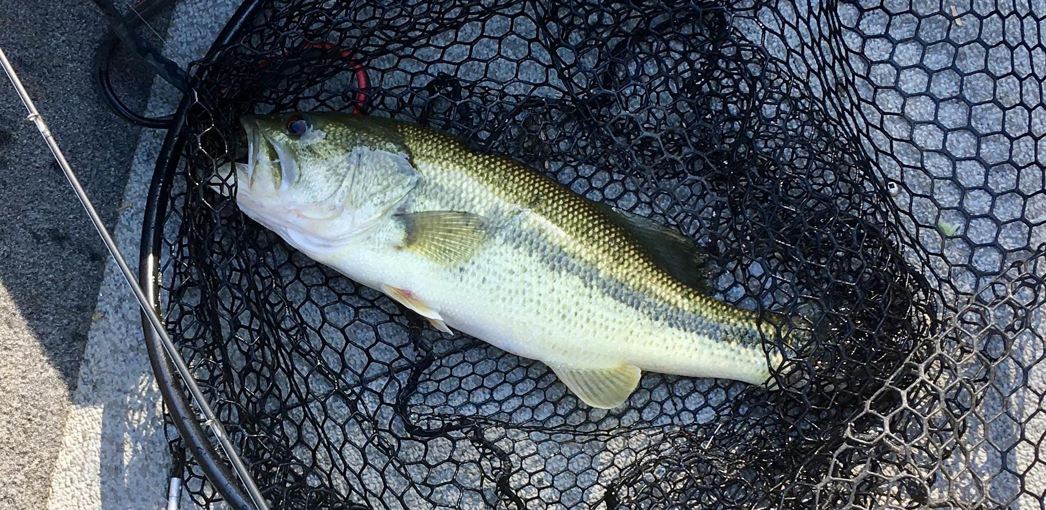 All of my eighth graders went job shadowing today. That prompted me to take a personal day to go fishing I went out around 8 this morning and within minutes the wind picked up. My high sided aluminum boat sails with a wind and I chose to fish the lee sides and cuts. I also went up Roaring River. I started with a paddle tail grub on one of bo"s 1/4 oz. jig heads. I swam it and fished it like a grub. I had one tentative bite. I picked up my Ned rod and started catching fish, several 12 to 14 inch fish and one solid keeper. After three hours I could not take the blowing dust and pollen any longer. Water temp was 62-64n and the water was fairly clear with about four feet of visibility.
 -
I have the Terrova. Get the Motorguide. With mine I have to keep telling it that it's drunk and needs to go home.
-
I will just say this: It was one of those days where my deep V and windshield certainly helped!
-
All of my eighth graders went job shadowing today. That prompted me to take a personal day to go fishing I went out around 8 this morning and within minutes the wind picked up. My high sided aluminum boat sails with a wind and I chose to fish the lee sides and cuts. I also went up Roaring River. I started with a paddle tail grub on one of bo"s 1/4 oz. jig heads. I swam it and fished it like a grub. I had one tentative bite. I picked up my Ned rod and started catching fish, several 12 to 14 inch fish and one solid keeper. After three hours I could not take the blowing dust and pollen any longer. Water temp was 62-64n and the water was fairly clear with about four feet of visibility. This post has been promoted to an article
-
Not everything I try works either.
-
I welcome Babler reports back again!
-
For a quick and easy, that is an outstanding approach.