
jdmidwest
-
Posts
10,041 -
Joined
-
Last visited
-
Days Won
33
Content Type
Profiles
Forums
Blogs
Events
Articles
Video Feed
Gallery
Everything posted by jdmidwest
-
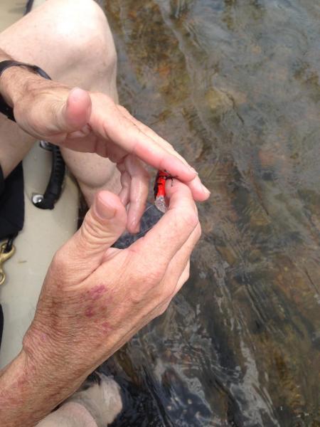
Poor little fishy.
-
Bootleg is the highest normal water putin I would consider. There is wading above.
-
Looks like he found a use for it.
-
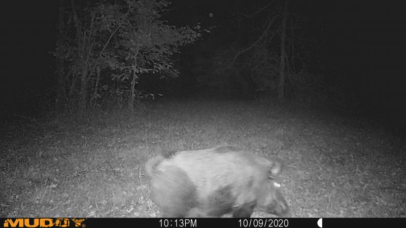
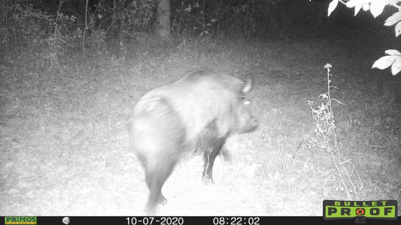
Commies Invaded the Farm This Week.
jdmidwest replied to jdmidwest's topic in New News and General Discussion
How can anyone really blame that on her? This problem started with a game ranch that failed. Then MDC opened a season on them without any license and locals started spreading them. What better thing to do when there is nothing to kill but hunt pigs on a horse with dogs while drinking. The problem is, they were not identified as invasive species and eradicated from the start. Its a kudzu plant that has slowly taken over. -
Commies Invaded the Farm This Week.
jdmidwest replied to jdmidwest's topic in New News and General Discussion
We run hog panels or board fence growing up to keep the Chester Whites and Hampshires in.. That stretch of the farm is either woven wire or 3 strand barbed wire. Have to run the fence to see where it came in. Checked with neighbors, seems like he has been running up and down for several miles. Maybe just a lone boar. But an active group is being worked about 10 miles away. Deer seem to suck this year. Game cams are all does. No acorns. Newly clearcut nearby that is probably being used as a bedding area for the bucks. My new mission, tusks. -
Nice. Did you have a good fish fry?
-
Commies Invaded the Farm This Week.
jdmidwest replied to jdmidwest's topic in New News and General Discussion
Our fences did not seem to stop it. -
Was not wanting to see one of these on the cams. Big ole boar. But, the firepower of a fall season is about to be unleashed.
-
Shhh.
-
You need some rope flies for the gar, it tangles in their teeth. Hard to catch with just a hook, they swipe sideways at the prey. Backside of a knife works on stickers best.
-
Batteries wear out. But so do the guys that have to mess with them.
-
Explorers learn from experience, get out and see them for yourself. Missouri's streams change constantly. Every rain brings changes. The Paddler's guide from when I was a kid in the 80's is pretty obsolete now. Accesses have changed due to ownership of the lands. And, the streams have all lost water for the most part due to alot of reasons. Some channels have switched back and forth. All I had growing up was printed topo maps from Rolla, 7 minute sections. The Paddlers guide. Mo. Road Maps. The MDC issued an atlas for the first time in the late 80's, it was spiral bound and rode in the truck. Forest Service had maps at the local offices. Some of the Scenic Riverways had maps at the accesses. The net offers so much more info than we ever had. Weather reports, stream gauges, and aerial views. If you subscribe to some sites, even ownership info and real time aerial photos.
-
My trigger finger normally.... But rivers are the place to be.
-
Hopefully better than about 4 weeks ago. High water had the Theodosia Arm messed up. Did not stay or launch there. But they were dropping water fast.
-
And your blog is???
-
It can be done. Especially on flight days and still water freeze-ups. I used to do it on St. Francis in Wayne Cty.
-
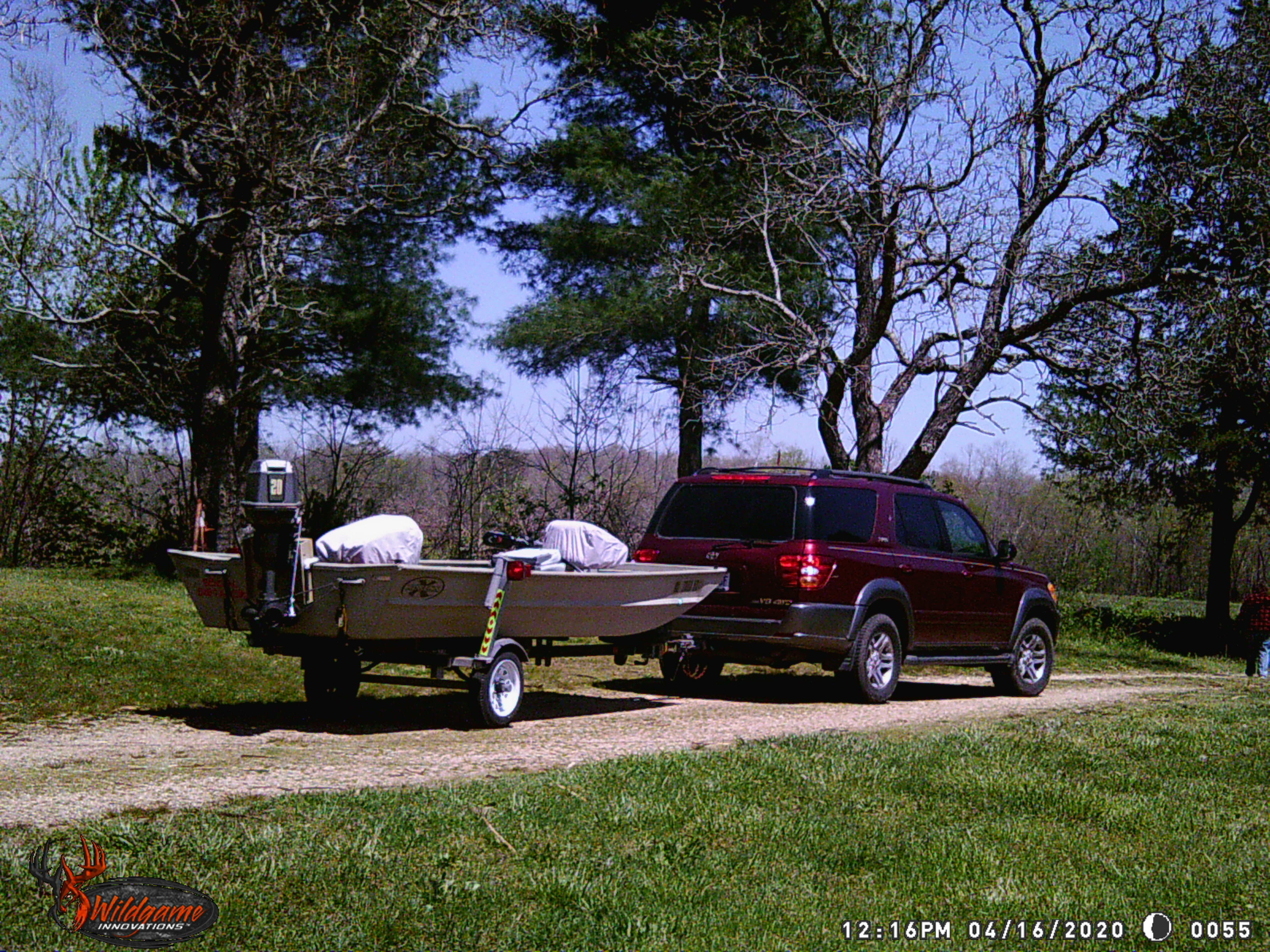
Spry little minx.... just picked her up. Lee Craft 14ft.
jdmidwest replied to N9BOW's topic in White River
Looks like it's running shallower than a jet in those pics. -
Nice. That blind looks really tight. Add some blow in insulation and it should be comfy.
-
Crappie don’t belong in ponds ?
jdmidwest replied to Hog Wally's topic in General Angling Discussion
Catfish as they get bigger will eat almost any size crappie and keep them in check. Catfish will never overpopulate a pond, you would have to restock them. -
The outdoors are dangerous. One should always be thinking a few steps ahead. I launched a 17' Tracker boat in a new to me big lake today in 30 mph wind gusts out of the north. But I read the weather and looked at the lake maps and planned my ramp accordingly. Got my fishing in and came home dry as a bone. With all of the newcomers this year, maybe some lessons before you can rent a boat or boaters course ID like most have to have to hunt. Even local equipment rentals ask for something before you rent a trackhoe and take it off their lot.
-
I thought they were all "river strains". That is where the walleye in this state came from, Mississippi or Missouri River drainages. The have been raised and stocked since then to replenish, but the brood stocks were caught from streams. MDC Walleye River Program Never gave it a thought about where the lake ones came from.
-
Montauk and Upper Current River are 2 different things. The river below the park should be about the same as always. Its not really put and take. Upper Meramec is completely different than the lower parts near the city. If you are looking for trout, you could try Meramec Spring State Park and the river below it has a trophy trout area also.
-
Montauk is a zoo this year and it seems like they may have run out of fish. I was hearing stories and went by the first time on Sunday for 2020 season and lack of fish. Fished the trophy area and went back to park around noon as the festivities of Rose Holland was dishing out prizes. Newspaper said they expect 2500 anglers. Last I heard, they stock 2.5 fish per tag expected to sell based on past history. Board at lodge said 1400 trout stocked. Fished the catch and release area and caught a few, then moved over to the fly fishing area only. Fish were few and far between. Campers were rolling in to the park as I was leaving on Sunday afternoon.
-
Did not count and I was less that than the specified weight. And it was a double.
-
No pic, no confirmation. Just a lie in this day and age. Post a digital pic for all of us to aknowledge.


